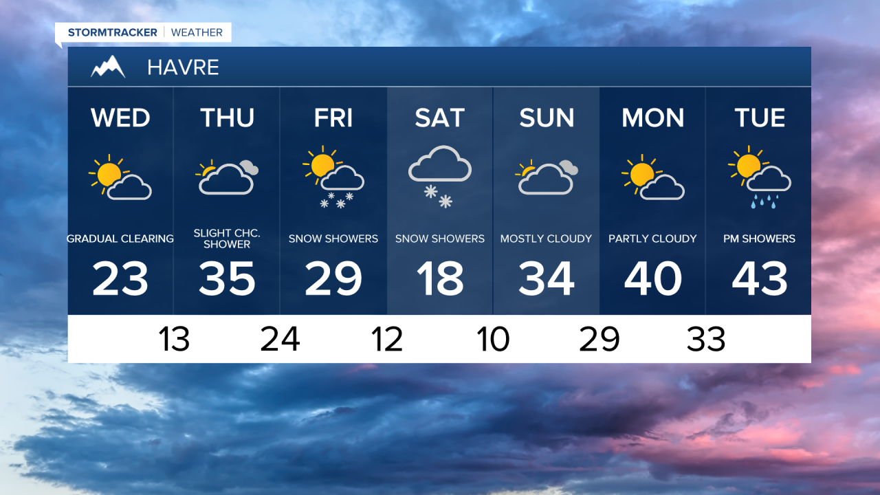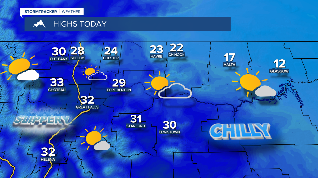


On the heels of Tuesday's system that brought accumulating snow to a lot of the area, areas of fog are possible as skies cleared out and winds are lighter. Decreasing clouds and dry conditions, with chilly temperatures in the 0s and 10s in northeast Montana, low to mid 20s for the Hi-Line and upper 20s and lower 30s in central Montana.
Today's Video Forecast:
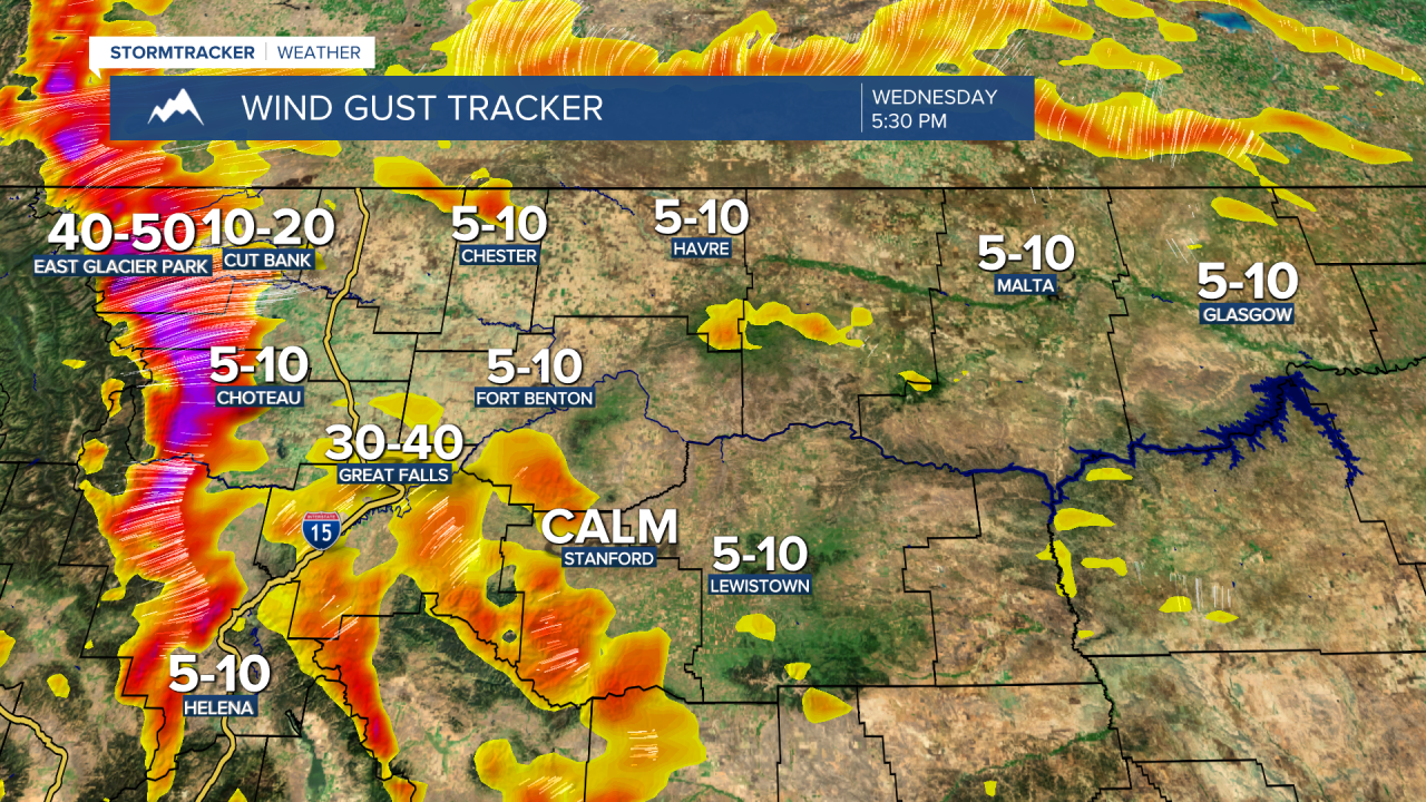
Gusty winds start to develop for the Rocky Mountain Front and East Glacier Park region later this afternoon and evening, with occasional gusts over 40 mph.
Thursday will start off quiet and dry, but it'll get breezy across the plains, with widely scattered rain and snow showers. Temperatures warm up for everyone, with highs in the low to mid 30s for the Hi-Line and upper 30s in central Montana.
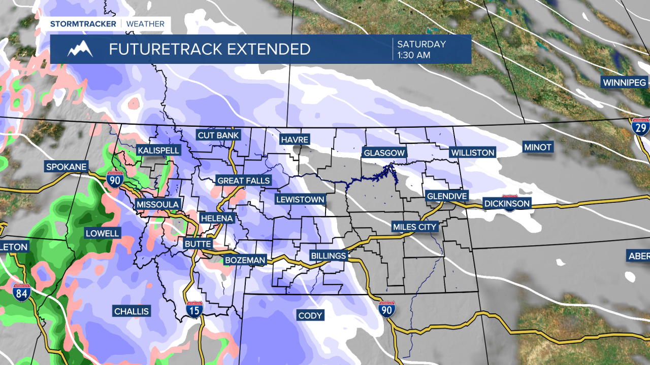
Pacific moisture starts to move into the state Friday into Saturday. Precipitation is expected to arrive Friday afternoon and evening, lasting through Saturday morning. In lower elevation areas, snow could mix with rain as temperatures will be near or just above freezing. Currently, this system does not appear to produce significant snowfall for lower elevations, with mainly light accumulations. However, the mountains could receive moderate snowfall, potentially up to a foot in the higher terrain.
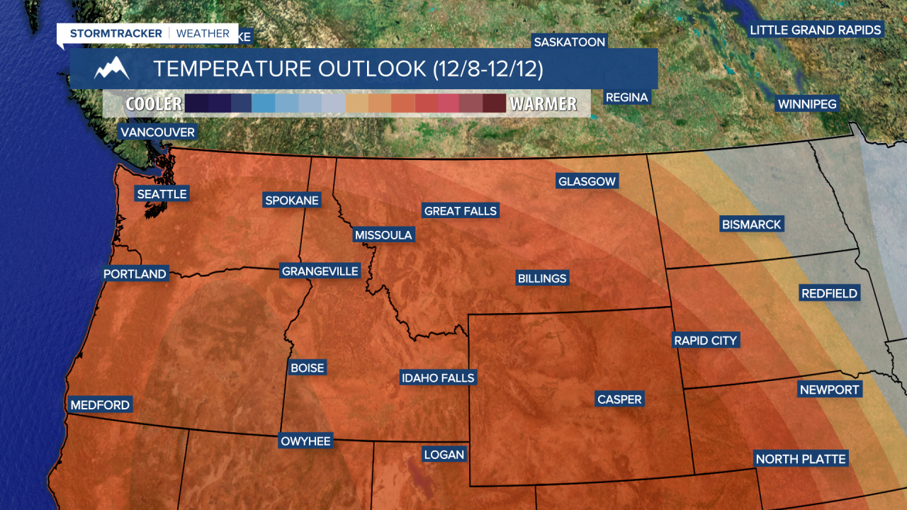
As we look to Sunday and early next week, a milder weather setup is expected, with high temperatures up into the 40s and even lower 50s. Warmer temperatures will come with stronger winds as well, with sustained winds between 10 and 30 mph and gusts exceeding 50 mph.