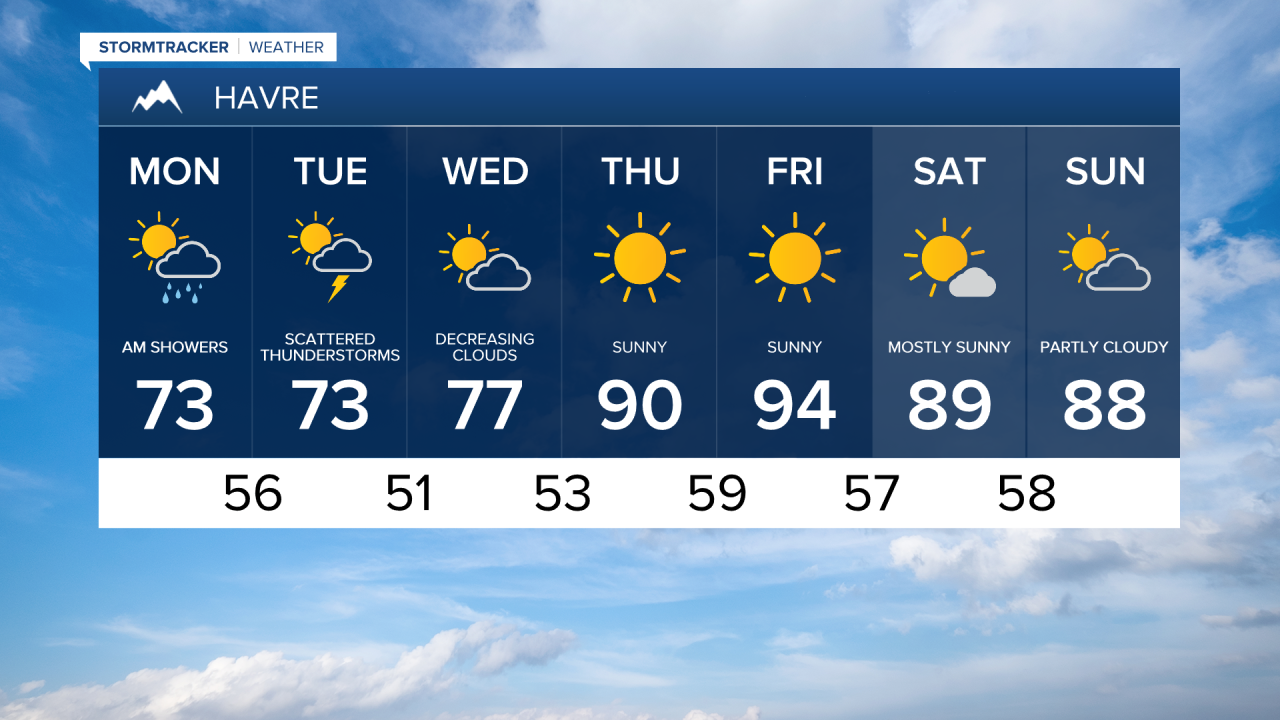


Good Monday morning! A steady rain has been falling throughout the morning across Glacier Nation Park and the western side of the Hi-Line from Glacier County to Havre. Browning has already receive 0.69" of rain since yesterday evening.
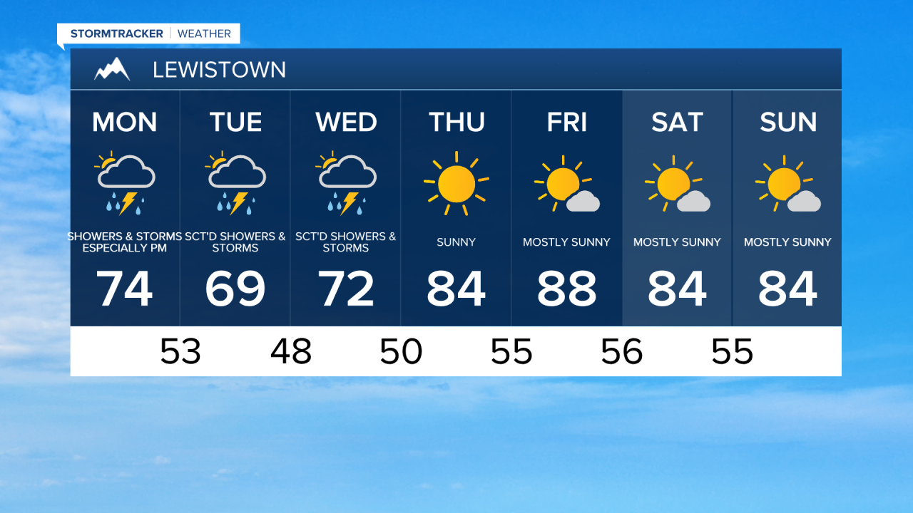
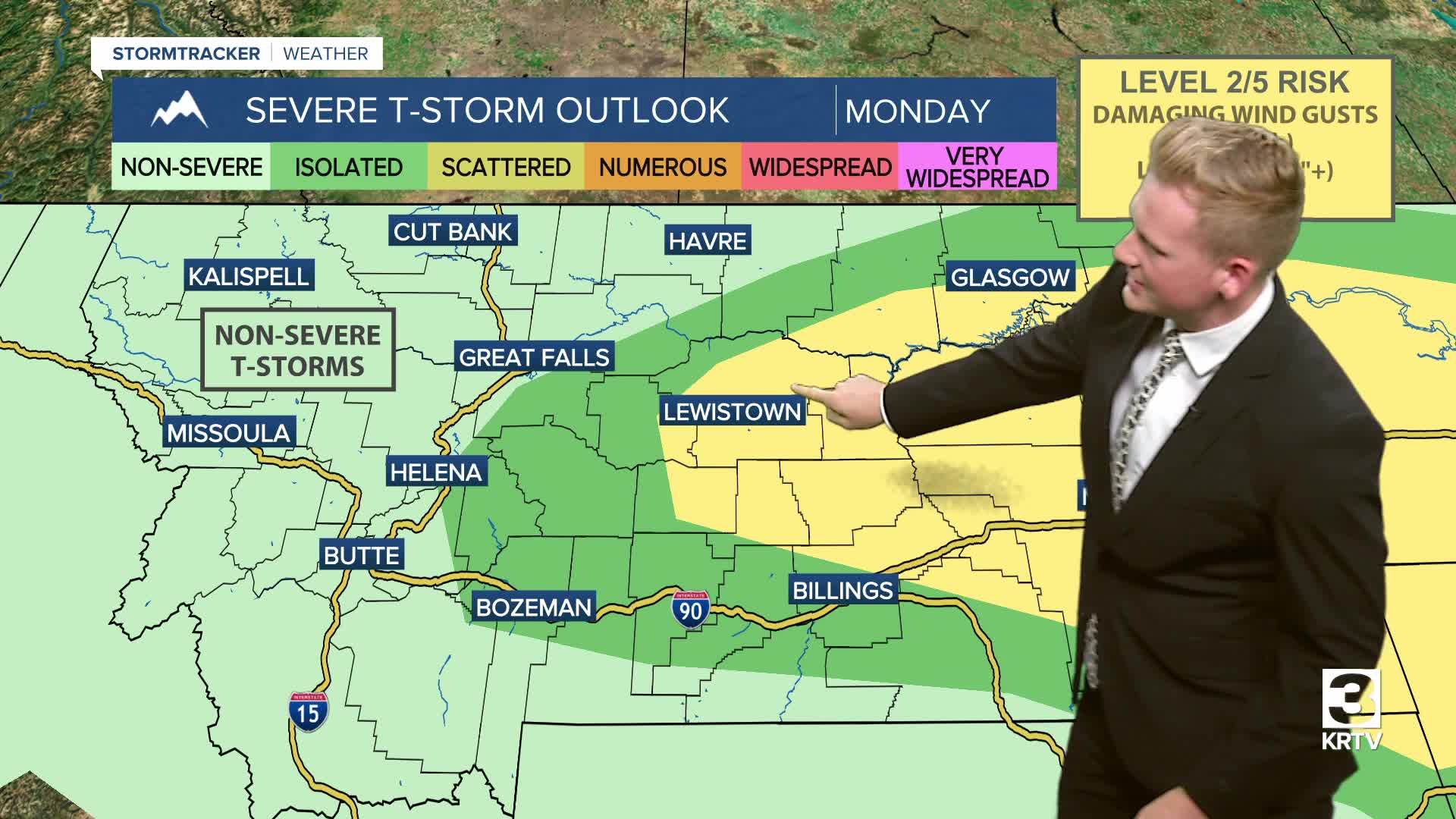
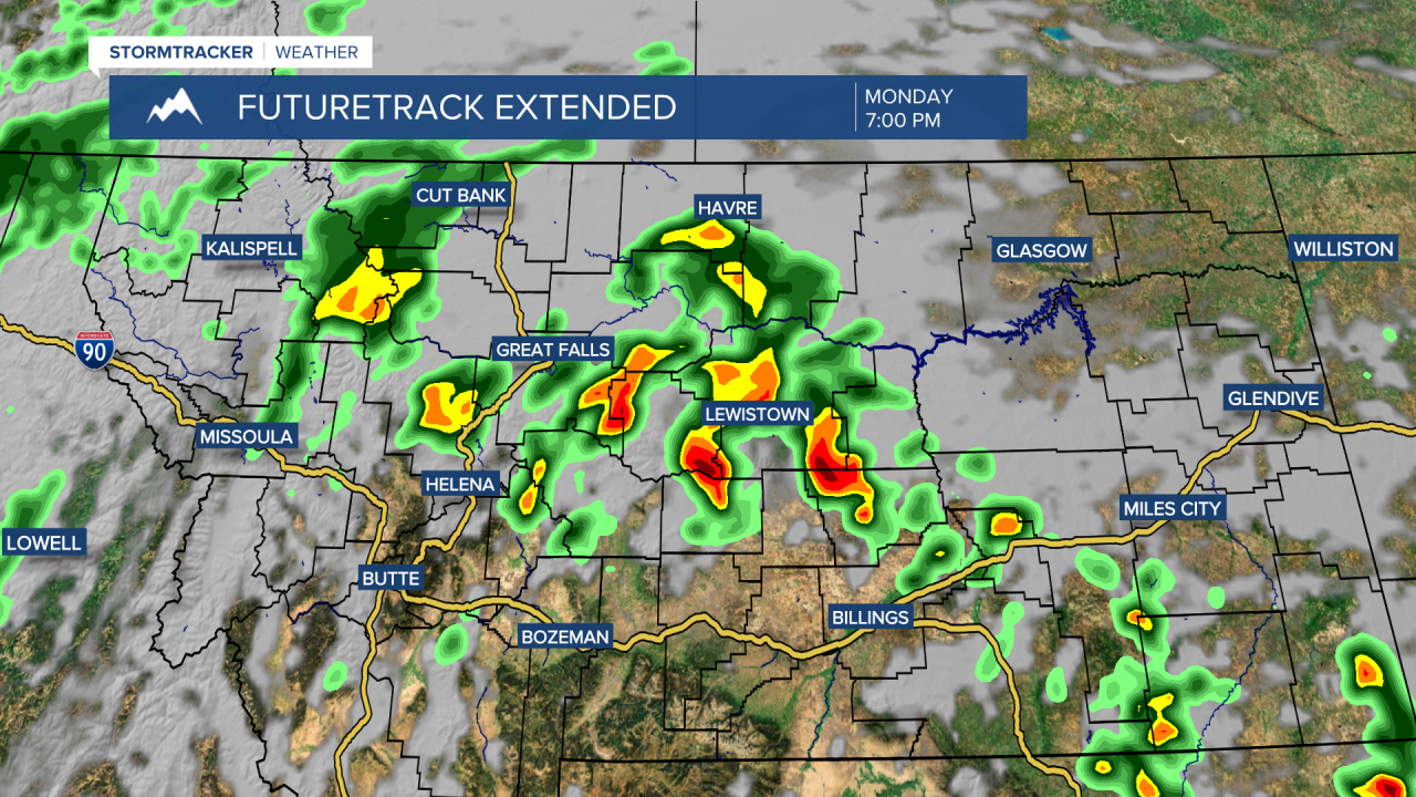
Rain will continue steadily across northwest Montana throughout the day. Meanwhile, scattered showers and thunderstorms will develop further east across the plains. Most areas will receive between 0.1"-0.5" of rain, but where heavier showers and thunderstorms set up, some spots could receive 0.5"-1"+ rain.
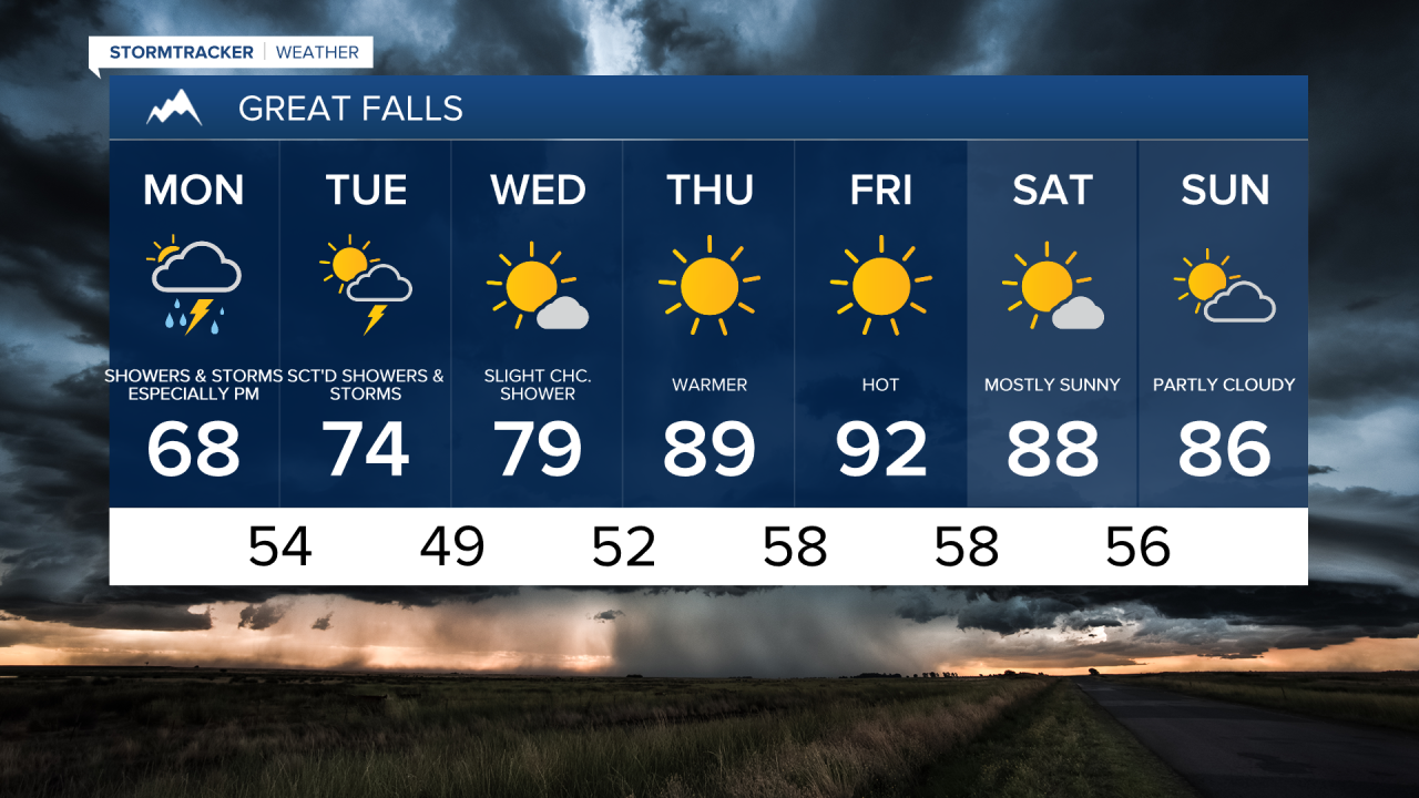
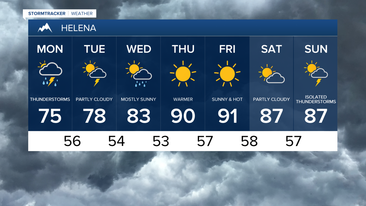
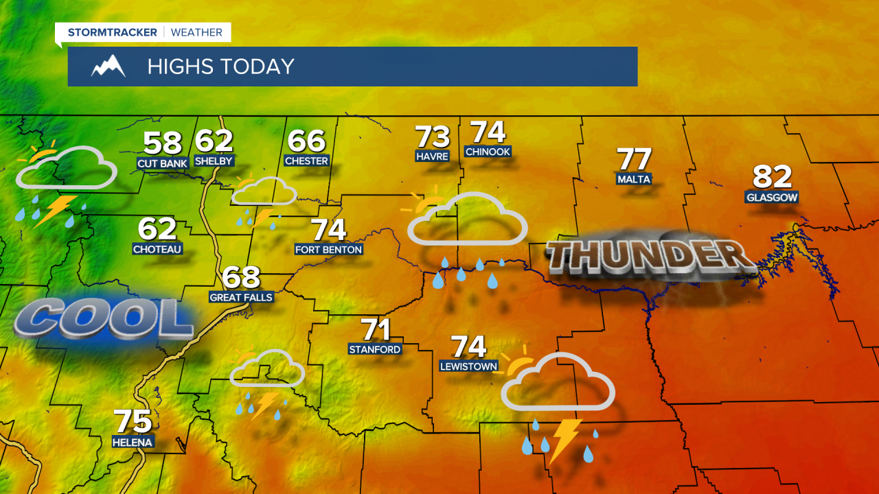
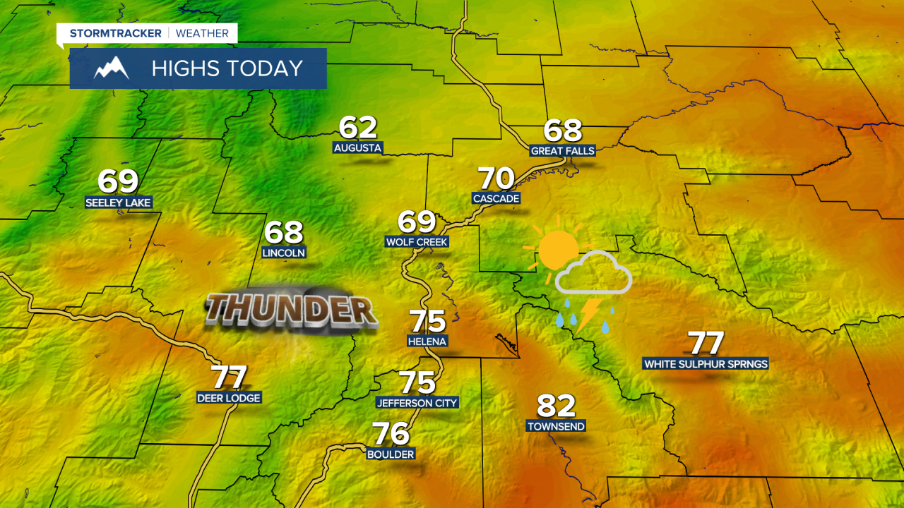
High temperatures throughout central and eastern Montana are expected to vary from the 50s along the Rocky Mountain Front to the lower 80s in eastern Montana, putting central Montana in the 60s and 70s. Most areas will have well below average temperatures throughout the day.
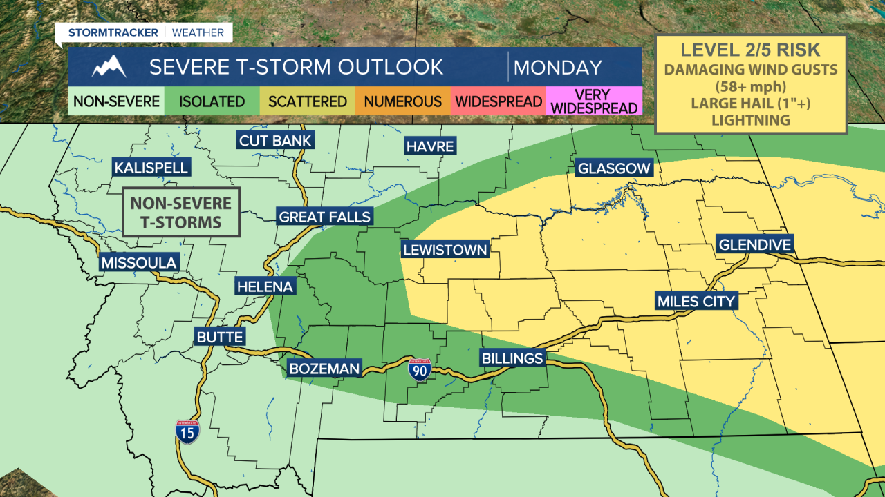
There is a chance for severe weather across the plains with damaging wind gusts (58+ mph) and large hail (1"+). Make sure to keep an eye on the radar and have a way to receive weather alerts and warnings! Let us know what you see!
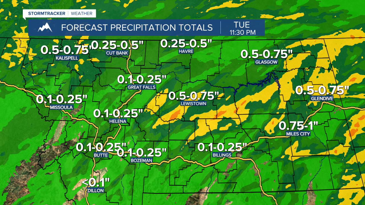
Tuesday will also be unsettled with scattered showers and thunderstorms developing in the afternoon, although the severe threat is not as high there could be a damaging wind gust or some hail east of I-15. High temperatures will remain below average in the 60s and 70s.
As high pressure shifts back to the west later this week, temperatures start to climb and drier weather is expected. By Thursday and Friday, heat and sunshine are back in our forecast with high temperatures in the 80s and 90s.