We're off to a chilly start as temperatures have dropped into the low to mid 30s in central Montana. Today will feature seasonably cool temperatures and mostly cloudy to overcast skies. Showers will hold off until after sunset, but a shower or thunderstorm could sneak into the Helena area around dinnertime.
Highs get into the upper 50s and low 60s in the Helena area, low to mid 60s in central Montana and upper 60s and low 70s for the Hi-Line east of Havre.
Our next system is currently over the Washington and Oregon. This will moves towards the area today leading to increasing clouds and eventually scattered showers during the evening in the Helena area. Most of the rain holds off until after sunset in central and eastern Montana. The system will continue to slowly move through on Friday, so a few showers are possible again Friday afternoon. Temperatures will be near or slightly below average both days, with highs in the 60s to low 70s.
Rain amounts shouldn't be too impressive, with most areas receiving between 0.1" and 0.4" in central Montana, although a few areas in north central Montana could receive over 0.5" of rain.
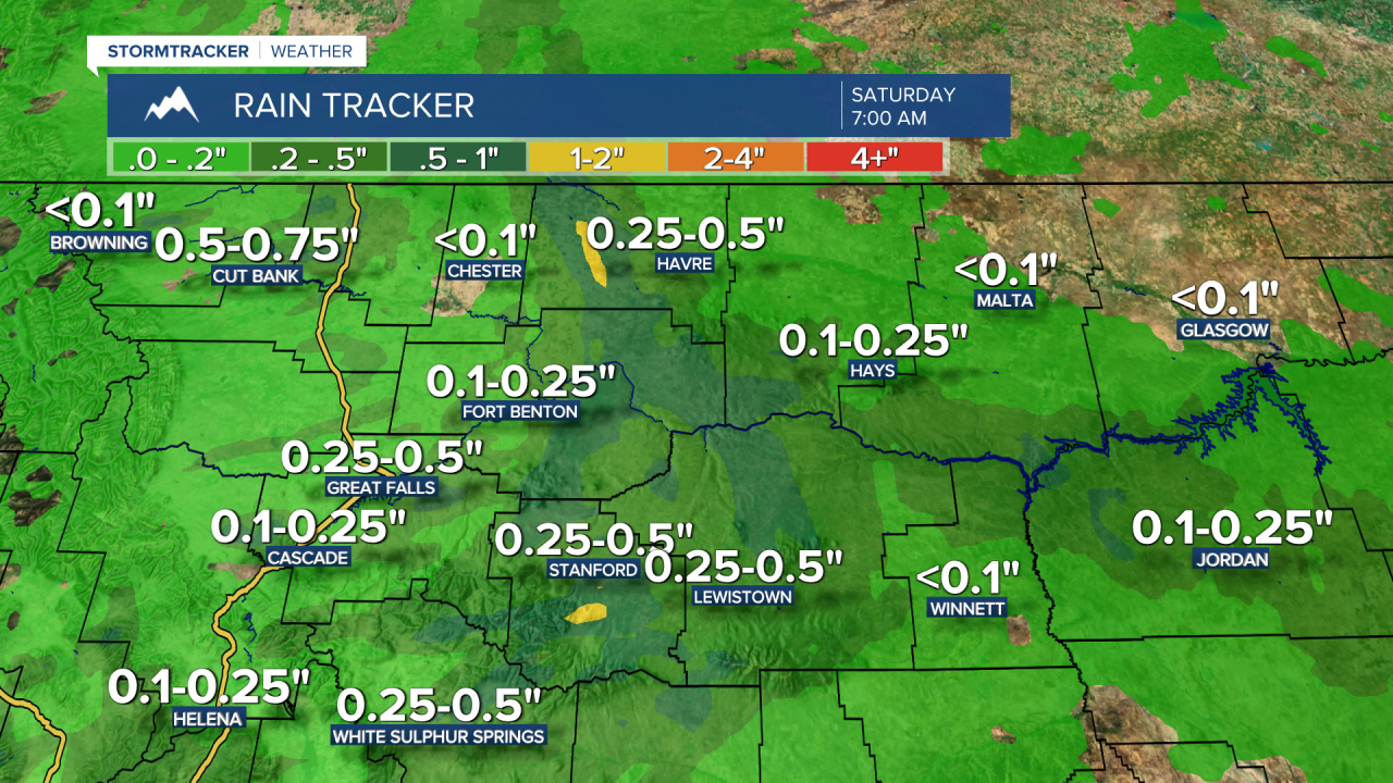
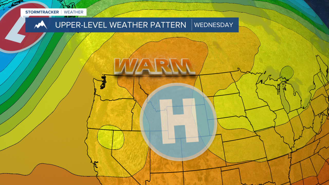
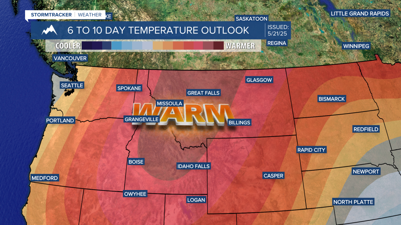
Another weak system is going to pass through on Saturday, providing the chance for a few showers and thunderstorms during the afternoon and evening. Then, high pressure quickly strengthens over the Mountain West. Temperatures will respond quickly with high temperatures into the low to mid 70s on Sunday.

Memorial Day is look exceptional weather-wise with sunshine, lighter winds, and warm temperatures. Most areas are expected to reach the 70s on Sunday and Monday, with a few spots even hitting the low 80s on Memorial Day. A stray shower or thunderstorm is possible, but most areas are going to remain mostly dry. Next week is going to stay warm with most days getting well into the 70s and lower 80s.