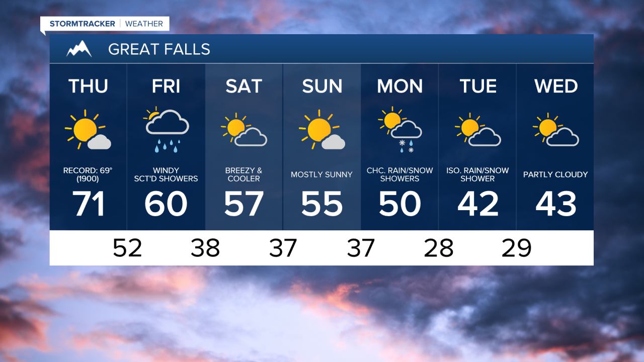
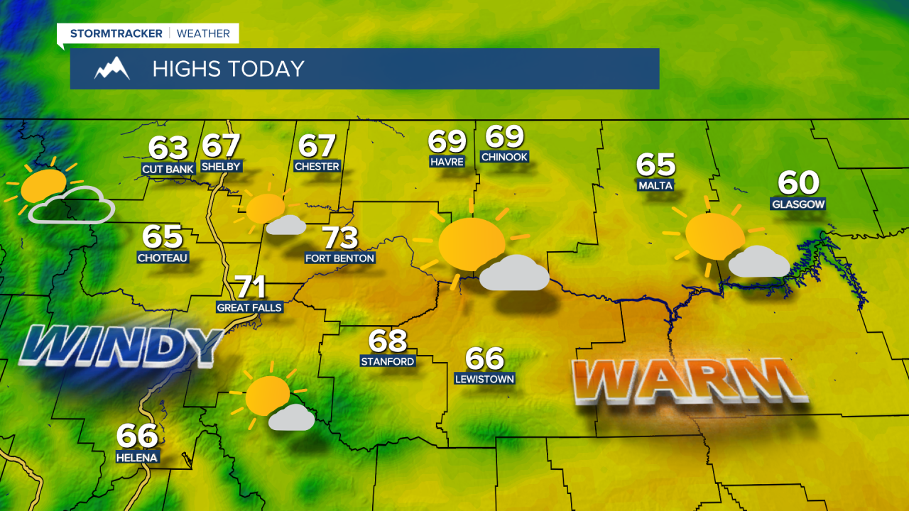
A record-setting warm November day in central Montana, with high temperatures in the 60s and lower 70s, accompanied by mostly sunny skies. The average high for this time of year is 45°, and the record high is 69°, set back in 1990. Today, we're expecting a high of 71° in Great Falls.


Today's forecast:
Unfortunately, warmer temperatures often bring gusty winds this time of year, and today is no exception. A High Wind Warning goes into effect at noon today and remains in effect through 5 p.m. Friday for Glacier, western Toole, western Pondera, western Teton and northern Lewis & Clark counties. Wind gusts of 70-80+ mph will be possible near the Rocky Mountain Front. Expect very difficult travel conditions for high-profile vehicles within the warning area. Elsewhere, winds could occasionally gust over 40 mph throughout the afternoon and evening.

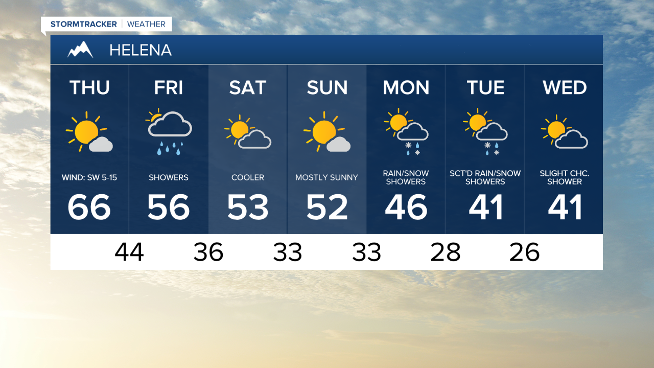
An upper-level low spinning off the coast of northern California, and a piece of that system will move into Montana late Thursday night into Friday. As a result, shower chances increase, with scattered rain and mountain snow showers expected during the day. Daytime highs will be cooler, in the 50s and lower 60s, with more clouds around. Gusty winds will continue on Friday, with gusts reaching up to 40 mph across central and eastern Montana.
A Canadian cold front drops in from the north Friday evening, helping to diminish the winds. Cooler weather is expected for the weekend, with high temperatures in the upper 40s and 50s. It will still be somewhat breezy on Saturday, but winds will lighten into Sunday.

As we move into early next week, things will turn cooler and more unsettled. Expect highs in the 30s and 40s, with near daily chances for rain and snow showers through at least the middle of next week.