


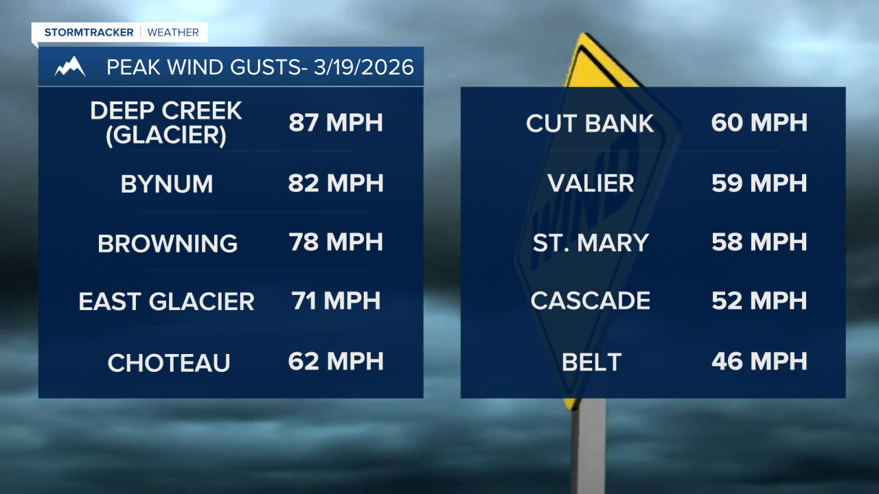
Today is the last full day of winter, but it will feel much more like the middle of spring, with gusty winds and high temperatures reaching the upper 60s and 70s. A High Wind Warning has been issued for the Rocky Mountain Front through midnight tonight. Winds have been particularly intense in Glacier County and near the Rocky Mountain Front.

The Spring Equinox is at 8:46 a.m. Friday morning, and we will kick off spring with record warmth in Montana. High temperatures will reach the 70s, with a few towns possibly touching 80. Partly cloudy skies are expected as a strong westerly flow brings in some mid-level moisture.
As a Pacific cold front approaches on Friday, strong westerly winds will pick up again across the plains. A High Wind Watch has been issued for the Rocky Mountain Front and parts of central Montana from Friday morning through Saturday morning. These could be the strongest wind gusts of the week, exceeding 90 mph near the Rocky Mountain Front and reaching up to 60 mph in parts of central Montana.

There is an elevated fire risk from today into Friday, especially in southern Montana. The warm temperatures, gusty winds, and low humidity will create prime conditions for wildfires to spread. Please use caution and avoid outdoor burning.


The front will push through Saturday morning into early afternoon, bringing a few showers and some light mountain snow. Highs will cool to the 40s and 50s for the first weekend of spring. As the system clears out on Sunday, we can finally expect some sunshine.
A stronger system looks to impact the state next Wednesday and Thursday, bringing cooler temperatures, strong winds, and some rain and snow.


