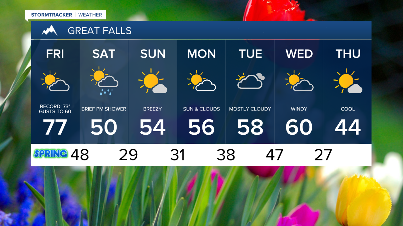
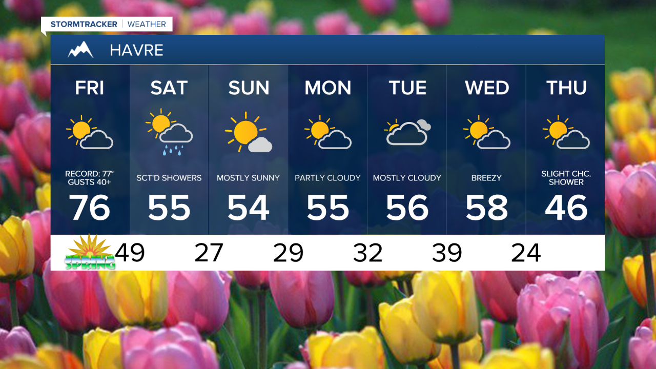
Welcome to spring! The equinox is at 8:46 a.m. MDT. Today will feel like late spring or even early summer with highs in the 70s and low 80s. Temperatures will easily run 20-30° above normal shattering daily records. All-time March monthly records could also be tied or broken for some.
Today's Forecast:


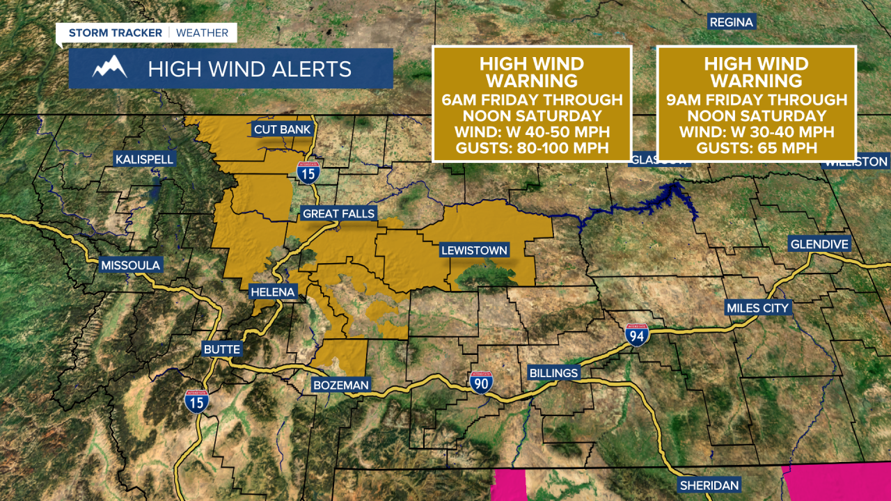
Avoid outdoor burning as warm temperatures, dry fuels and gusty winds will elevate fire danger. Gusty southwest winds develop during the afternoon, with gusts over 60 mph across the plains and over 90 mph near the Rocky Mountain Front.

The wind was very intense in Glacier County and near the Rocky Mountain Front yesterday, Salmond Ranch, located 25 miles west of Choteau, recorded a 106 mph gust. This is a new record high wind gust for March for the entire state of Montana. The strong wind will continue, with a High Wind Warning through midday Saturday, but the highest wind gusts will occur this afternoon and evening. Top wind gusts could reach 90-100 mph near the Rocky Mountain Front and over 60 mph across the plains.
The first weekend of spring will look a lot more like spring than today. A cold front drops in during the morning and afternoon, with a few showers and temperatures falling into the 40s by the evening. We'll finally get some sunshine by Sunday with highs in the 40s and 50s.
By next Wednesday, a storm system will bring much cooler temperatures, stronger winds and some precipitation.