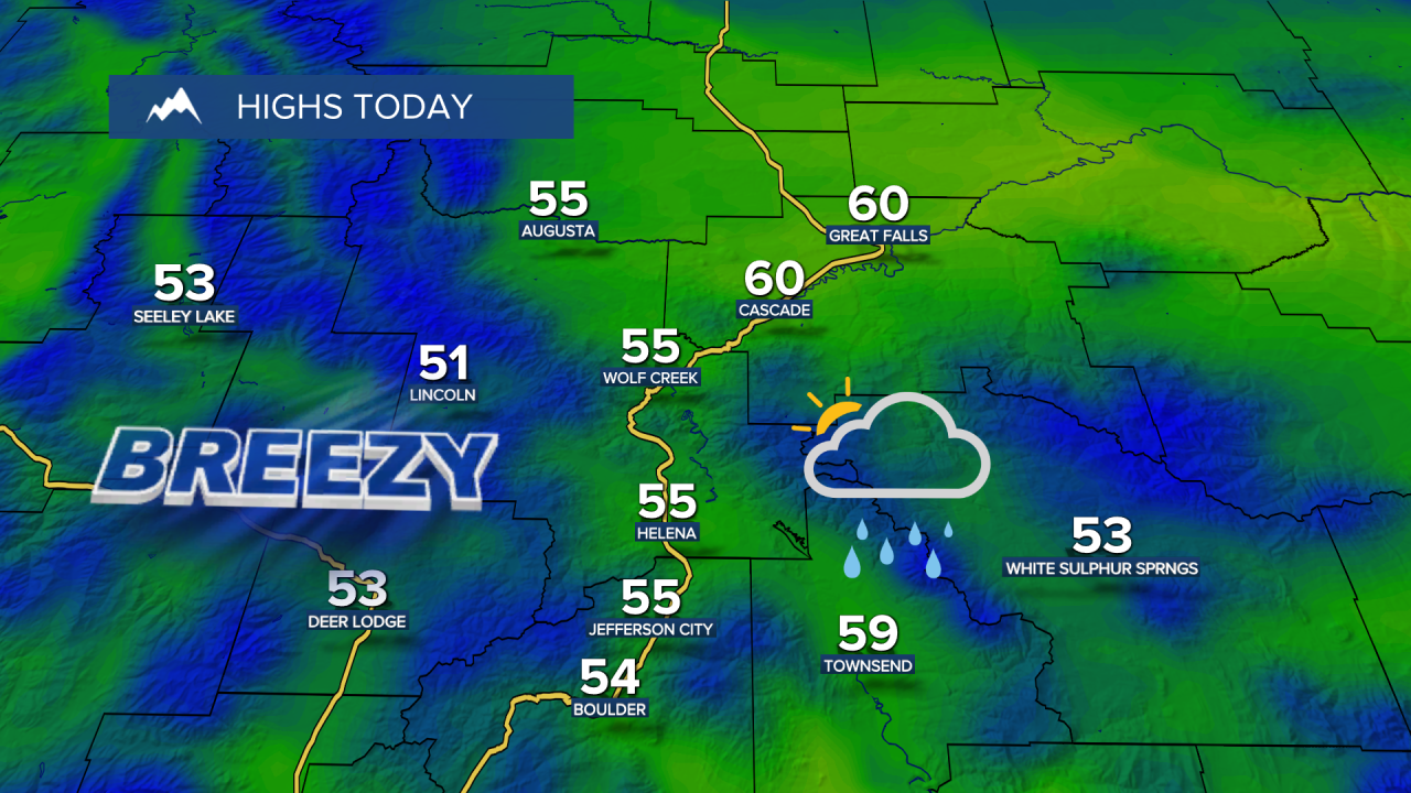
High temperatures were in record territory on Thursday, but we will finally start to get some more fall-like weather in the picture this weekend and especially next week.


Today's forecast:
Great Falls shattered its record high temperature of 69° set in 1990, with a high temperature of 70°. Helena tied the record high temperature of 71°.
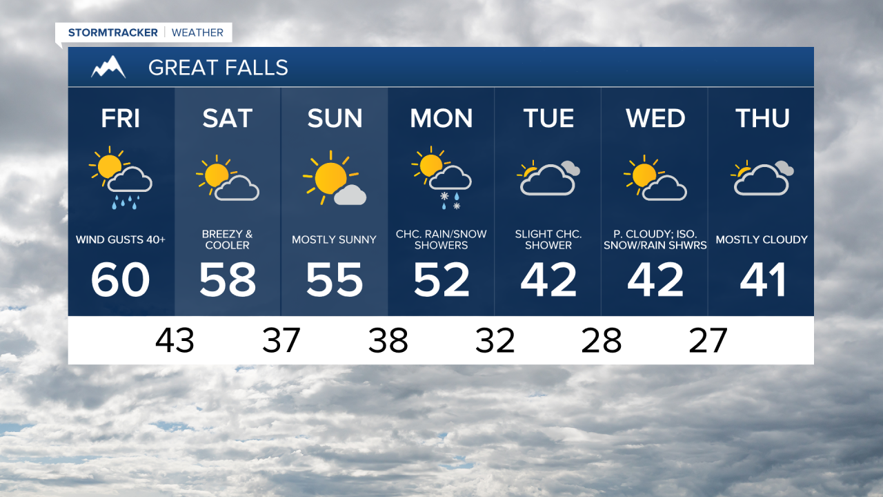
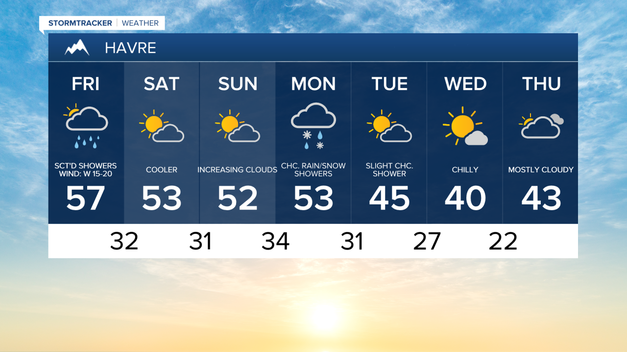
A High Wind Warning is in effect through 5 p.m. for the Rocky Mountain Front and Judith Basin County as gusts of 50-60 mph continue through the evening. Elsewhere, gusts of 40-50 mph are likely through Friday evening. Mostly cloudy to overcast skies and mild temperatures with highs in the upper 50s and lower 60s but falling into the 40s and lower 50s by the evening.

A Pacific system brings passing rain and mountain snow showers through Saturday morning. Snow mixes in for the Hi-Line near the Canadian border. Up to an inch or two of snow could fall for northern Blaine, Phillips and Valley counties by Saturday morning.

An overall pleasant weekend with gusty winds on Saturday and then calmer wind into Sunday. Decreasing clouds with high temperatures in the upper 40s and 50s both days.
Then, a weak disturbance brings in more mountain snow and some rain and wet snow for the lower elevations early next week. Temperatures cool closer to average with highs in the upper 30s and 40s.
As the system moves out on Wednesday, shower chances will gradually diminish ahead of another potential system arriving in the middle to later part of next week. Overall, the extended forecast looks cool and unsettled.