Happy Tuesday!
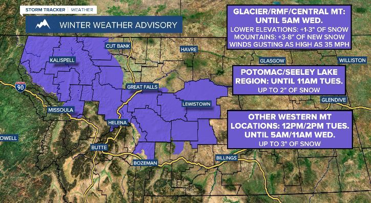
A WINTER WEATHER ADVISORY is in effect for the Glacier area, the Rocky Mountain Front, and portions of central Montana until 5am Wednesday; for the Potomac and Seeley Lake region until 11am Tuesday; and for portions of western Montana from Tuesday afternoon through Wednesday morning.
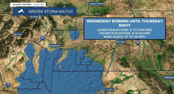
A WINTER STORM WARNING is in effect for portions of southwestern Montana Wednesday evening through Thursday night.
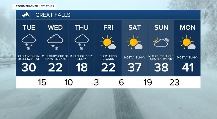
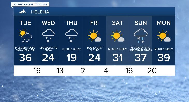
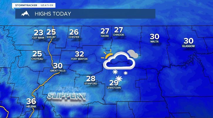
Today skies will be mostly cloudy with scattered areas of snow around, generally in central, western, and portions of north-central Montana. Temperatures will be a bit cooler with highs in the mid to upper 20s and low to mid 30s. Conditions will be a little breezy as well with sustained wind speeds between 5 and 20 mph.
Wednesday will be mostly cloudy with some scattered snow showers around. Once again temperatures will cool down with highs in the upper teens and low to mid 20s. Thursday skies will be mostly cloudy with scattered areas of snow around, generally in locations south of the Hi-Line. High temperatures will be in the teens and conditions will be a little breezy with sustained wind speeds between 5 and 20 mph.
Friday and Saturday will be mostly sunny and mostly dry as high pressure takes control of Montana’s weather. Temperature highs will be in the mid to upper teens and low to mid 20s on Friday, and the mid to upper 20s and low to mid 30s on Saturday. Conditions on Saturday will be breezy sustained wind speeds between 10 and 20 mph.
Sunday skies will be mostly cloudy with some isolated snow and rain showers around. Conditions will be a little breezy with sustained wind speeds between 5 and 20 mph. Temperature highs will be ranging from the upper 20s to the low 40s. Monday will be partly to mostly sunny and mostly dry. Conditions will be a little breezy with sustained wind speeds between 5 and 20 mph. High temperatures will be in the mid to upper 30s and low to mid 40s.