


After a beautiful but gusty start to the workweek, Tuesday brings even warmer temperatures and lighter winds. Daytime highs top out in the 70s and lower 80s.


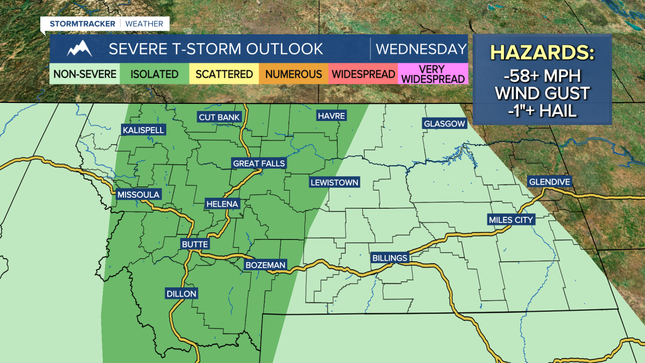
A strong southwest flow ahead of an approaching system will bring very warm temperatures, strong winds and scattered strong to severe thunderstorms on Wednesday. Daytime highs climb into the 80s and lower 90s, nearing daily records.
Tuesday Morning Forecast:
The heat and instability will help to fuel some stronger thunderstorms Wednesday afternoon and evening. Some storms could produce heavy downpours, large hail and damaging wind gusts. There’s also a low-end risk for an isolated tornado.
Fire danger becomes a concern once again as winds increase and temperatures soar into the 80s and lower 90s. A Fire Weather Watch has been issued for Wednesday.


A strong cold front pushes through Wednesday night into Thursday, followed by widespread strong westerly winds. Gusts could reach 50–60+ mph. A High Wind Watch is in effect from Wednesday night through Thursday.

Areas of rain and high mountain snow continue throughout Thursday as temperatures struggle to get out of the 50s and 60s.
An isolated shower or thunderstorm may linger into Friday, but overall it looks like a pleasant day with mostly sunny to partly cloudy skies and highs in the 60s and lower 70s.
This weekend looks much cooler than last weekend, with highs in the 50s and 60s along with a few isolated showers.


