


Hot, dry and gusty weather will elevate fire danger ahead of a cold front before scattered strong to severe thunderstorms erupt this evening with damaging wind gusts, hail, heavy downpours and lightning.

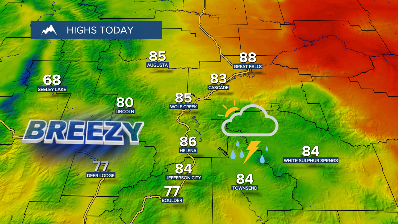
Temperatures will soar to near record highs in the 80s across central Montana and the 90s in eastern Montana. Critical fire weather conditions are forecast for eastern Montana, where a Red Flag Warning remains in effect through 9 p.m.
Wednesday Morning Forecast:
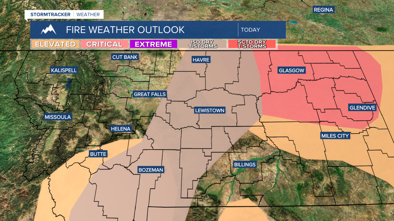

Today is the first Slight Risk (Level 2) of the year for central Montana. The biggest threat will be damaging wind gusts of 60–80 mph, though an isolated storm could also produce large hail. Lightning may spark new fires as well. The bulk of the storms will move through between 2 and 9 p.m. Make sure you have a way to receive warnings!

The cold front moves through Wednesday night with widespread strong winds developing across the entire area. Peak wind gusts will reach 50–60+ mph, with the strongest winds expected Thursday morning into the early afternoon.

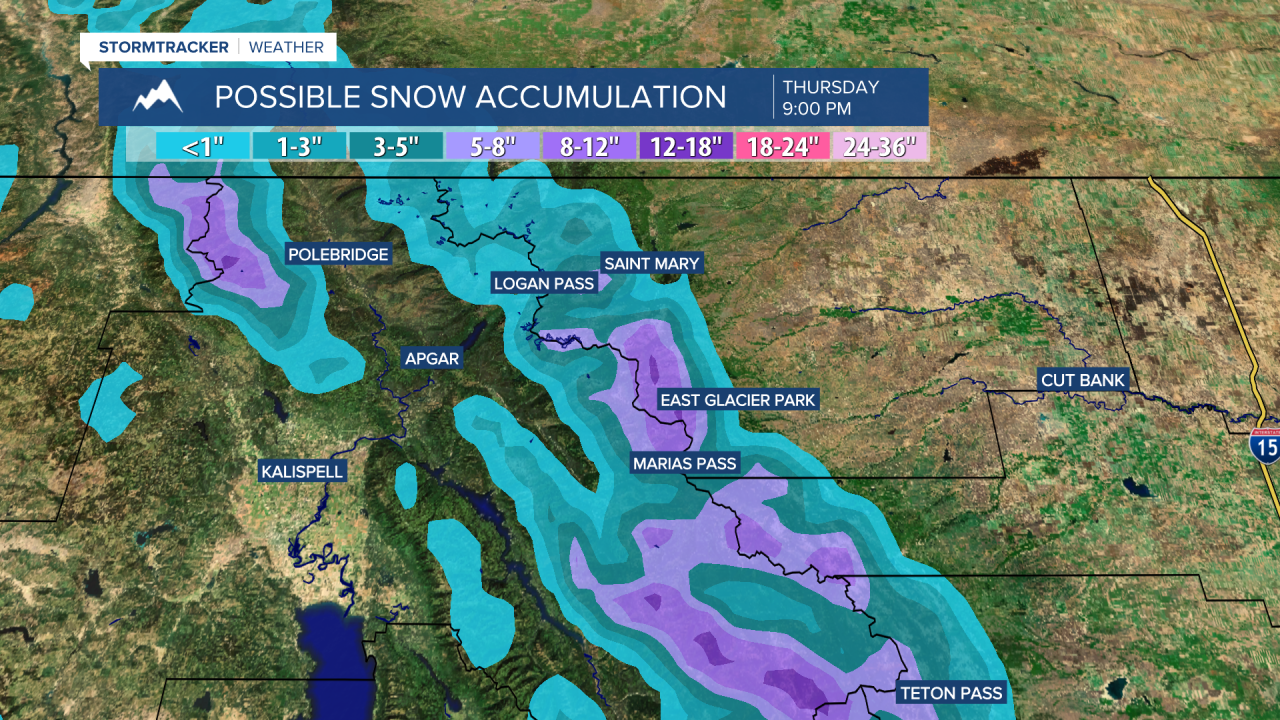
Snow levels will fall to around 5,000 feet by Thursday morning, with several inches of snow piling up in the mountains of Glacier National Park. Prepare for cold, damp and snowy backcountry conditions.

Highs will only reach the upper 50s and 60s on Thursday and Friday. Breezy conditions continue into Friday, but conditions will remain dry with partly cloudy skies.
This weekend will be much cooler and more unsettled than last, with some clouds and some sunshine. A few passing showers possible, especially on Sunday. High temperatures only reach the 50s and 60s on Saturday and 40s and 50s on Sunday. Snow levels will stay around 5,000 feet.


