


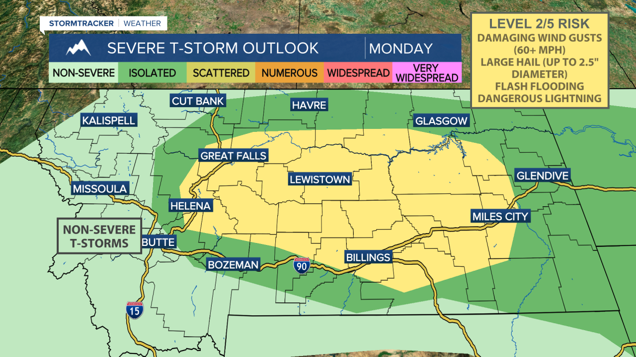
The National Weather Service has issued a Severe Thunderstorm Watch for central Montana until 9:00pm on Monday, July 28, 2025. Storms capable of damaging wind gusts, large hail, dangerous lightning and flash flooding are expected to develop and move through the area over the next several hours.
Throughout the workweek, moisture levels will continue to rise, and storms will move somewhat slower. This increases the concern for flash flooding beneath stronger thunderstorms.
Please stay alert and have a way to receive weather warnings! If you see standing water on a roadway, turn around don't down - even if you are familiar with the road.
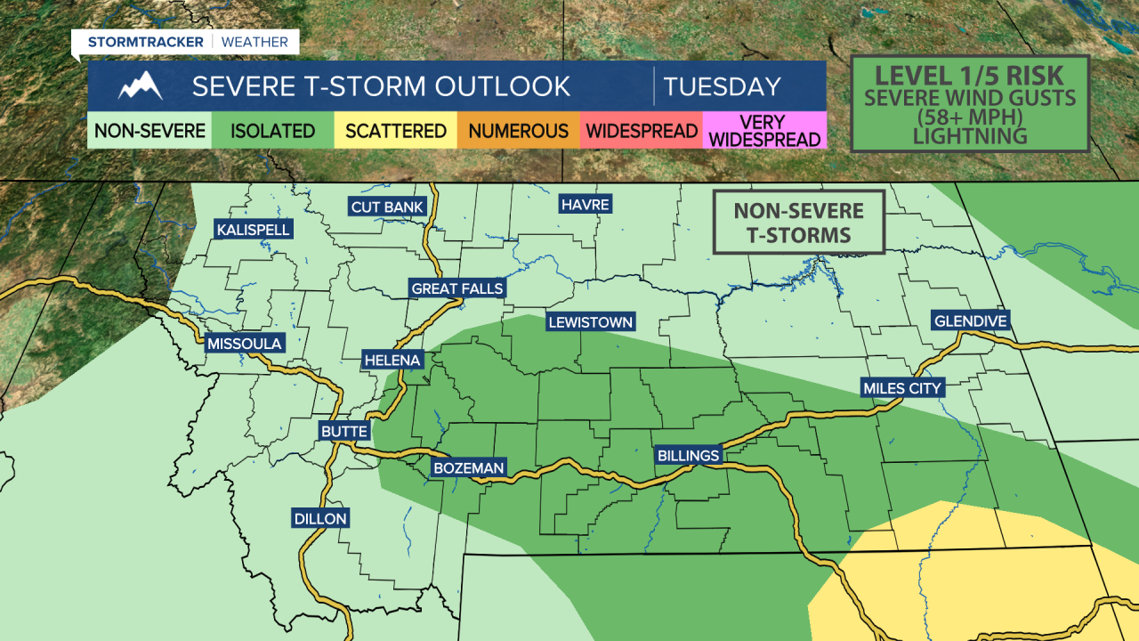
The severe weather threat appears to shift further south on Tuesday, mainly impacting areas south of MT-200 and east of I-15. Damaging wind gusts, heavy rainfall, and large hail will remain the primary concerns.
Temperatures will stay fairly seasonable, if not slightly below average, with highs reaching the upper 70s to low 80s throughout the week. Daily chances of showers and thunderstorms continue, but the severe threat is expected to diminish as the week progresses, while the flood risk may increase.


