Severe thunderstorm threaten central Montana with damaging winds, hail and an isolated tornado Friday afternoon and evening.
DENSE FOG advisory in effect until 9AM. Very dense fog is impacting a lot of central Montana. Use low beam headlights and allow extra time to reach your destination. Expect rapidly changing visibility on roads and highways, sometimes down to a few hundred feet.

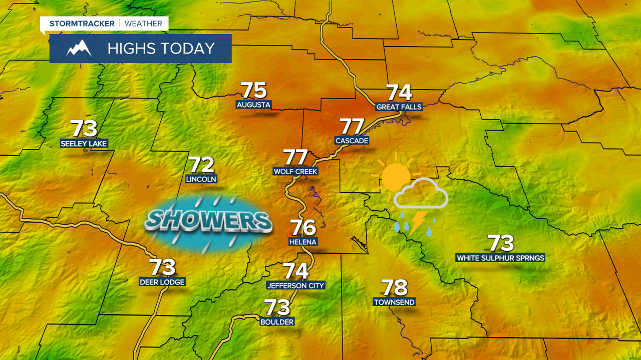
The Storm Prediction Center has issued a Level 3 risk for severe weather in central Montana. This is the highest risk of severe weather so far this year in our area. Storms are expected to develop early to mid-afternoon over central Montana, then move east across the plains throughout the afternoon and evening.
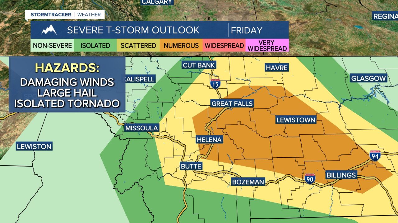
Damaging wind and large hail are the primary threats, but isolated tornadoes can't be ruled out in this setup. The timing for the storms will be between noon and 4 p.m. for central Montana and between 4 and 8 p.m. for eastern Montana.

Make sure you have a way to get those weather warnings today! Follow Meteorologist Erik Johnson and Meteorologist Ryan Dennis on Facebook for the latest updates and warnings.
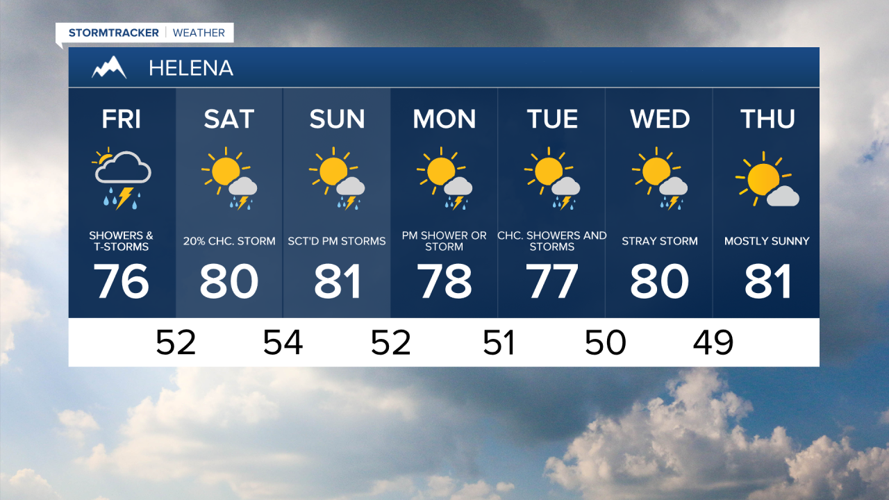
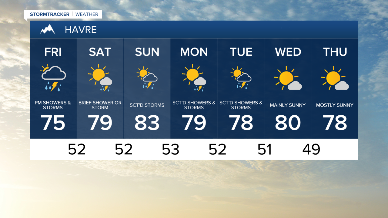
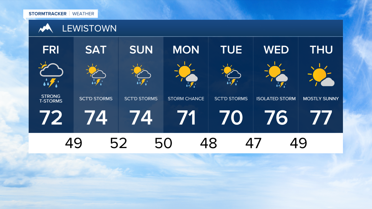
Showers and thunderstorms will wind down tonight, but another round of dense fog is possible into Saturday morning due to leftover low-level moisture from today’s storms. Temperatures will warm into the mid to upper 70s and low 80s both days this weekend.
There will be chances for additional thunderstorms, including a lower risk of severe storms on Saturday in areas shaded in dark green. The main hazards with these storms will be damaging winds and hail.
Daily storm chances will continue into Sunday and Monday before a relatively drier weather pattern sets in next week. Overall, temperatures will stay steady in the mid to upper 70s and low 80s.