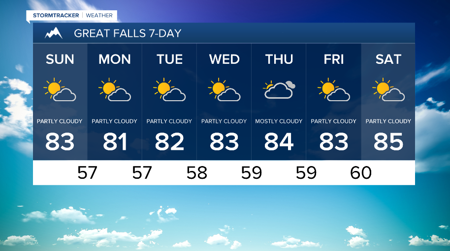
WEATHER DISCUSSION: Slightly cooler temperatures on the way, with Saturday being the first of the next upcoming week of mainly 80-degree temperatures. High temperatures ranged in the low to upper-80s and low-90s with increasing cloud cover. Tonight, expect low temperatures in the low to upper-50s and low-60s with mostly cloudy skies and 5 to 10 mph winds (gusts up to 20 mph).
WATCH THE FULL FORECAST:
Scattered showers and thunderstorms (isolated severe thunderstorms) will be expected throughout the rest of the evening, decreasing after sunset. Southwesterly flow aloft will persist across the region over the upcoming week, meaning more daily chances of afternoon and evening showers and thunderstorms. As thunderstorms develop across portions of Southwest Montana and shift northeastward, the risk for strong to severe wind gusts will increase.

High temperatures tomorrow cool slightly for some areas along the Rocky Mountain Front. Most high temperatures will remain in the mid to upper-70s and low to mid-80s. Expect increasing cloud cover, mainly partly cloudy to mostly cloudy, with more chances of showers and mostly non-severe thunderstorms towards late-afternoon and evening.

Looking toward the work week, better chances of precipitation eventually work in around mid-week, which will help the more robust thunderstorms produce higher rainfall rates/amounts. The main threat with thunderstorms that form appears to be gusty winds most days, with a lesser concern for hail. High temperatures look to remain in the 70s-80s zone.