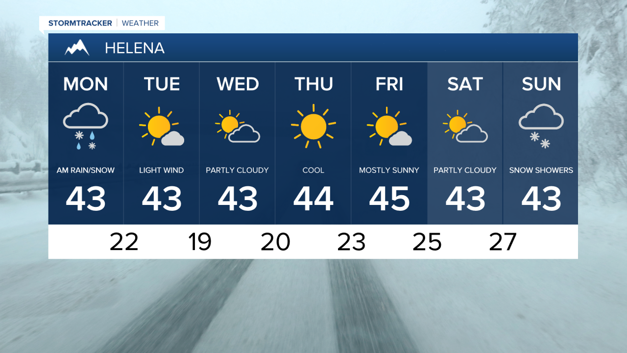
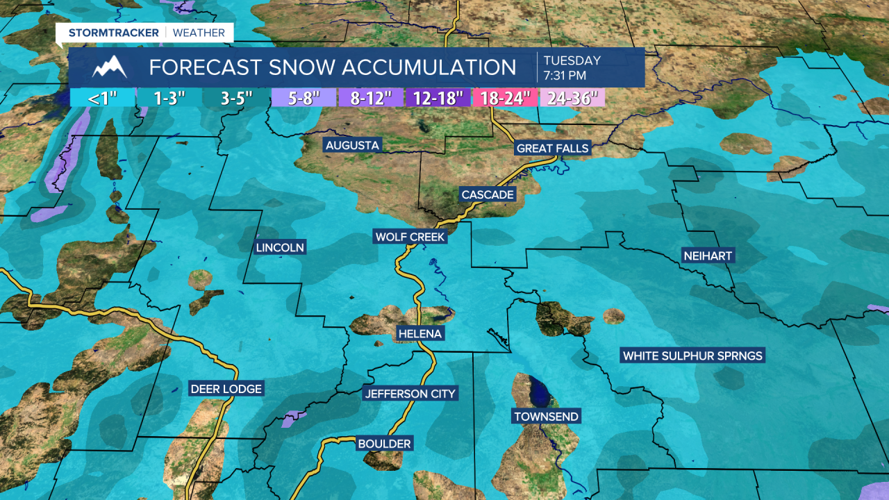
Rain changed over to wet snow in the lower elevations as a cold front passed through overnight. Helena has received 0.47" of precipitation since midnight, making it the wettest February 9th on record with more to come throughout the day. Showdown is closing in on a foot of snow! The snow will continue to come down over the next several hours in the mountains and for areas between Great Falls and Lewistown. Otherwise, mostly cloudy and cool with highs in the 30s and 40s. Passing rain and snow showers will continue through this evening.
Monday Morning Forecast:
Snow totals Monday 7:00 a.m. through Tuesday 6:15 p.m.

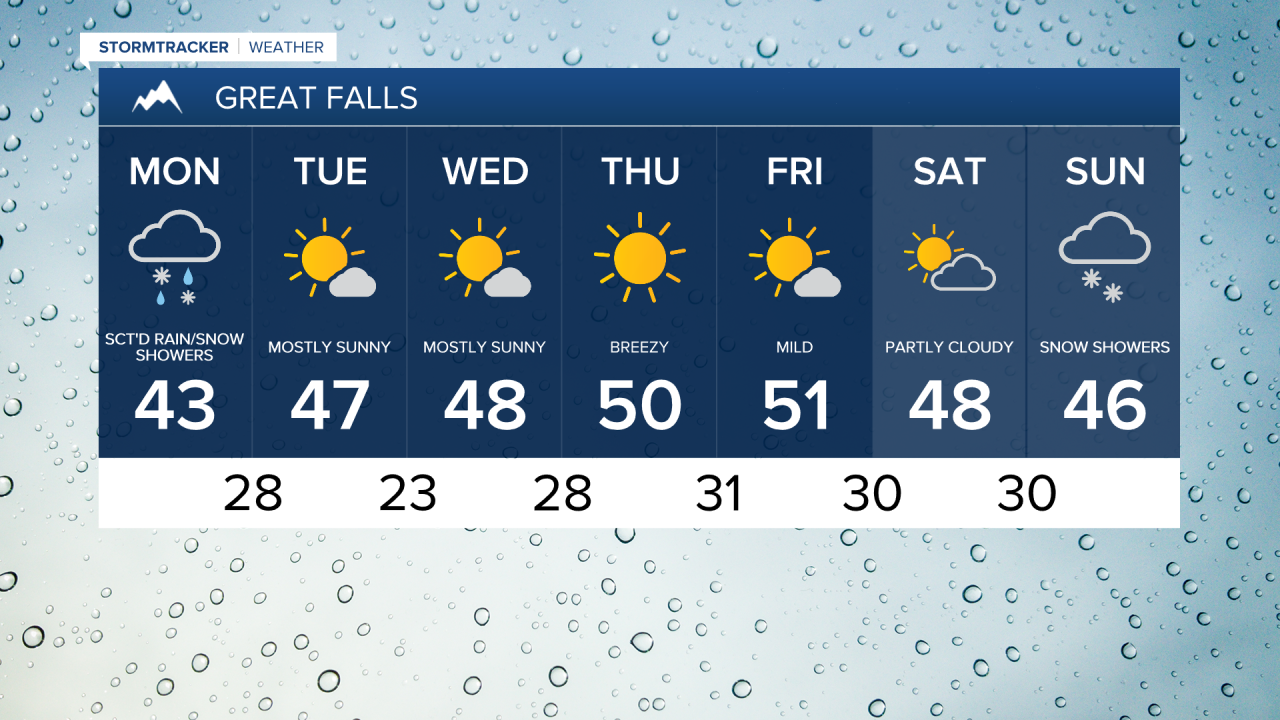
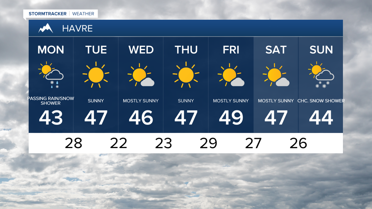
Above average temperatures continue for the rest of the week, but it will be cooler than last week with high temperatures in the 40s and lower 50s and overnight temperatures dipping down into the 10s and 20s. Mostly sunny to partly cloudy skies can be expected each afternoon.
The next system is set to impact the area late next weekend into early next week with the potential for some rain and snow showers.