


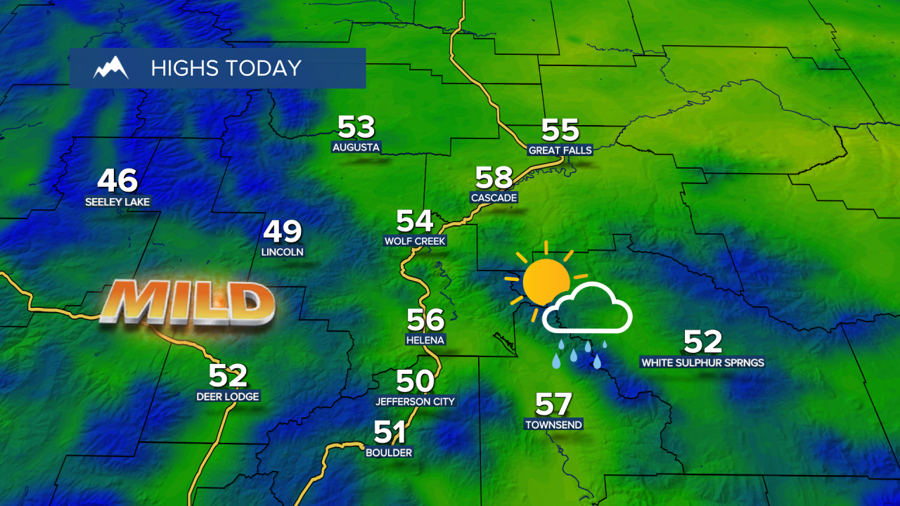
Wednesday will be mostly cloudy with high temperatures in the 50s. A cold front moving onto the Pacific Northwest coast this morning will pass across Montana late today into tonight. Some area of rain and mountain snow will move through tonight through Thursday.
Today's Forecast:

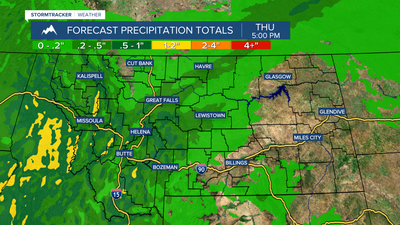
The mountains will receive some much-needed snow, with up to a foot of snowfall in the higher peaks. Expect winter driving conditions over mountain passes on Thursday. Lower elevations may see a few rain or snow showers, with up to a couple of tenths of an inch of moisture accumulating. We'll take what we can get!


High temperatures cool to the 30s and 40s, accompanied by a cold northwesterly breeze. This system pulls away into Friday, leaving behind just a few lingering mountain snow showers.
This weekend will be mild and windy, with high temperatures in the 50s and 60s under partly to mostly cloudy skies. Don't forget to set your clocks forward as Daylight Saving Time begins - we’ll lose an hour of sleep Saturday night into Sunday.
A strong cold front pushes across the state next Monday, bringing widespread rain and snow. This will set the stage for a colder and more active weather pattern next week.


