Highs in Montana soared into the 60s and lower 70s on Thursday, setting the earliest 70° day on record in Great Falls for the calendar year. A warm and dry weather pattern will persist again today through the weekend, thanks to a strong ridge of high pressure over the region.
Today's Forecast:

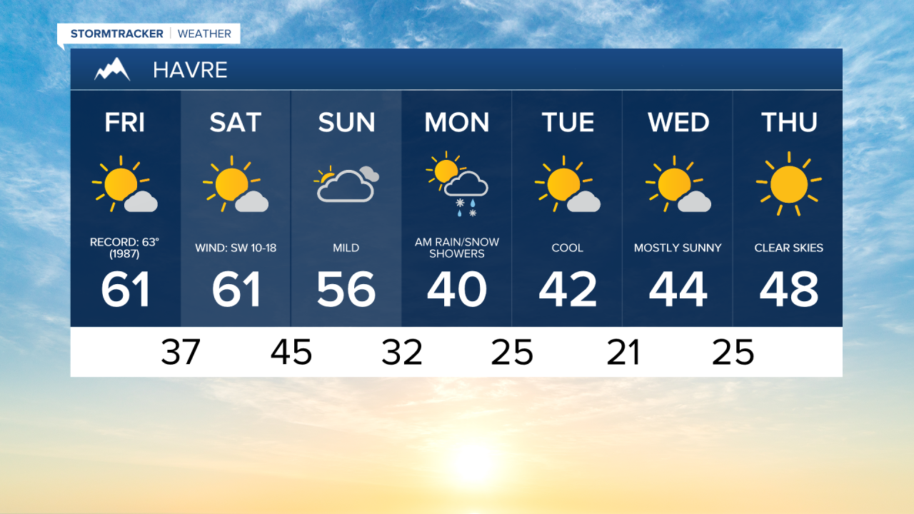
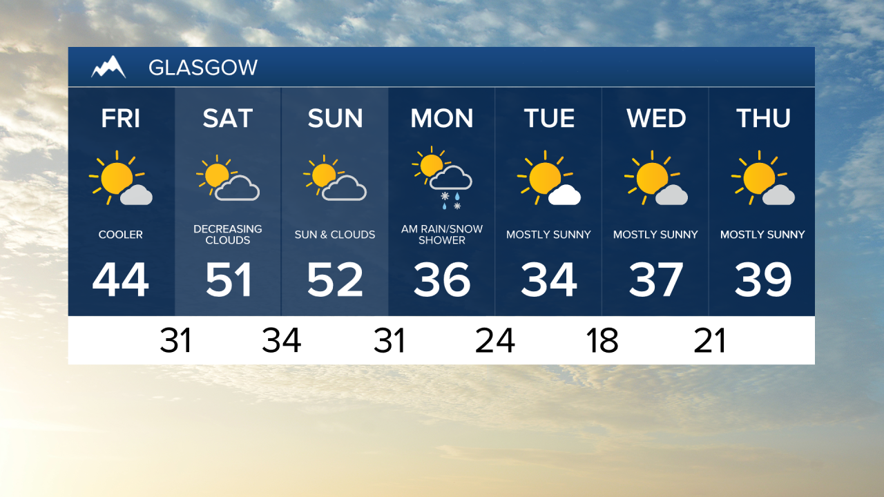
It is a cold start, however, as clear skies and light winds have allowed temperatures to dip into the 20s. Highs will jump into the 60s in central Montana and reach the 40s and 50s in the Helena area and across northeast Montana under a mostly sunny sky.


This weekend will be pleasant, with highs in the upper 50s and 60s on Saturday, falling into the upper 40s and 50s on Sunday with more clouds. As the high pressure ridge breaks down, winds will pick up on Saturday. A High Wind Watch is in effect for the Rocky Mountain Front, with the potential for gusts up to 75 mph. These stronger winds will increase the risk of grassland fires throughout the weekend. Please do your part to help prevent any fires!
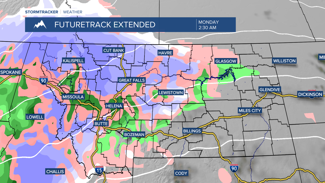
We are tracking a change in the warm, dry pattern Sunday night into Monday, as a cold front moves across the state. Widespread precipitation is expected to develop Sunday night into Monday morning, with the potential for several inches of snow over the Rocky Mountain Front and 1-3 inches in lower elevations. The storm system will clear out fairly quickly, with sunshine returning by Monday afternoon and evening. Daytime highs will drop into the 30s and 40s next week, which is more typical for mid-February.