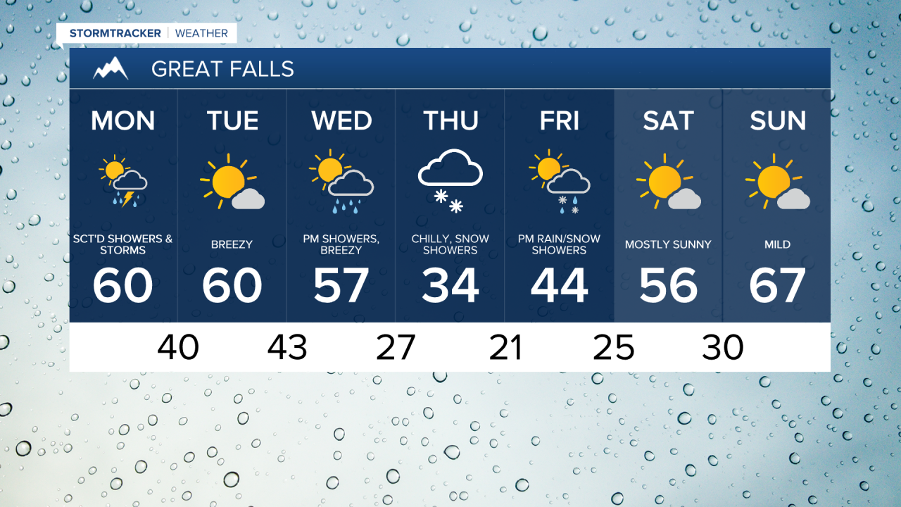
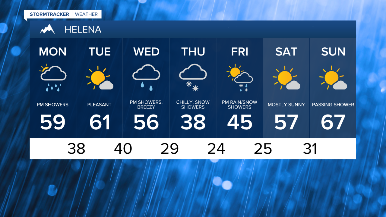
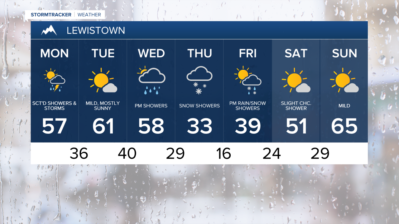
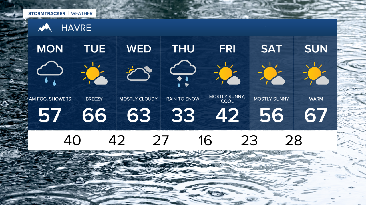
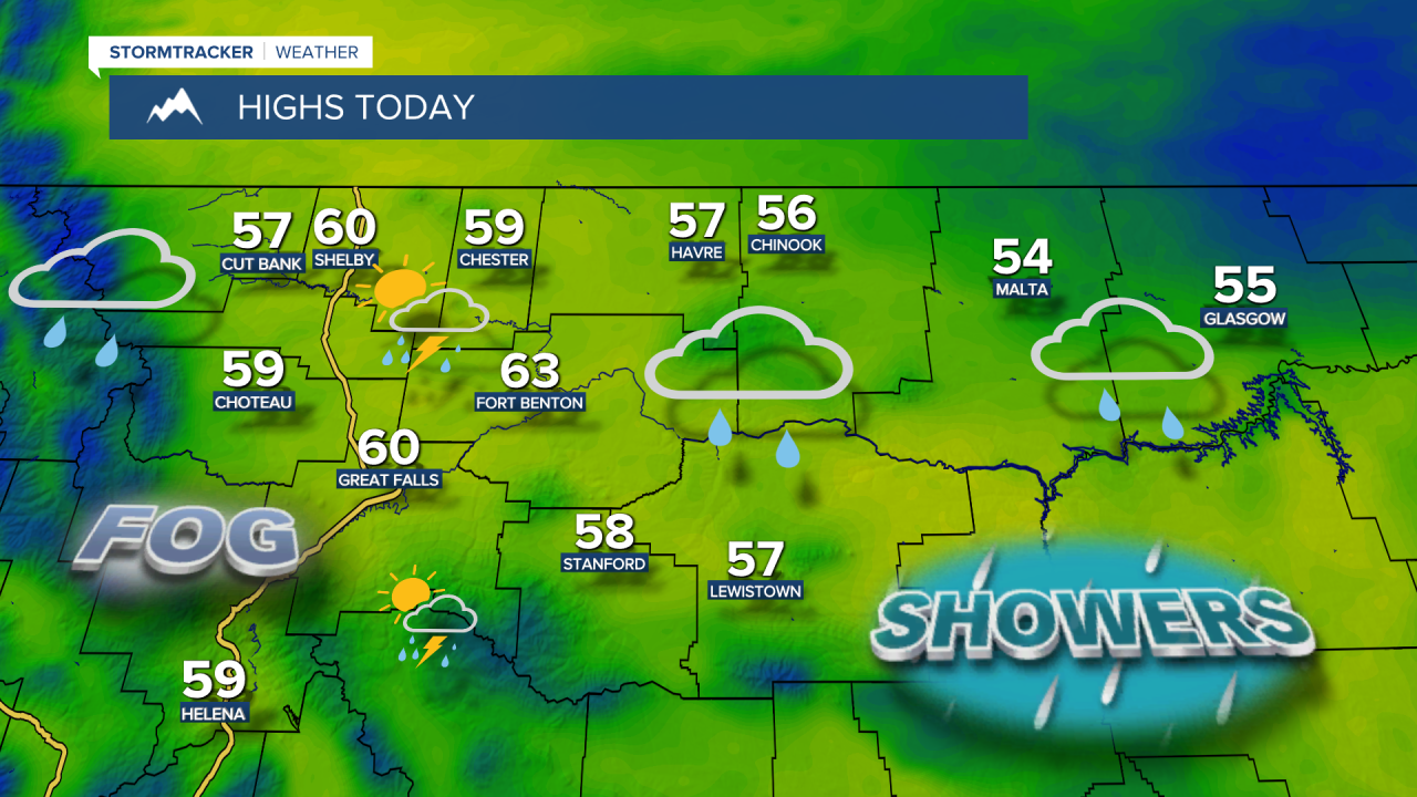
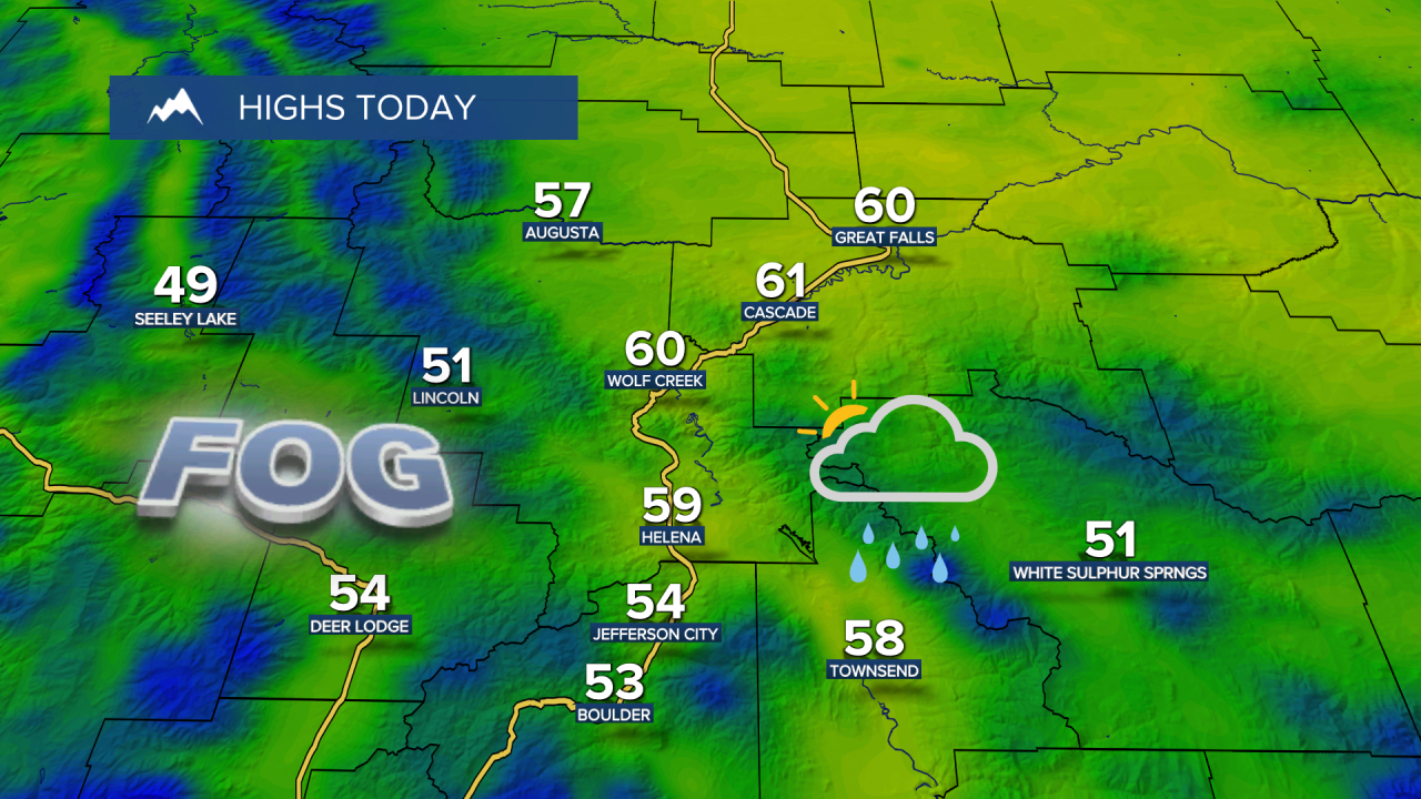
The storm system that brought showers and thunderstorms this weekend will shift east on Monday, but wraparound moisture on the backside of the system will trigger widely scattered showers and thunderstorms. Leftover moisture from the weekend rain is also leading to areas of dense fog, with visibility dropping below a quarter mile in the thickest fog. Daytime highs will reach the 50s and low 60s.
Monday Morning Forecast:
We dry out on Tuesday with mostly sunny skies and mild temperatures. Highs will be in the 50s and 60s, while west-southwest winds pick up with gusts as high as 30 to 40 mph.
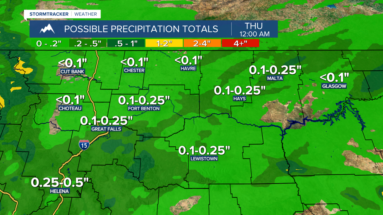
A cold spring storm moves in on Wednesday, with rain changing to snow at all elevations by Thursday morning. Accumulations should stay light in the lower elevations, with heavier snowfall amounts in the mountains. Daytime highs fall from the 50s and 60s on Wednesday to the 30s on Thursday. Scattered showers and cool temperatures linger into Friday, with highs in the 40s.
Aside from some lingering mountain showers, beautiful spring weather returns for the weekend as high temperatures rebound into the 50s and 60s under mostly sunny skies.