

Tonight & Tomorrow
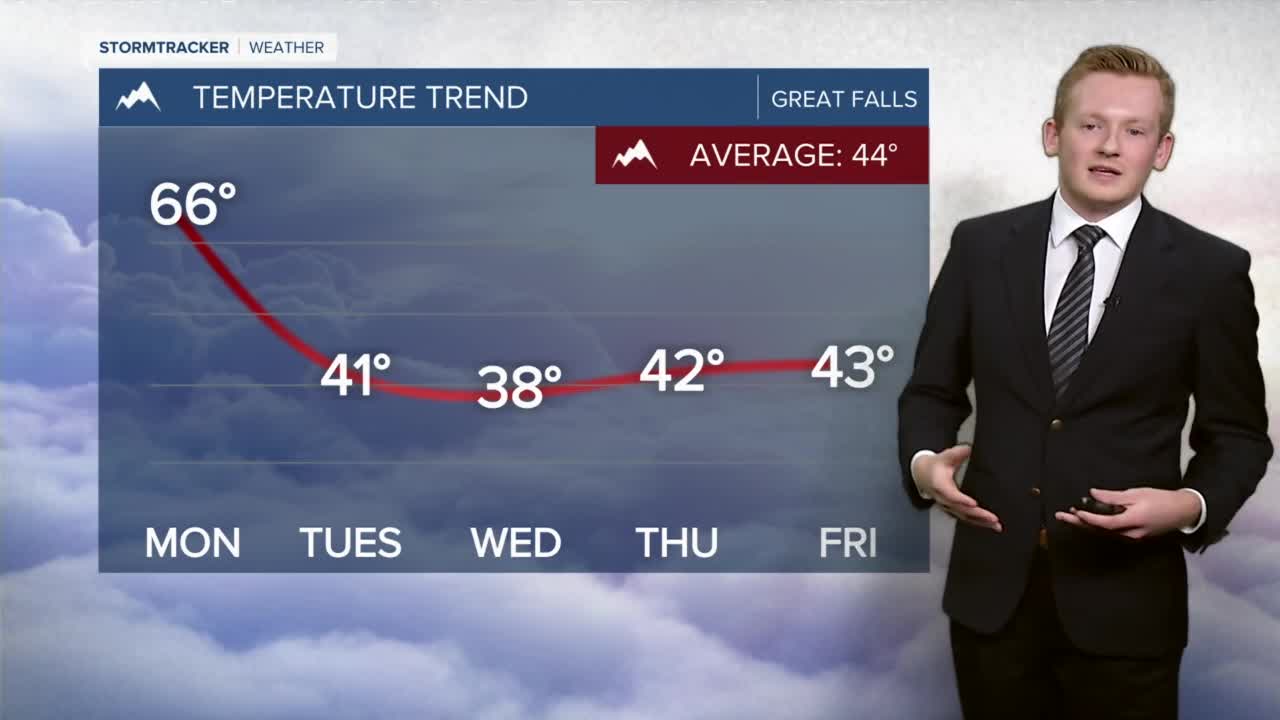
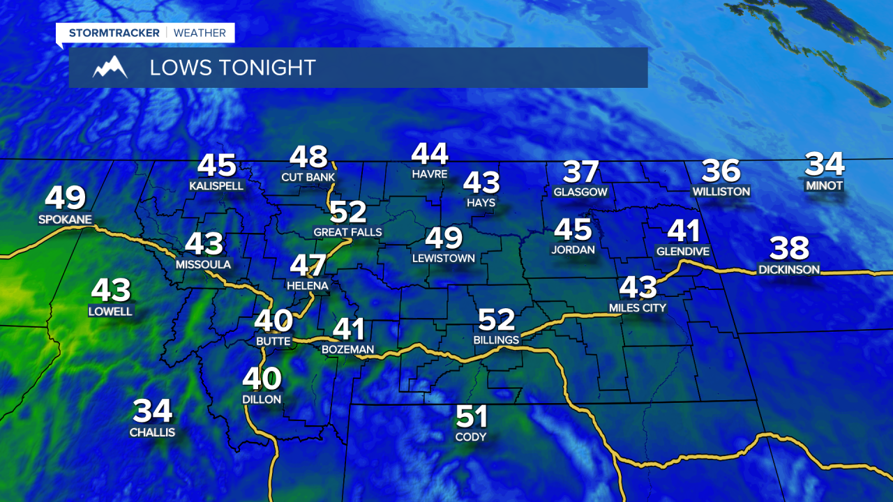
Temperatures will remain unseasonably mild with overnight lows in the low to mid 50's. Interesting note - this is about 5-10 degrees warmer than our normal high temperature for November 14th. Skies will be mostly cloudy throughout the night with some clearing during the afternoon on Monday. Cloud cover increases after dinner time as a cold front approaches from the west throughout the day. High temperatures on Monday will be in the mid to upper 60s.
Midweek
The cold front moves through late Monday night into Tuesday morning. Winds finally begin to relax after lunchtime on Tuesday, but expect gusts up to 55mph in the plains, up to 100mph for the Front. A High Wind Watch remains in effect through noon on Tuesday. Cooler temperatures for Tuesday with highs in the upper 30s and low 40s and overnight lows in the high teens and low 20s. Wednesday is going to be very chilly with highs in the upper 30s and lows in the lower 20s.

Late week
Thursday and Friday will be a bit warmer with highs in the mid 40s and overnight lows in the low 30s. The winds begin to increase again on Friday, however nowhere near as intense as Sunday-Tuesday's winds. Sky conditions will be partly to mostly cloudy but nothing in the way of precipitation.

Next weekend
Temperatures will be seasonable next weekend, in the low to mid 40s with breezy conditions on Saturday. A weak system works into the region Saturday evening which will bring the potential for some light snow showers Saturday night into Sunday.
