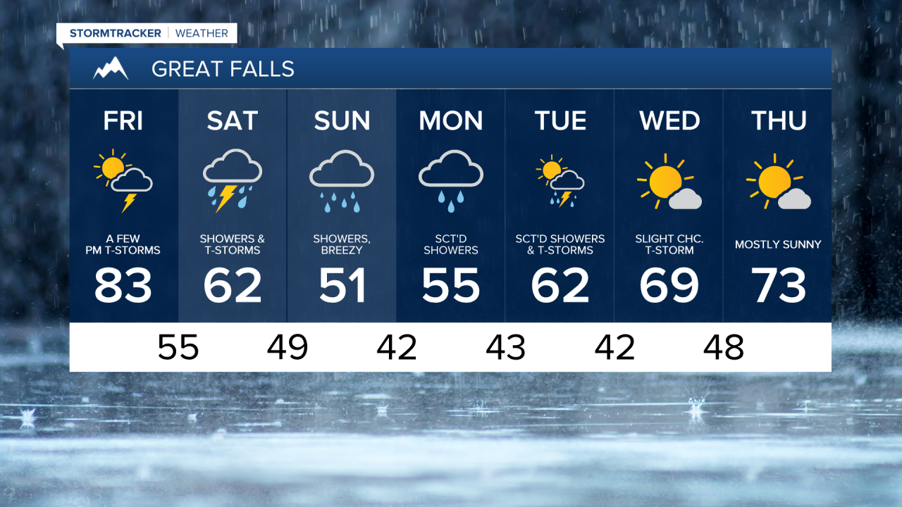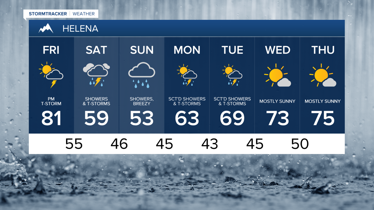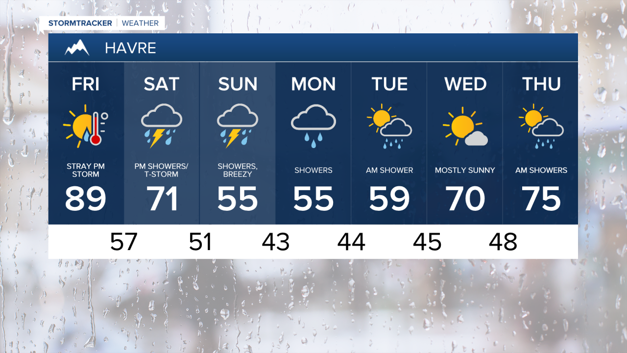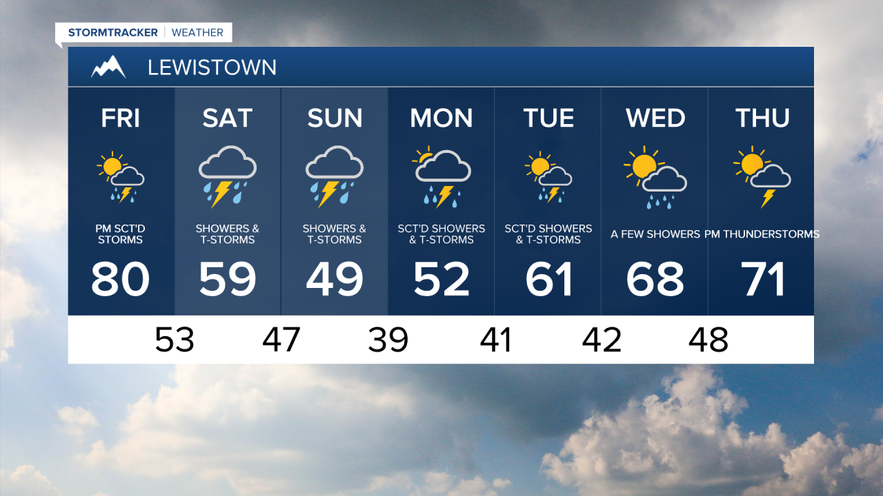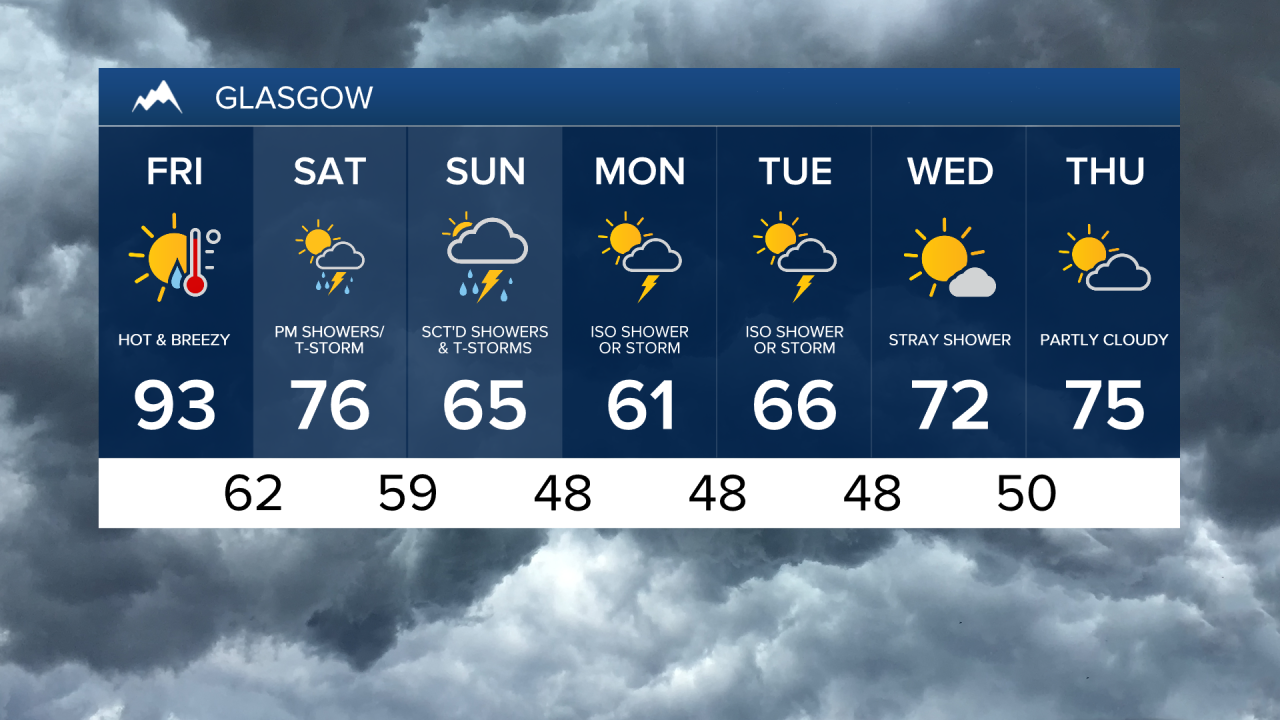


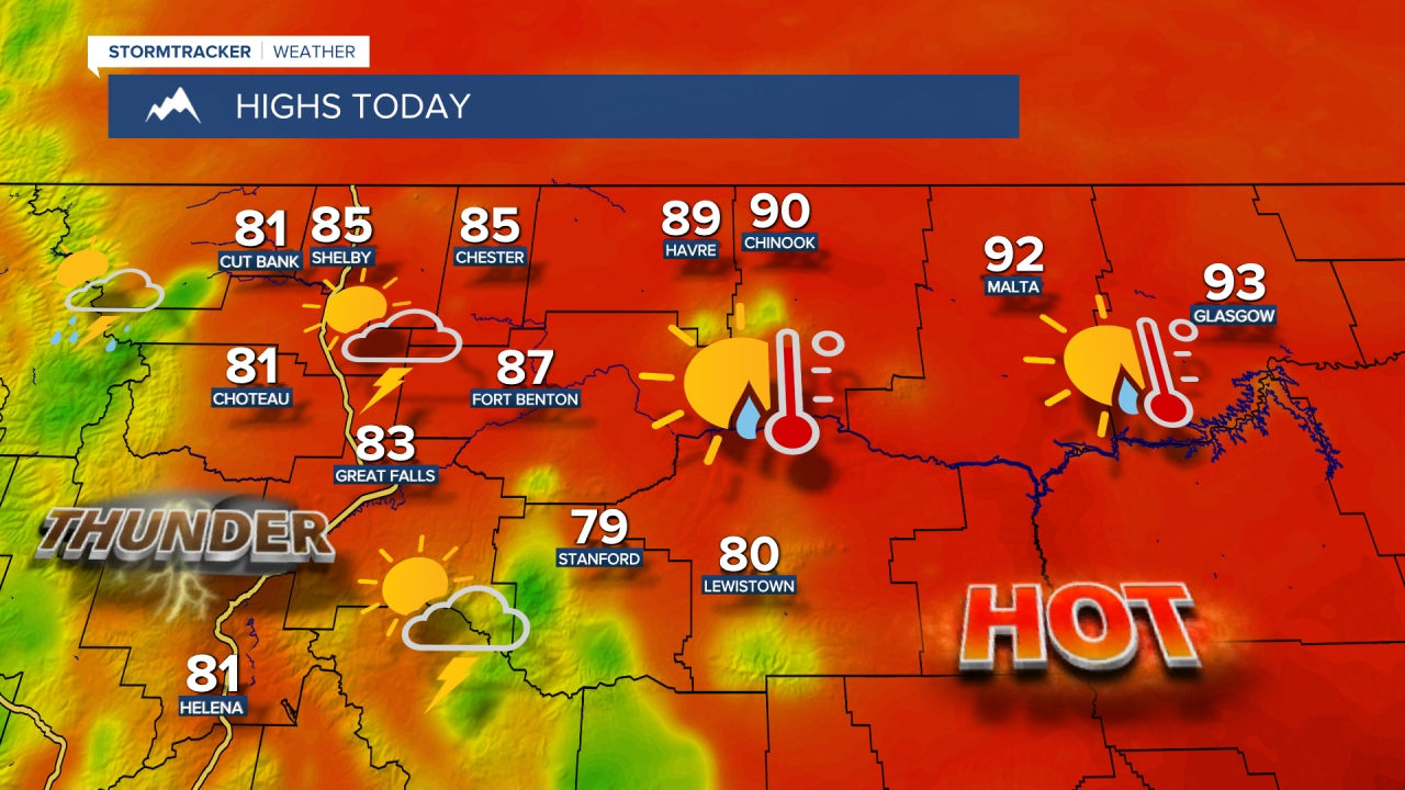
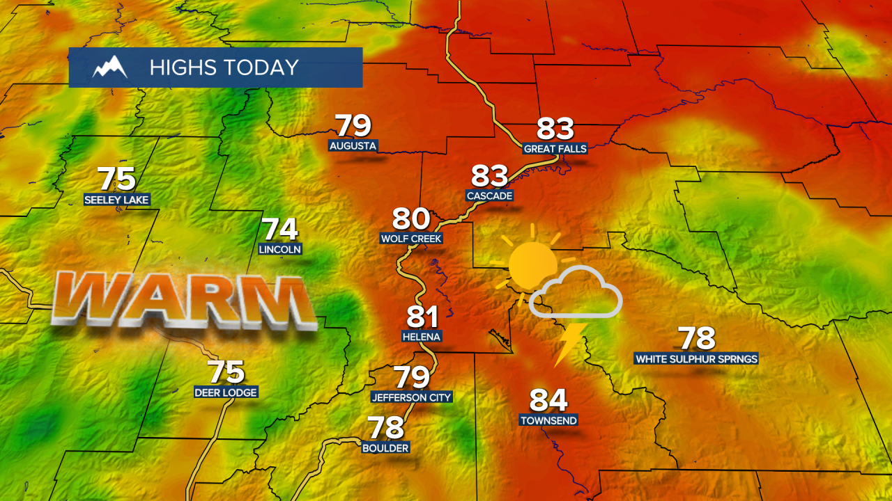
It's been an unusually warm last week of May with highs soaring into the 80s, 90s and even 100s, along with rounds of scattered thunderstorms packing strong wind gusts and lightning. Friday is the last day we'll be stuck in this summer-like pattern, with highs reaching the 80s in central Montana and 90s in eastern Montana. Another round of scattered showers and thunderstorms will fire up this afternoon and evening, with damaging wind gusts, frequent lightning, hail and heavy downpours all possible.
Friday Morning Forecast:
A cold front will slowly work across the area Saturday, bringing more scattered showers and thunderstorms out ahead of it, with some stronger storms possible east of I-15. Behind the cold front, cool and showery weather settles in for the rest of the weekend. High temperatures will only top out in the 60s in central Montana and 70s in eastern Montana on Saturday before cooling further into the 50s in central Montana and 60s in eastern Montana on Sunday.

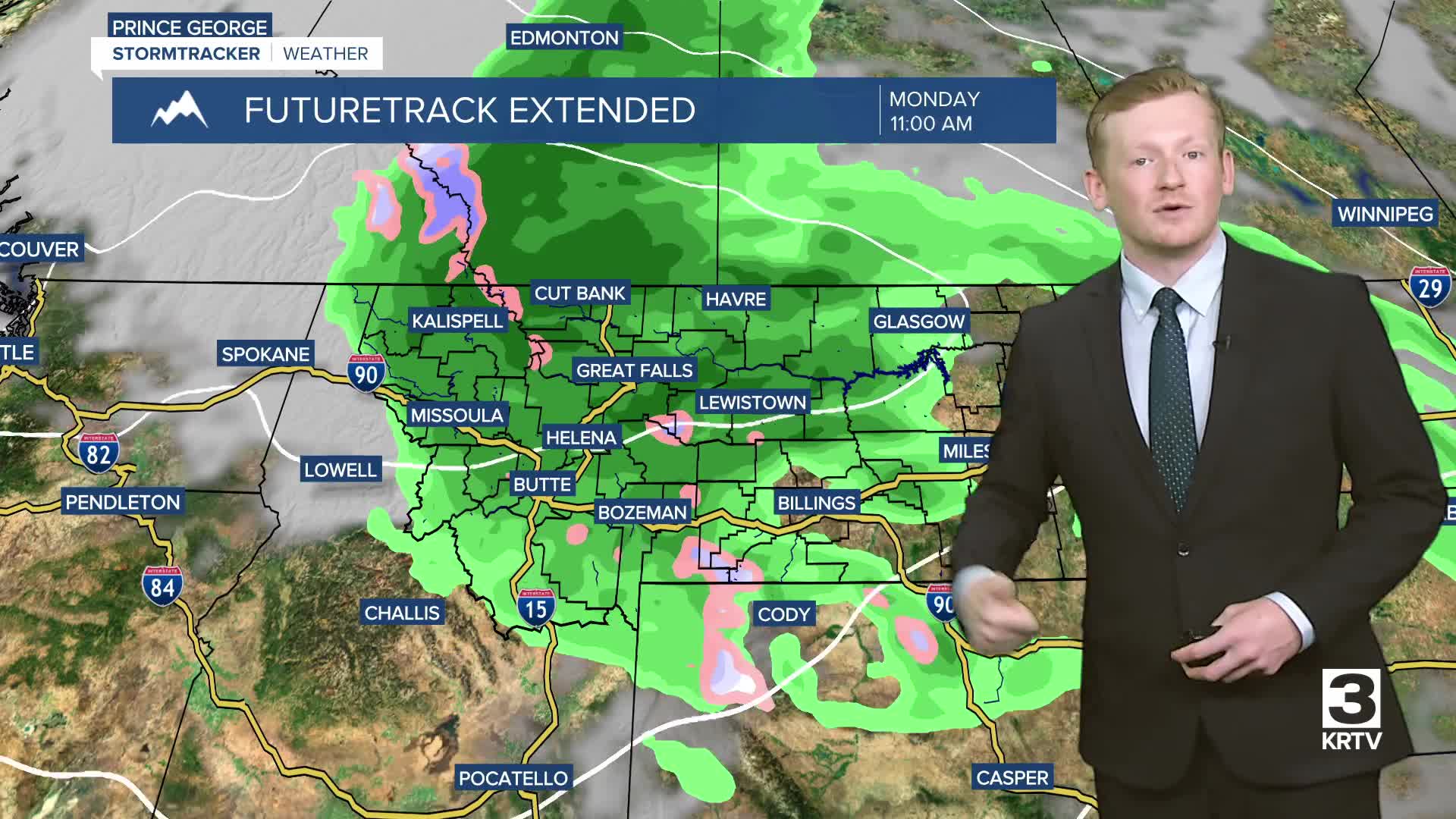
This slow-moving system will bring rounds of showers throughout Sunday, which looks to be the wetter day of the weekend. On-and-off rain showers will continue into Monday and Tuesday. For those with plans to head into the mountains, snow levels could drop as low as 6,000 to 7,000 feet by Sunday. Prepare for cold and wet conditions.
This system will bring significant and much-needed rainfall to central Montana, with most areas receiving 1-3 inches of rain by Tuesday. A few isolated areas could see more than 3 inches. Eastern Montana will generally pick up 0.5-1 inch of rain.

Sunshine and warmer temperatures return toward the middle of next week, with highs warming back into the 60s and 70s.