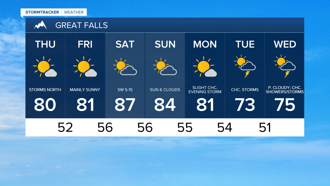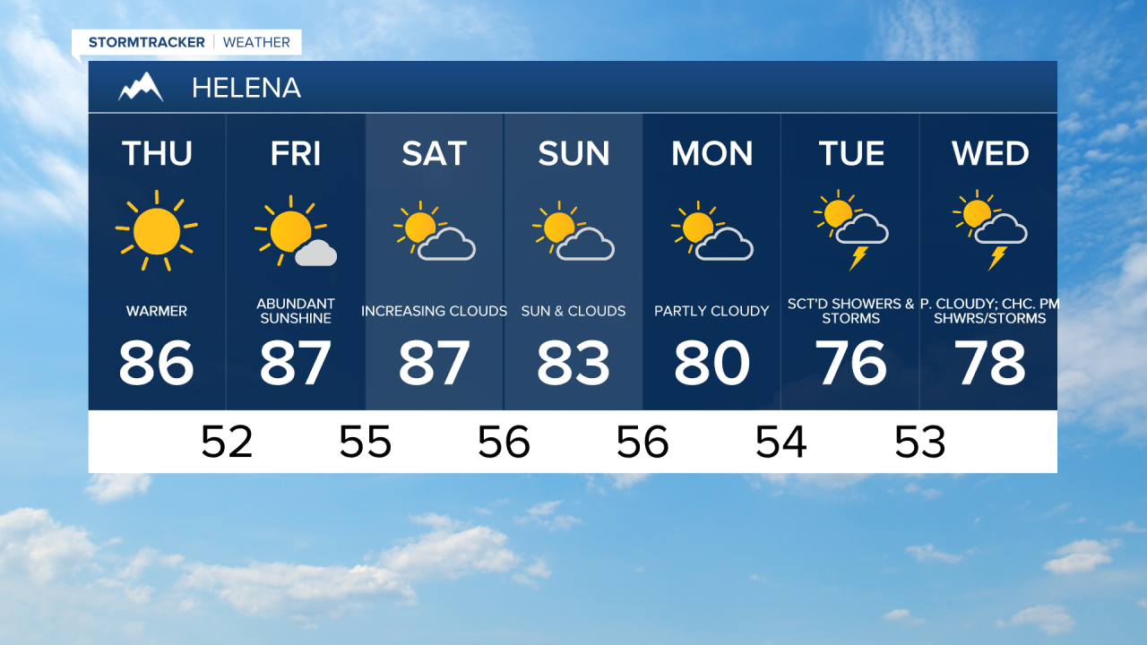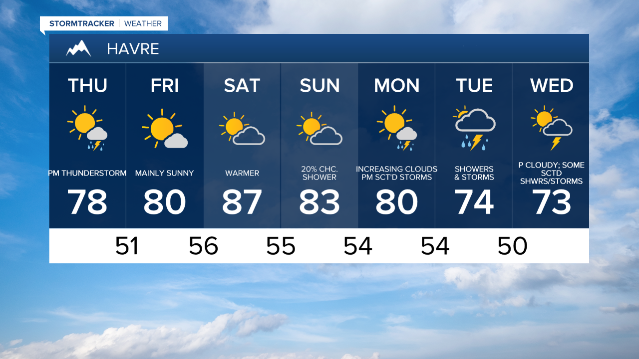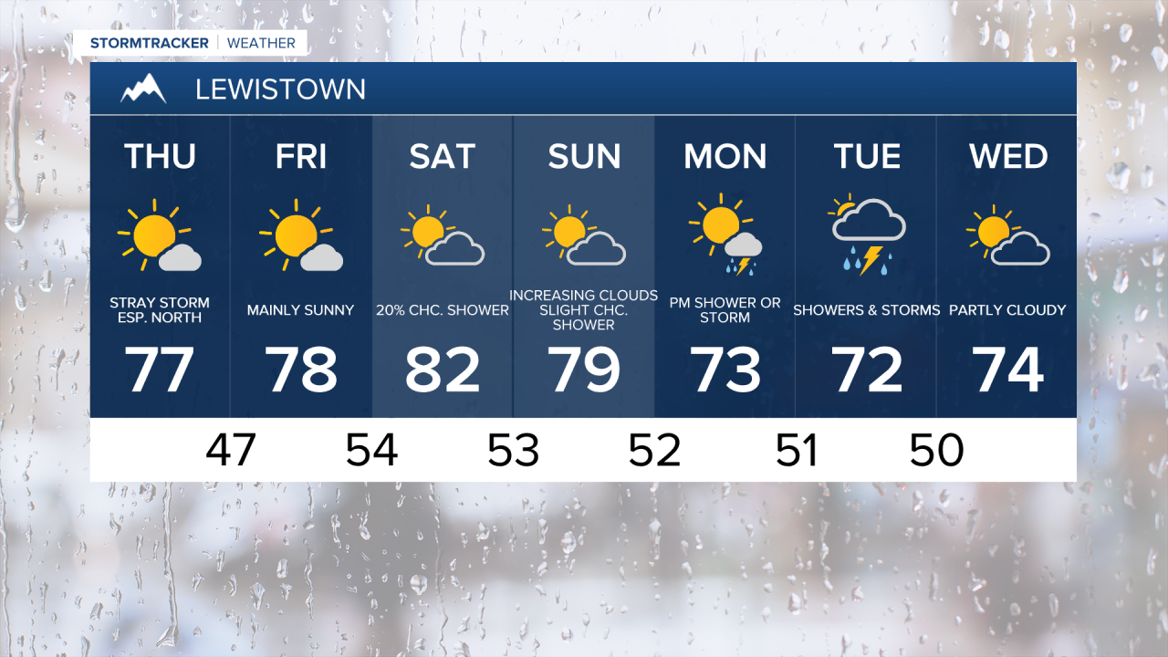


Below average temperatures continued on Wednesday, with most spots topping off in the upper 60s and low to mid 70s. The warming trend will continue into our Thursday as temperatures get into the 70s on the Hi-Line and low to mid 80s in central Montana.
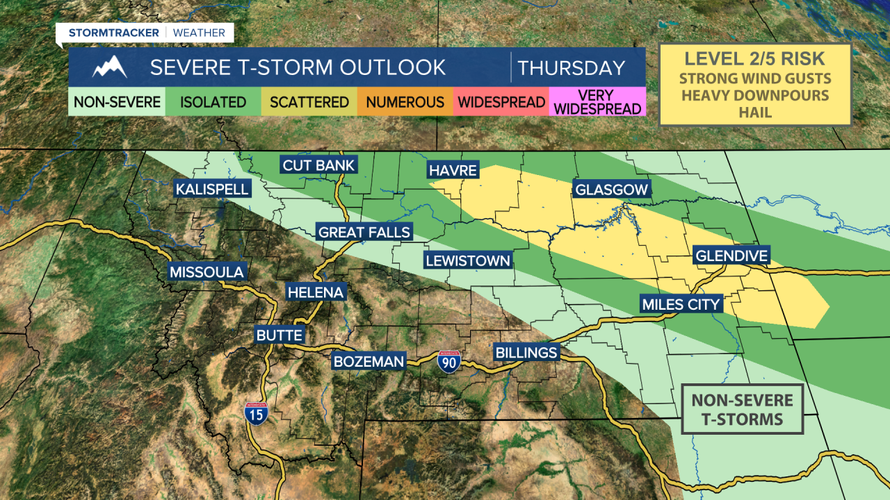
A new system dives southeast out of Alberta later today, bringing scattered showers and thunderstorms to the Hi-Line during the afternoon and evening. The bulk of the storm activity will stay on the Hi-Line, but a rogue storm could move through Chouteau or Fergus county. The storms develop around 2-3 p.m. in Glacier county and will move quickly to the east/southeast. Gusty winds and hail will be our number one concern and impacts.
Nicer weather on Friday as we'll have mostly sunny to partly cloudy skies as high pressure takes hold of our weather. Isolated showers and thunderstorms are possible near I-90. Temperatures hold in the 70s and 80s.
This weekend will feel more like July than what we experienced earlier this week with temperatures into the 80s in most locations. There's a slight chance of a shower or thunderstorm east of Havre on the Hi-LIne.
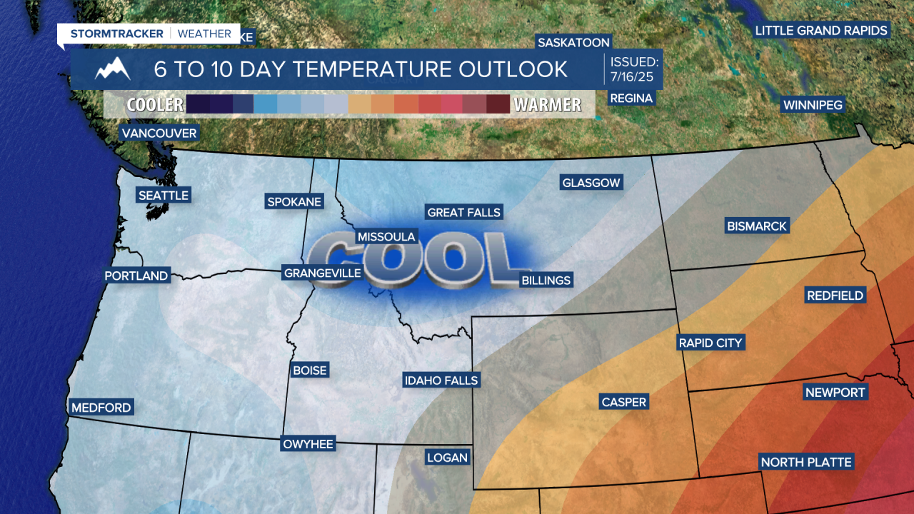
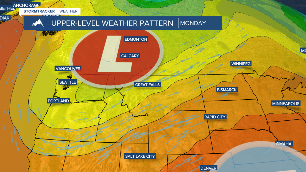
Another system dives south out of British Columbia early next week, bringing breezy and cooler weather by next Tuesday and Wednesday. Moisture looks more limited with this next trough than the one we saw this week, but there will still be an increased risk for showers and thunderstorms. Daytime highs will drop into the 60s and 70s for Tuesday and Wednesday.