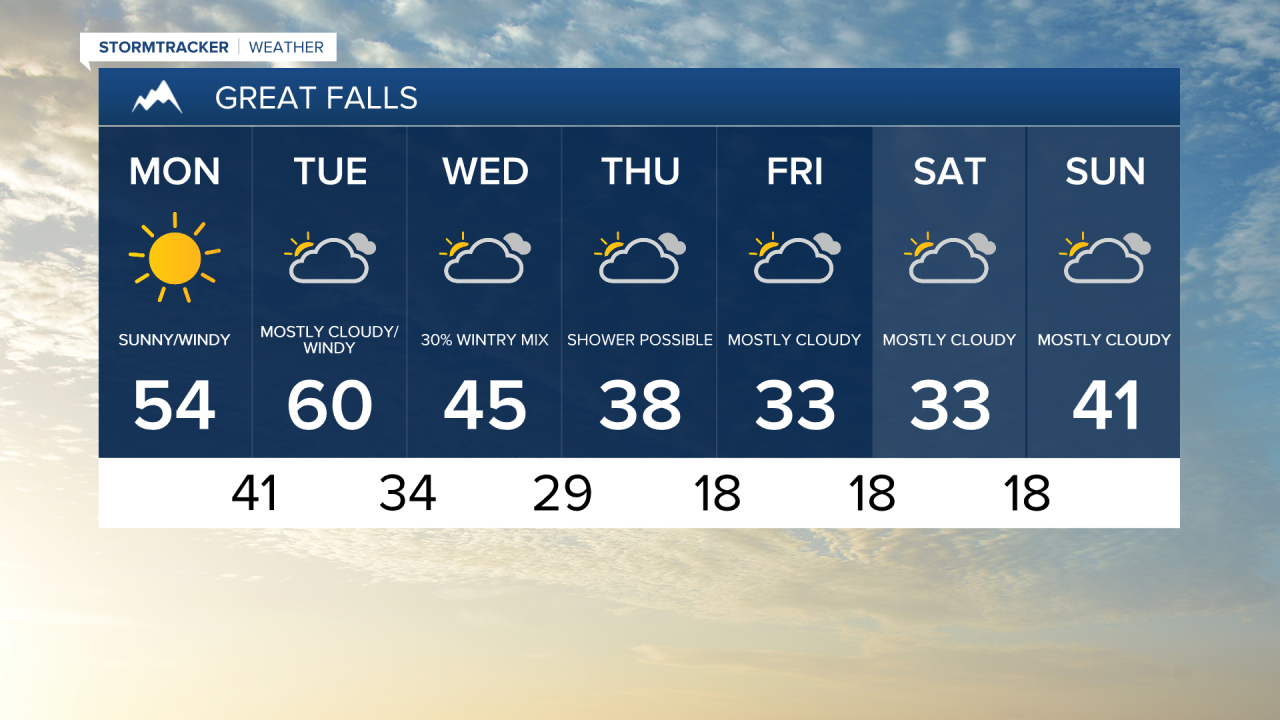
Strong Chinook winds will drive temperatures well above average as we enter a new work week.
Sustained winds of 20 to 30 mph are likely for most of North Central Montana today.
Gusts well over 60 mph are possible along the immediate vicinity of the Rocky Mountain Front.
Due the strong winds in this region The National Weather Service has issued a High Wind Warning for portion of Lewis and Clark, Teton, Pondera, Glacier, and Toole Counties.
The wind will allow for daytime highs to reach the mid to upper 50s throughout North Central Montana.
Areas south of Great Falls will remain much cooler due to the lack of wind.
Highs in Helena are expected in the mid 40s.
The strong wind will take over more of the Hi-Line on Tuesday.
On top of the High Wind Warning, a High Wind Watch will go into effect for Liberty, Hill, and Blaine counties.
Temperatures are expected to peak in North Central Montana and the Hi-Line on Tuesday with highs reaching the low 60s.
Once again Southwestern Montana will remain cooler with highs in the low 50s.
More seasonably average weather is on track to return on Wednesday as colder air pushes into the state.
A few mountain flurries are likely as this colder air invades.
There is about a 40 percent shot of rain in the plains on Wednesday as this initial cold front passes through the state.
Temperatures will fall to the mid 40s on Wednesday due to the passage of this cold front.
A few spotty flurries and showers remain a possibility on Thursday with daytime highs in the upper
30s.
The colder and more seasonably average temperatures are expected to stick around through the weekend.