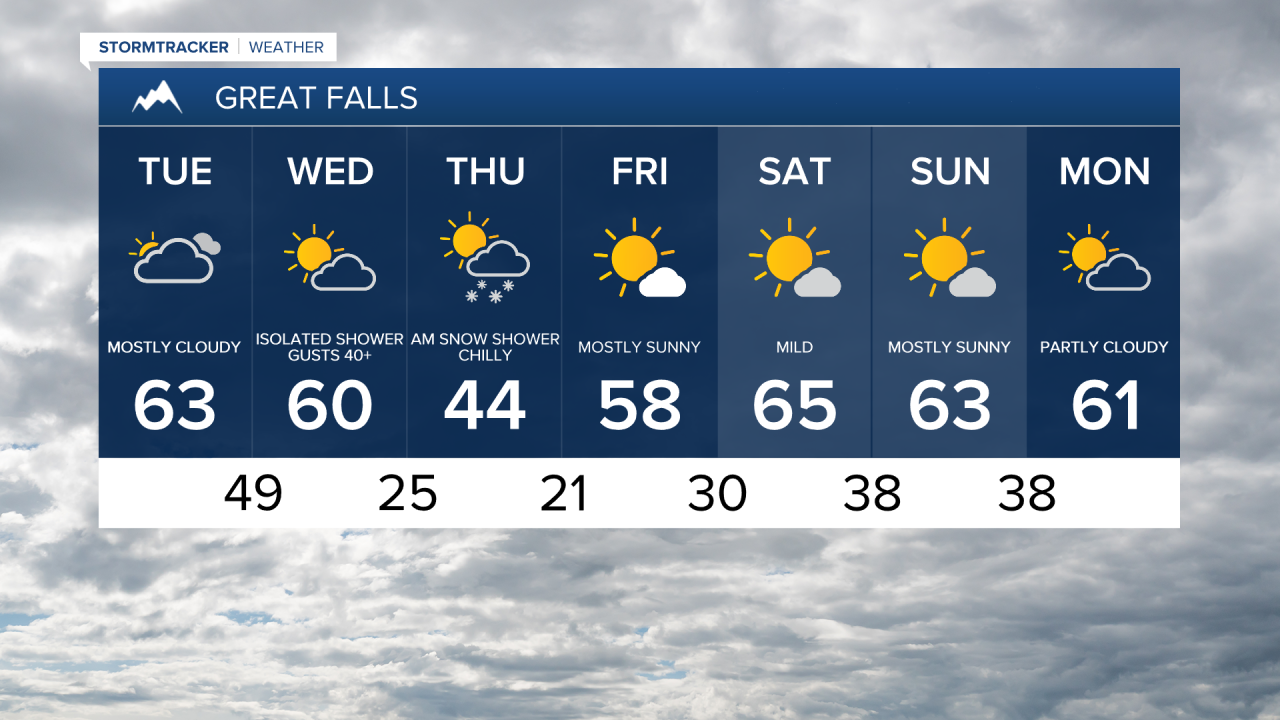
Happy Tuesday! Mostly cloudy and mild with high temperatures in the 50s on the Hi-Line and 60s in central Montana. Winds will pick up today and become much stronger on Wednesday as a Pacific cold front approaches from the west.
Tuesday Morning Forecast:

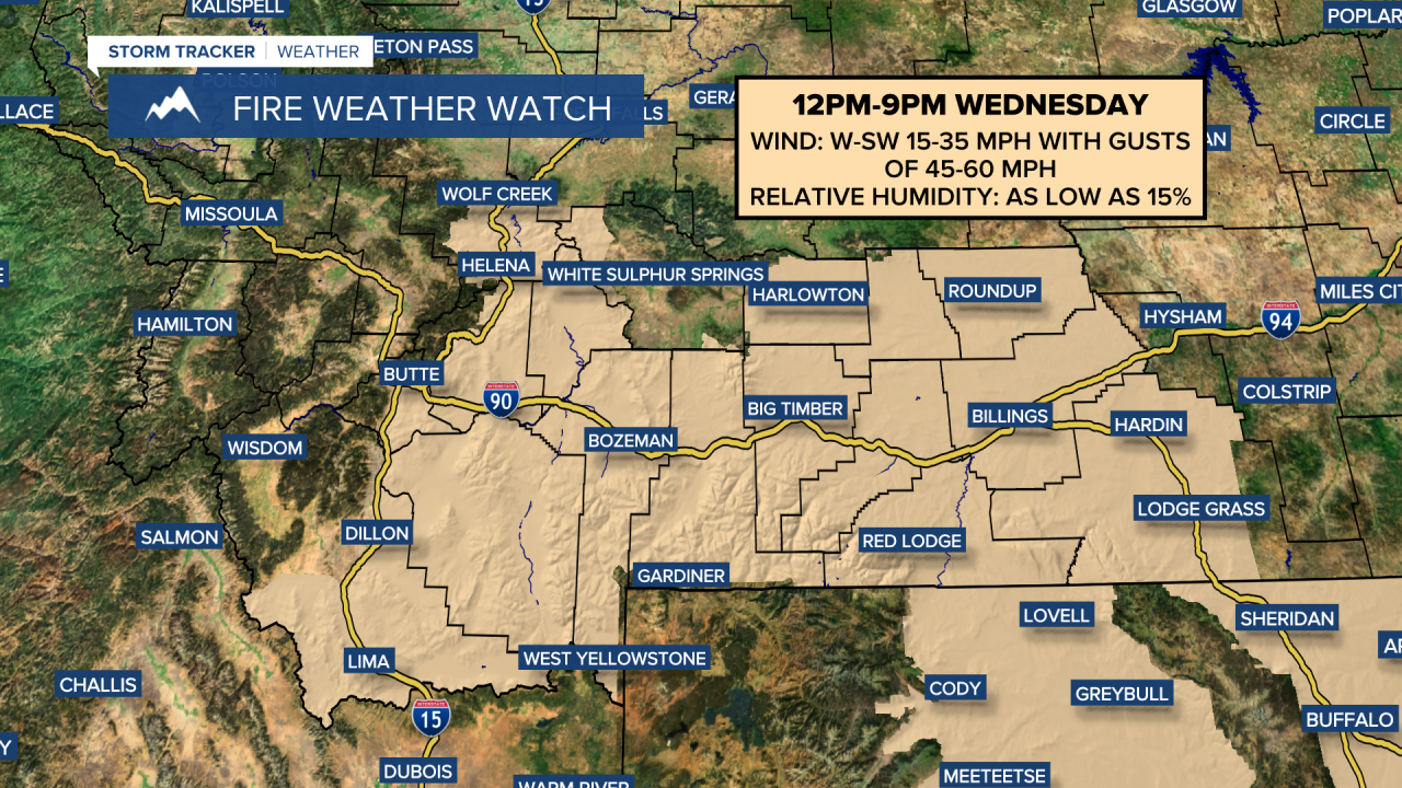
As humidity drops and winds increase, elevated fire weather conditions will be possible on Wednesday. A Fire Weather Watch has been issued for parts of central and southern Montana, including the Helena area.
Temperatures will remain mild with highs in the 50s and lower 60s, but will fall into the 40s during the evening after the front passes through. Wind gusts ahead of the front could reach 50-60 mph. Scattered rain showers are expected, switching to bursts of snow Wednesday afternoon through Thursday morning as temperatures drop into the 10s and 20s.


There will be a brief cooldown on Thursday, with high temperatures in the 30s and 40s, along with a cold west-northwest breeze. Temperatures rebound to the 50s on Friday, with sunshine and lighter winds. High pressure builds back in for the upcoming weekend, bringing warm and dry conditions, with high temperatures reaching the 50s and 60s.
By the middle of next week, a stronger spring storm could bring stronger winds, snow, and colder temperatures to the state.