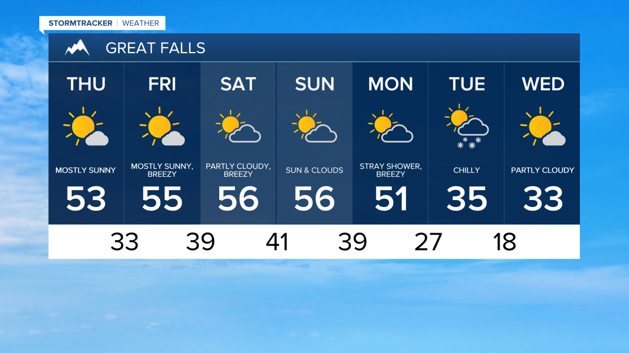
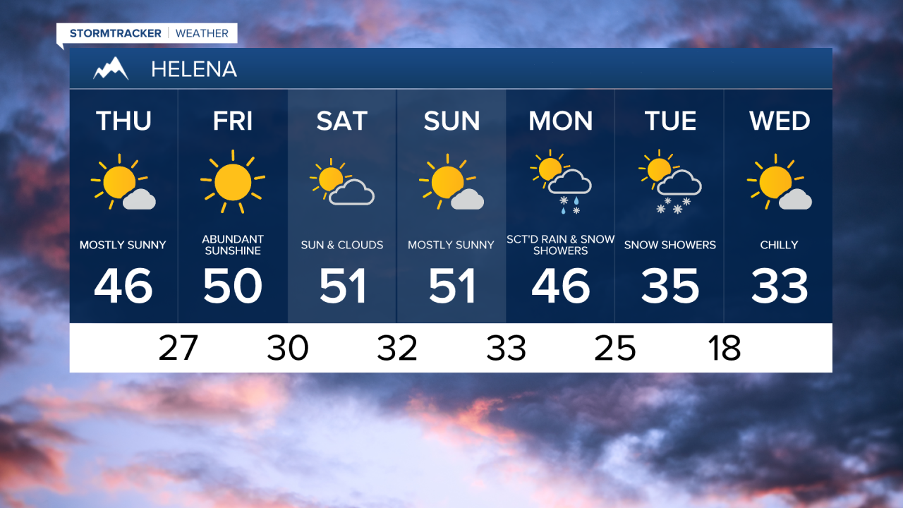
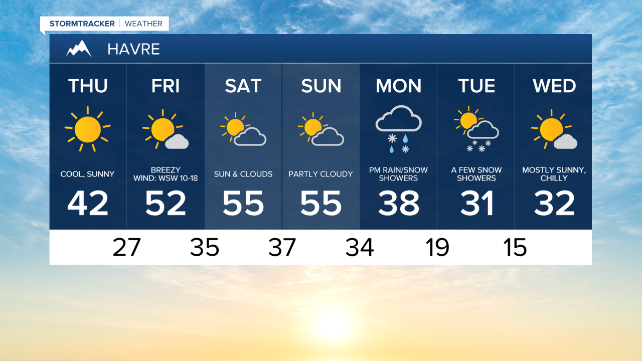
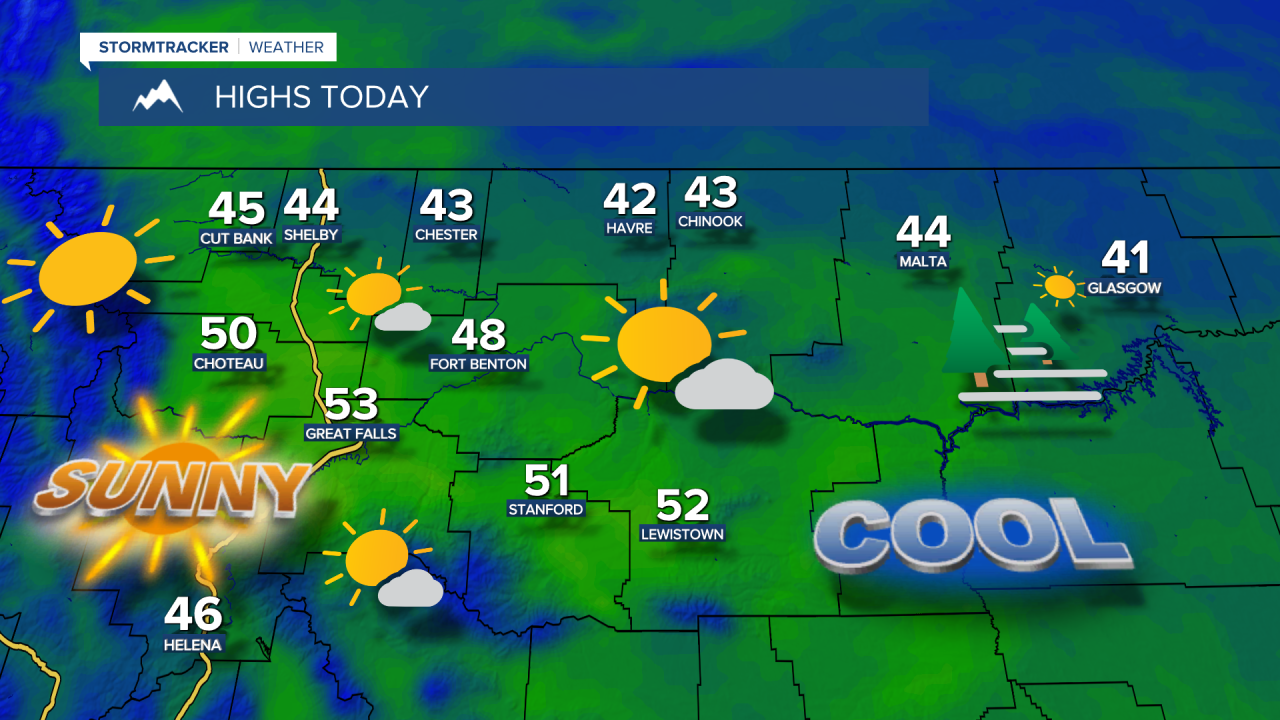
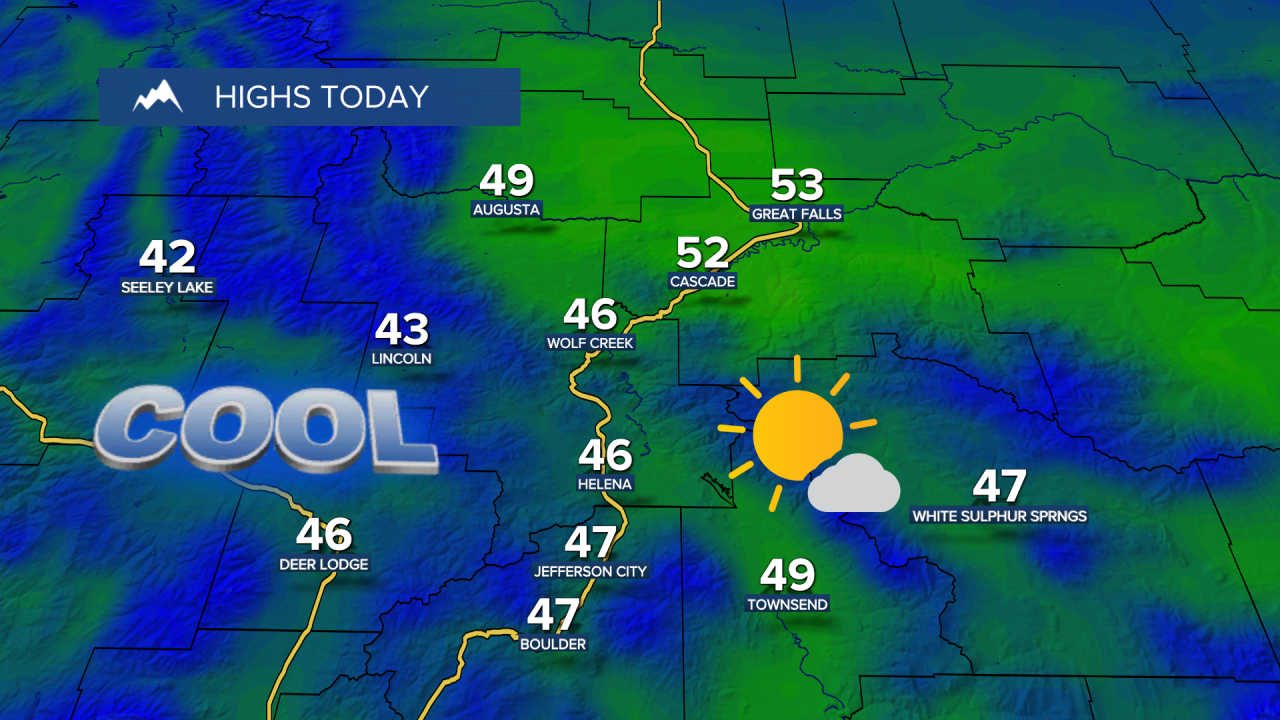
Patchy fog has settled into a few areas early this morning, with visibility down below 1/2 mile in northeast Montana. Skies cleared overnight, allowing temperatures to dip into the 10s and 20s, so leave some extra time to scrape the frost off your windshield this morning. Expect abundant sunshine and light winds today, with highs in the low to mid 40s for the Hi-Line and upper 40s to lower 50s across central Montana.
Today's forecast:
A strong westerly breeze will develop late tonight into Friday morning for the Rocky Mountain Front. Expect gusts of 60-70+ mph for the foothills east of the Rockies, out to Browning, and gusts up to 60 mph for the Cut Bank area. Breezy conditions will also develop across the plains, with winds occasionally gusting over 40 mph. Daytime highs in the 50s under mostly sunny skies.
High pressure stays in control through the weekend, keeping temperatures 5-10 degrees above average and maintaining the dry, partly cloudy weather. However, westerly flow will keep winds fairly gusty into Saturday, and there could be some light mountain snow near the Continental Divide. Daytime highs in the 50s on Saturday and Sunday.
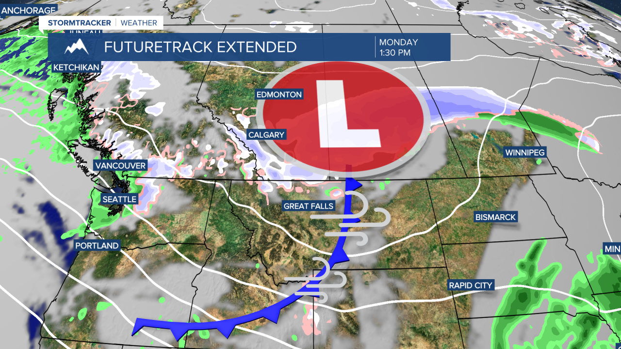
Looking to Thanksgiving week, a strong cold front races across the state on Monday bringing another round of strong winds and some light mountain snow. Behind it, cold northwest flow settles in Tuesday and Wednesday, and that will send temperatures tumbling below average. High will dip into the upper 20s and 30s by Tuesday, with morning lows in the single digits and teens.
An early look at Thanksgiving Day across the area shows cold temperatures and snow showers. High temperatures Thanksgiving Day will be in the 20s on the Hi-Line and low to mid 30s in central Montana. While it does not appear we'll be dealing with a major storm system, light accumulating snow could pose some minor travel impacts during a busy travel week.