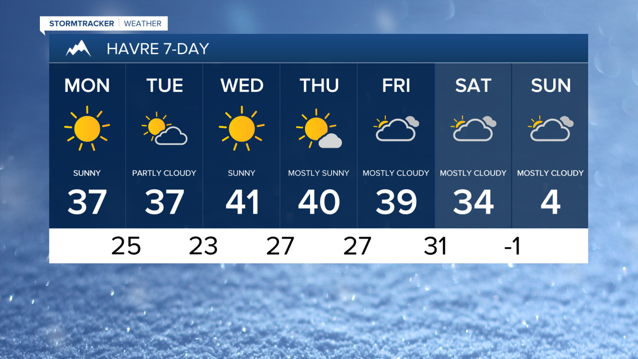
A sunny, mild and breezy week in store for central Montana. High pressure built in over the weekend and will continue to provide quiet but breezy conditions for the days ahead. It is going to be a bit cooler in Helena and across the valleys in southwest Montana as an inversion has formed. Daytime highs reach the mid to upper 20s in these areas, and upper 30s to low 40s throughout the rest of central and eastern Montana.

Dry conditions and warming temperatures ahead for the next several days. It will be breezy at times, especially Wednesday and Thursday, where sustaned winds will range from 15-30 mph and gusting to 30-40 mph across the plains and 40-50+ mph for the Rocky Mountain Front. Daytime highs will be in the upper 30s and low to mid 40s through Friday.

Clouds build Friday ahead of a large system expected to arrive on Saturday. A cold front drops through the area spreading rain and snow showers into central and eastern Montana. The rain quickly changes to snow as temperatures plummet behind the front. High temperatures will be in the low to mid 30s on the Hi-Line and low 40s for central Montana, before dropping into the 0s and 10s Saturday night. Snow is likely on Sunday as temperature stay in the 0s and 10s during the day. The colder, snowier weather pattern looks to stick around into the following week and throughout most of the first half of February.