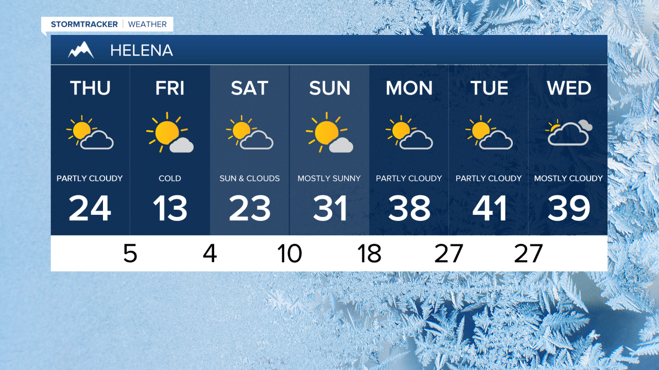
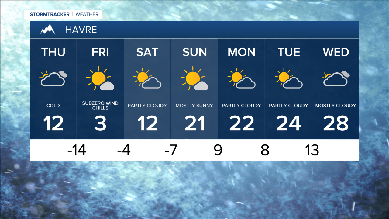
The colder air really settles in on Thursday with mostly cloudy skies and light snow showers at times with highs only hitting the 10s in central Montana and -0s and 0s in northeast Montana.
Today's Forecast:


A bitterly cold Thursday night as temperatures plummet below zero east of the Divide. Wind chills could drop to -30 to -45 on the Hi-Line and between -10 and -30 for central Montana. In this kind of cold, cover any exposed skin, dress in layers and limit time outdoors.

The National Weather Service has issued a Cold Weather Advisory for Hill, Blaine, Phillips and Valley counties as well as the Bear Paws. This goes through Friday morning and may be extended into Saturday.
Light snow showers will accompany the Arctic air. Accumulations of a dusting to an inch or two could cause slippery travel in some areas tonight into Friday morning.

Temperatures will start to recover this weekend, but highs and lows remain below averages. Saturday's highs will be in the 0s in northeast Montana and 10s and 20s in central Montana before warming to the 0s and 10s in northeast Montana and 20s and 30s in central Montana on Sunday.
We'll return to seasonable temperatures in the 20s in northeast Montana and 30s and 40s in central Montana next week with light precipitation at times.