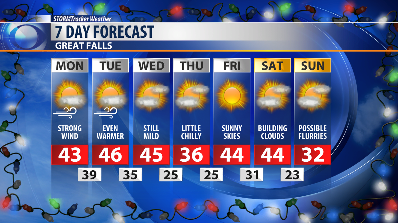
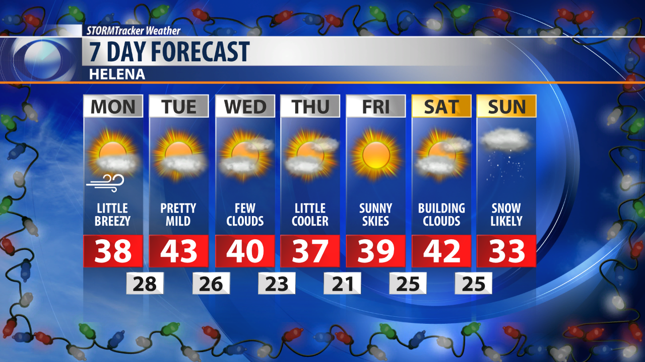
Strong wind will take over Montana with gust in upwards of 30 mph for most.
The strongest winds are expected to take pace in the immediate vicinity of the Rocky Mountain Front. Blowing and drifting snow in Glacier and Pondera County has caused the National Weather Service to issue a Blizzard Warning through Tuesday morning for this area. Blowing and drifting snow is likely throughout most of Central Montana, however as temperatures continue to warm, snow will become less likely to blow about.
The National Weather Service in Great Falls says: "Ground blizzard conditions are expected to continue along much of the Rocky Mountain Front today, especially northern parts in and around the Blackfeet Nation. The strongest winds and worst conditions are expected to occur Monday morning, with significant impacts including roadway obstruction from drifting snow and severe driving conditions with near-zero visibility at times. To the south and east along the entire lee of the mountains, significant drifting and blowing snow, especially in the most exposed areas, are likely to cause visibility and obstruction issues, mainly on roads."
Thanks to the wind, temperatures will continue climb this week eventually reaching the mid 40s by Wednesday.
A shot of cold air will drop temperatures on Thursday, however conditions will rebound on Friday.
Our next potential weather maker looks to move in on Monday of next week.