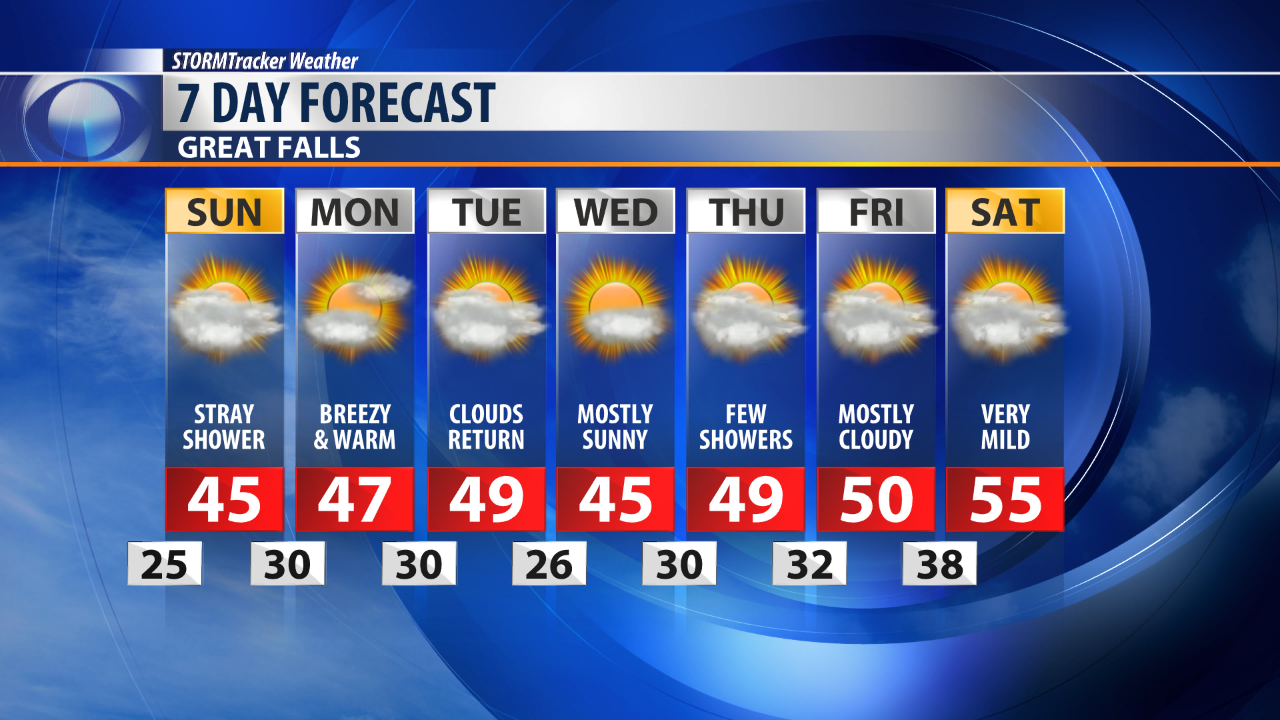
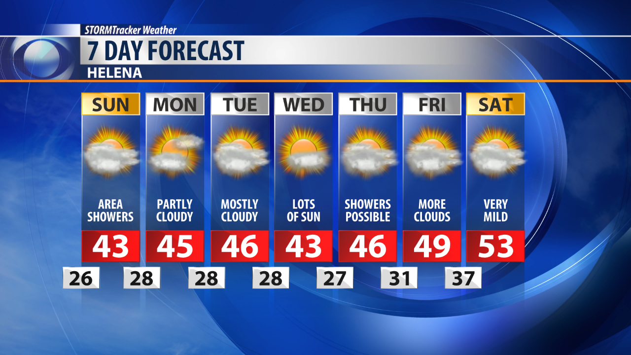
Overnight lows on Saturday will tend a bit cooler compared to the past few days.
Most of Central Montana will drop to the mid 20s with partly cloudy skies.
Cloudy skies will continue on Sunday as a weak cold front enters the state.
This cold front will bring a round of snow to the mountains and a few flurries into the foothills.
Most mountainous areas will pick up around one to three inches with the plains seeing more a rain and snow mixture.
The brunt of the snow will remain primarily in Southwestern Montana.
Despite this passing system, temperatures will continue to remain well above average.
The winds are anticipated to pick up a bit as we head into a new work week.
Daytime high temperatures will continue to trend in the mid to high 40s for our area.
A few showers are possible on Tuesday.