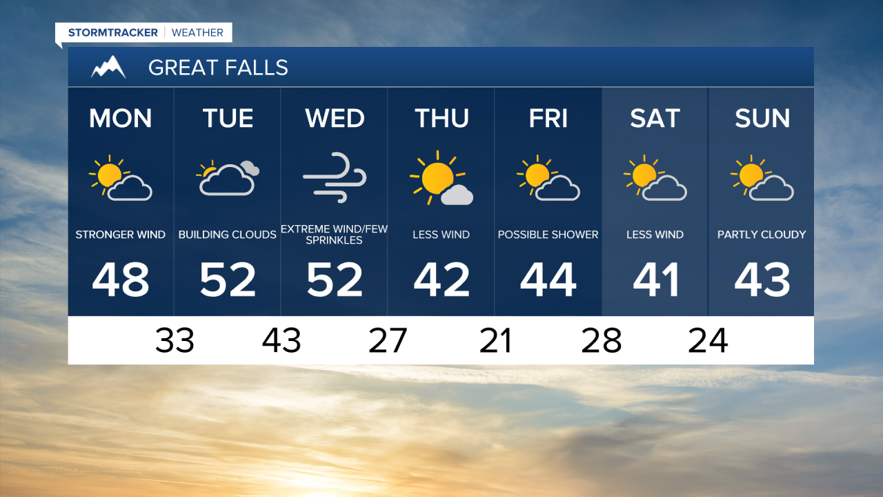
As we head into a new work week strong wind will once again be the main talking point.
A weak cold front will pass through the state this afternoon.
This front will help to instigate strong down sloping winds, in turn driving temperatures to the upper 40s.
Gusts are expected to hover around 30 mph this afternoon.
The prominent wind will continue on Tuesday with still warmer temperatures.
Some snow is possible west of the divide primarily into Northwestern Montana.
The wind on Tuesday will allow for temperatures to reach the high 40s and low 50s throughout Central Montana.
Wednesday is shaping up to be the windiest day with gusts well over 60 mph.
Due to the extreme wind a high wind watch is scheduled to go into effect early Wednesday morning.
Another cold front will pass through the state helping to ramp up the wind and increase the chances of rain and mountains snow.
The strong wind east of the divide will burn up most of the moisture however a few spotty showers can't be ruled out.
With the wind, daytime highs will hover around 50 degrees Wednesday afternoon.
Although still breezy, the later half of the work week is shaping up to less gusty.
With less wind daytime highs will fall to the low 40s on Thursday and stay in the low 40s through Sunday.