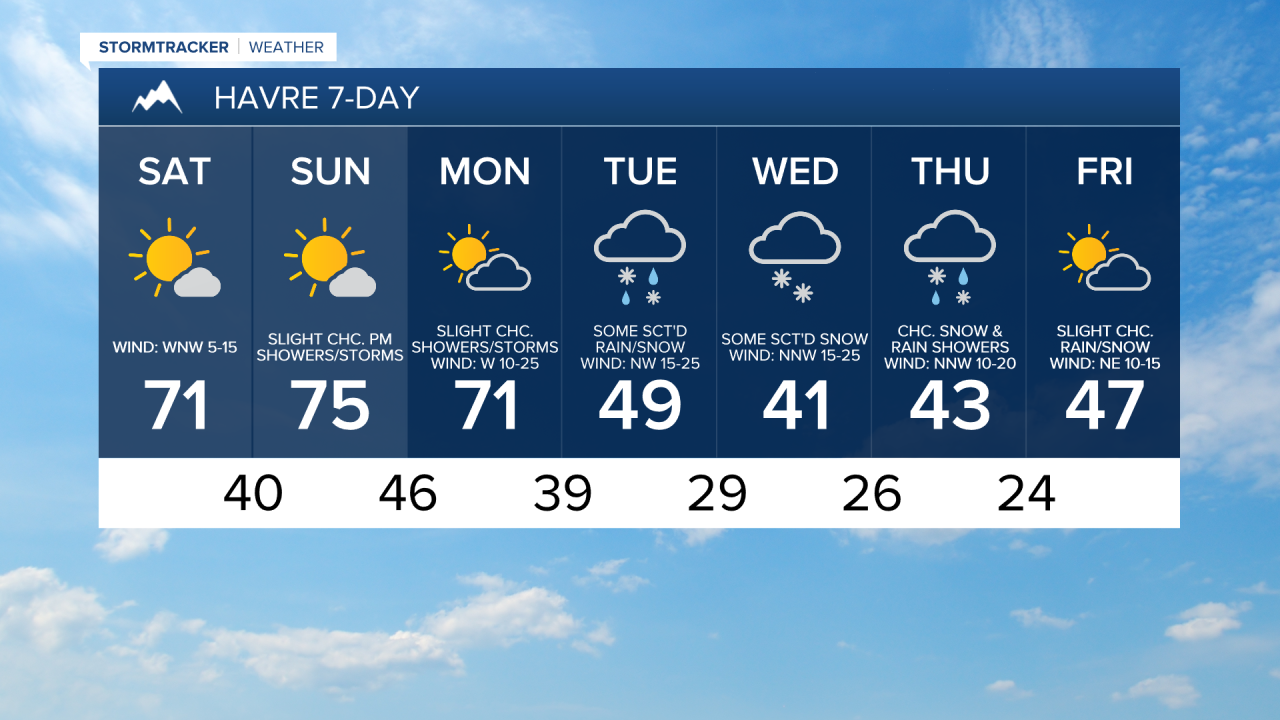
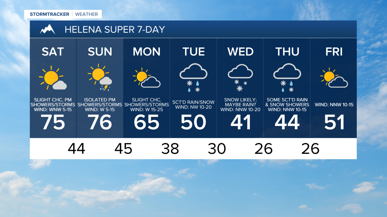
We are going to have partly to mostly cloudy skies tonight with some isolated showers and thunderstorms around as a disturbance passes through our area. It is also going to be mild tonight as lows are going to be in the upper 30s and low to mid 40s in most locations. There is also going to be a breeze around tonight along the Rocky Mountain Front.
For tomorrow, we are going to have partly to mostly sunny skies with a couple isolated showers around during the morning in north-central Montana and a few isolated showers and thunderstorms around during the afternoon and evening around Helena. There is also going to be a bit of a breeze around tomorrow as sustained wind speeds are going to be between 5 and 20 mph. It is also going to be warm again tomorrow as highs are going to be in the mid to upper 60s and low to mid 70s.
We are then going to have mostly sunny skies (via increasing clouds) on Sunday with some isolated showers and thunderstorms around during the afternoon and evening. It is also going to be warm again on Sunday as highs are going to be in the 70s and upper 60s. There is also only going to be a little breeze around on Sunday as sustained wind speeds are going to be between 5 and 15 mph.
It is then going to be breezier and a touch cooler on Monday as sustained wind speeds are going to be between 10 and 25 mph and high temperatures are going to be in the mid to upper 60s and low to mid 70s. We are also going to have partly cloudy skies on Monday with a few isolated showers and thunderstorms around, generally during the afternoon and evening.
There are then going to be some scattered areas of rain and snow around on Tuesday and there are going to be areas of snow around on Wednesday as a storm system impacts our area. Some rain may also mix in with this snow in some locations on Wednesday. We are also going to have partly to mostly cloudy skies on Tuesday and mostly cloudy to overcast skies on Wednesday.
The temperatures are also going to cool down a lot over these two days as highs on Tuesday are going to be in the mid to upper 40s and low to mid 50s and highs on Wednesday are going to be in the mid to upper 30s and low to mid 40s. Gusty winds are also expected on these two days as sustained wind speeds are going to be between 10 and 30 mph, and wind gusts over 40 mph are possible.
On Thursday, we are going to have mostly cloudy skies with some scattered snow and rain showers around. It is also going to be chilly and a bit breezy on Thursday as highs are going to be in the 40s and sustained wind speeds are going to be between 10 and 20 mph.
We are then going to have partly to mostly sunny skies on Friday with just a few isolated rain and snow showers around. It is also going to be warmer and a little breezy on Friday as highs are going to be in the 40s and low 50s and sustained wind speeds are going to be between 5 and 20 mph.