


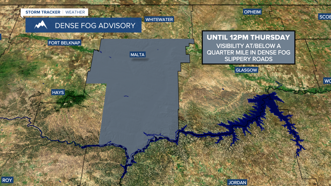
There are going to be areas of freezing fog around again tonight and tomorrow morning, especially along the Hi-Line, and some of this fog will be dense (visibility less than .25 miles), so please use extreme caution when driving. A DENSE FOG ADVISORY is still in effect for central and southern Phillips County until 12pm Thursday, and this advisory will likely get extended to cover more locations once the fog redevelops.
Outside of the fog, we are going to have partly to mostly cloudy skies tonight with a few isolated snow showers around. It is also going to be cold tonight along the eastern half of the Hi-Line as lows are going to be in the single digits and it is going to be chilly elsewhere as lows are going to be in the 20s and mid to upper teens.
Watch the detailed forecast:
If you are traveling for Thanksgiving tomorrow, only minor travel impacts are expected during the daylight hours, with dense fog being the main hazard. A lot of locations will be dry during the daylight hours tomorrow, but there will be a few light snow/rain showers around. Snow will begin to develop tomorrow afternoon in Glacier County. Conditions will then begin to deteriorate tomorrow evening as the snow becomes more widespread within north-central Montana. Around Helena, there will be scattered rain/snow showers around tomorrow evening.
Widespread accumulating snow is likely tomorrow night in north-central Montana and there are going to be scattered snow/rain showers around the Helena area tomorrow night, with more impactful snow developing after midnight.
- Road Conditions: click here
- MDT Webcams: click here
- MTN Cameras: click here
Widespread accumulating snow will continue on Friday, with the snow gradually tapering off as we head into Friday evening/night. Some of the snow that falls tomorrow night and Friday may be moderate to heavy at times.
There has been a northward trend with this storm system, which has led us to forecast higher snow amounts for the Hi-Line and lower snow amounts in central Montana compared to our previous forecasts.
Around the Helena area, 1-6” of snow is expected through Friday night. In north-central Montana, snow amounts will range from 3-10”, with the highest snow amounts along the Hi-Line. In the mountains, 3-12” of snow is expected through Friday night.


Due to this forecasted snow, a WINTER STORM WATCH is in effect for a lot of western, north-central and northeastern Montana from Thursday evening through 2pm/5pm Friday (5am Saturday for northeastern Montana).
Snow-packed roads and difficult travel conditions are expected tomorrow evening/night and Friday. Consider changing your travel plans if you can. If you have to travel during this timeframe, then make sure you have a safety kit in your car, drive slowly, and give yourself plenty of time to get to where you need to go.

There is also going to be a breeze around later tomorrow night and Friday as a cold front passes through our area. Sustained wind speeds are going to be between 10 and 20 mph, and wind gusts over 30 mph are possible. This wind will cause there to be some blowing snow.
It is going to be cold again tomorrow along the Hi-Line as highs are going to be in the 20s and low 30s. South of the Hi-Line, it is going to be cool tomorrow as highs are going to be in the 30s and low 40s. It is then going to be cold for everyone on Friday as highs are going to be in the teens and 20s, and wind chills are going to be in the -0s, 0s, and 10s.
This weekend will be cold, but otherwise nice. Highs this weekend are only going to be in the single digits and low teens along the Hi-Line and the teens and low to mid 20s in locations south of the Hi-Line. Lows Friday night and Saturday night will be in the -10s and -0s along the Hi-Line and the -0s and 0s south of the Hi-Line. Sunshine will return this weekend as it is going to be partly cloudy on Saturday and partly to mostly sunny on Sunday, so that will help make it feel slightly warmer out there. It is also going to be mostly dry this weekend and there will be little to no wind.
The temperatures will warm back up early next week as highs are going to be in the 20s and 30s on Monday and the 30s on Tuesday. The temperatures will then cool back down into the 20s and low to mid 30s on Wednesday. On Monday, we are going to have mostly cloudy skies with a few isolated snow showers around. There are then going to be scattered snow/rain showers around on Tuesday, especially during the afternoon/evening, and there ae going to be some scattered snow showers around on Wednesday as we remain in an unsettled weather pattern. It is also going to be a bit breezy on Monday as sustained wind speeds are going to be between 10 and 20 mph.


