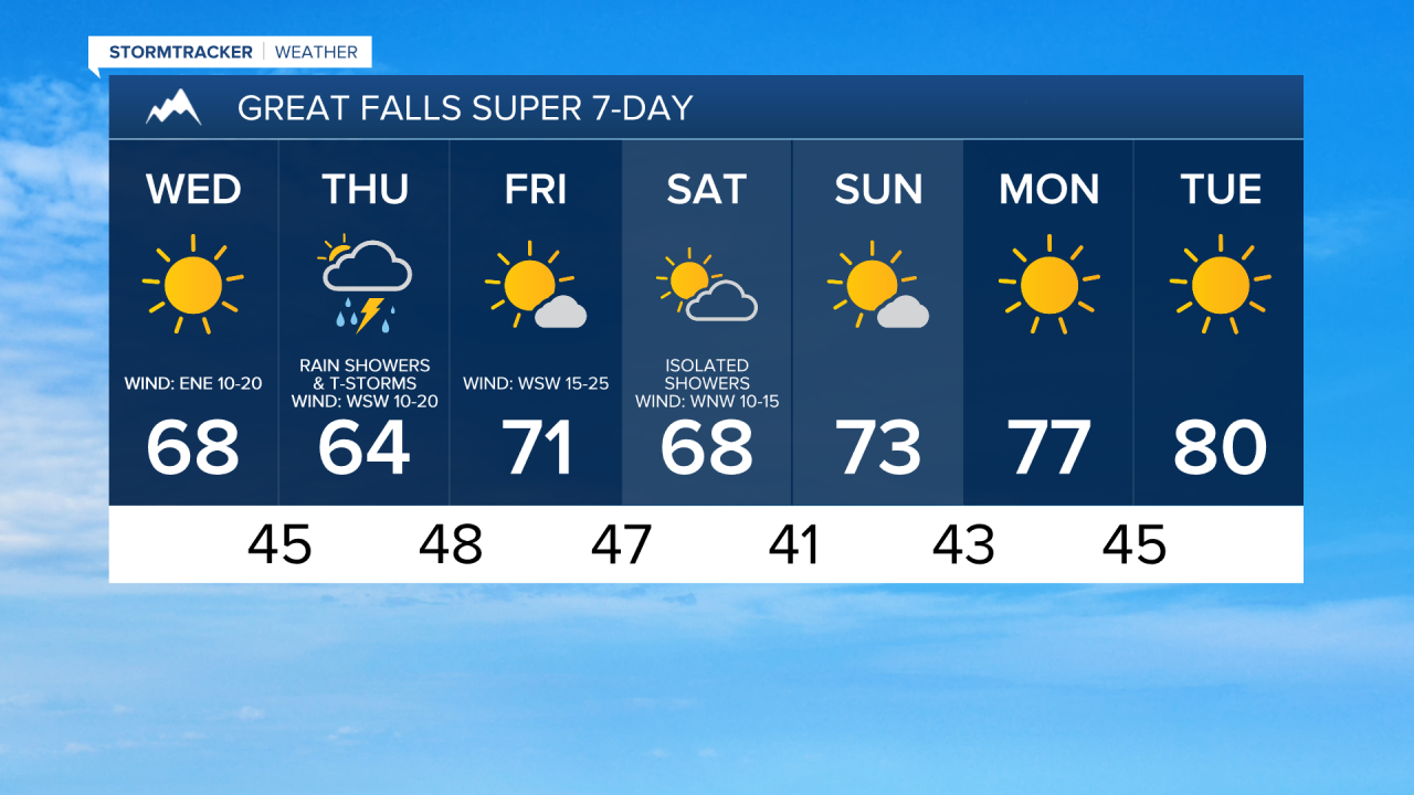
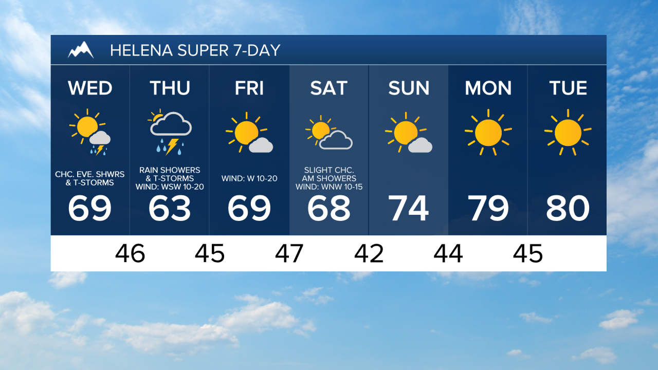
A frost and/or freeze is possible in a lot of locations tonight as lows are going to be in the 30s, and some spots will get down into the 20s. If you have any sensitive plants/vegetation, please make sure you take the necessary precautions to protect them. We are also going to have mostly clear skies and mainly dry conditions tonight.

For tomorrow, we are going to have lots of sunshine during the morning and afternoon. We are then going to have increasing clouds tomorrow evening with a chance of showers and thunderstorms around the Helena area. It is also going to be warmer tomorrow than it was today as highs are going to be in the 60s in most locations. There is also going to be a breeze around in spots tomorrow as sustained wind speeds are going to be between 10 and 20 mph, and wind gusts over 30 mph are going to be possible at times.
Rain showers and thunderstorms are then likely tomorrow night, and some of this rain may be heavy at times. This precipitation is going to start out in southwestern and south-central Montana and will move towards the north and northeast as the night goes on, impacting locations in north-central Montana after midnight. There are then going to be rain showers and thunderstorms around throughout the day on Thursday as this storm system slowly passes through our area, and once again, some of this rain may be heavy at times. We are also going to have increasing clouds tomorrow night and mostly cloudy skies on Thursday.
It is also going to be breezy in spots on Thursday as sustained wind speeds are going to be between 10 and 20 mph, and wind gusts over 30 mph are going to be possible at times. Cooler temperatures are also expected on Thursday as highs are going to be in the upper 50s and low to mid 60s in most locations.
Gusty winds are then expected on Friday as sustained wind speeds are going to be between 10 and 30 mph, and wind gusts over 40 mph are going to be possible at times. We are also going to have mostly sunny skies, mostly dry conditions, and seasonable temperatures on Friday as highs are going to be in the mid to upper 60s and low 70s.
There are then going to be some isolated showers around on Saturday, generally during the morning, as a disturbance passes through our area. We are also going to have decreasing clouds and slightly cooler temperatures on Saturday as highs are going to be in the mid to upper 60s. There is also going to be a little bit of a breeze around on Saturday as sustained wind speeds are going to be between 10 and 15 mph, and this wind is going to be coming out of the WNW.
Mostly to mainly sunny skies and dry conditions are then expected on Sunday, Monday, and Tuesday as high pressure is going to be in control of our weather. The temperatures are also going to warm back up some over these three days as highs are going to be in the low to mid 70s on Sunday; the mid to upper 70s on Monday; and the upper 70s and low 80s on Tuesday.