


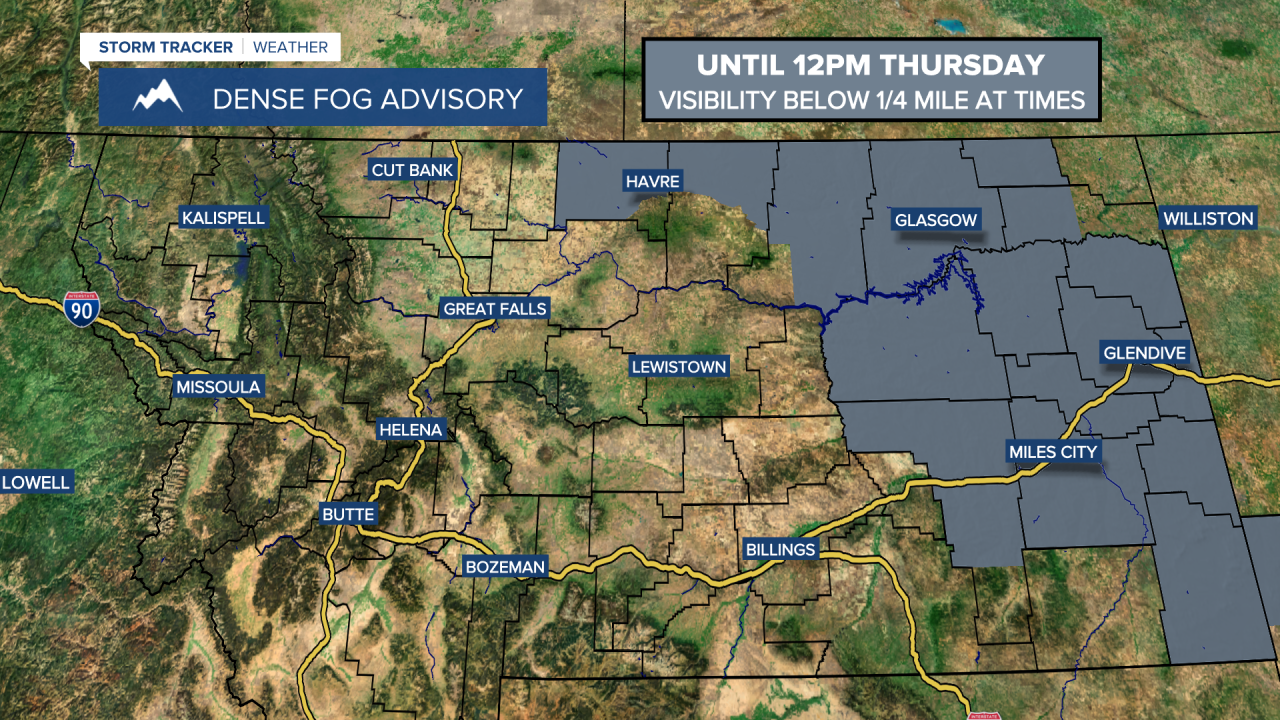
A DENSE FOG ADVISORY is in effect until 12pm Thursday for a lot of eastern Montana and portions of the Hi-Line. Visibility, at times, is going to be at or below a quarter mile.
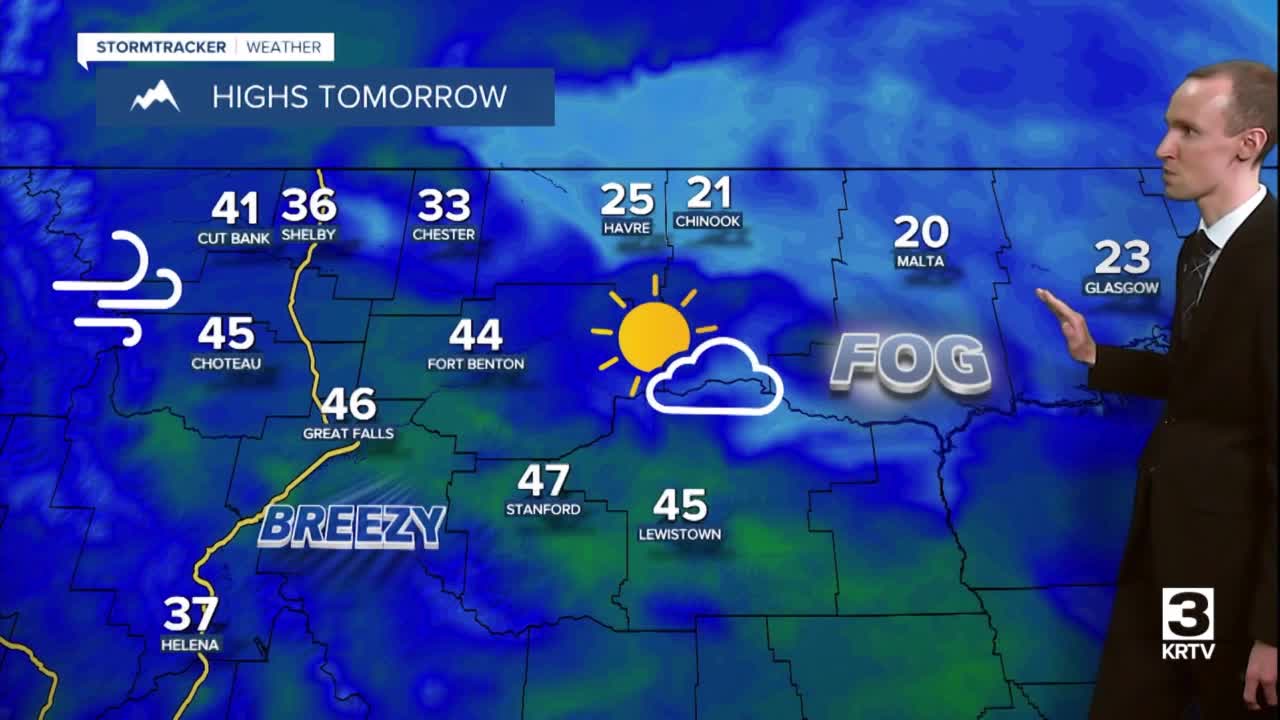
There are going to be areas of fog around tonight and tomorrow, generally along the Hi-Line, and some of this fog may be dense. We are also going to have partly to mostly cloudy skies and mainly dry conditions tonight and tomorrow. It is also going to be cold/chilly tonight as lows are going to be in the single digits, teens, and 20s, with the coldest temperatures along the Hi-Line. It is then going to be warmer tomorrow than it was today as highs are going to range from the low 20s to the mid 40s, with the coldest temperatures along the central and eastern half of the Hi-Line.
The wind is also going to begin to increase tonight, especially in the mountains in central Montana and along the Rocky Mountain Front. We are then going to have gusty winds around tomorrow along the Rocky Mountain Front as wind gusts up to 50 mph are going to be possible at times, and it is going to be breezy tomorrow in some locations east of the Rocky Mountain Front as wind gusts between 30 and 40 mph are going to be possible at times.
On Friday, we are going to have partly to mostly cloudy skies and mainly dry conditions as high pressure is going to continue to be in control of our weather. It is also going to be warmer on Friday than it is going to be tomorrow as highs are going to be in the 30s, 40s, and 50s, with the coldest temperatures along the Hi-Line. There is also going to be a breeze around on Friday as sustained wind speeds are going to be between 10 and 25 mph, and wind gusts up to 40 mph are going to be possible at times.
There are then going to be some scattered rain and snow showers around Friday night and Saturday (especially during the morning) as a disturbance passes through our area. We are also going to have decreasing clouds on Saturday. It is also going to be mild and breezy again on Saturday as highs are going to be in the 30s, 40s, and low 50s, and sustained wind speeds are going to be between 10 and 25 mph.
On Sunday, we are going to have increasing clouds with a few scattered rain and snow showers around, generally during the afternoon and evening, as another disturbance begins to approach our area. There are then going to be some isolated rain and snow showers around on Monday, generally in locations east of I-15, as this disturbance leaves our area. We are also going to have mostly cloudy skies on Monday. It is also going to be cooler on Sunday and Monday than it is going to be on Friday and Saturday as highs are going to range from the mid 20s to the mid 40s.
We are then going to have partly cloudy to mostly sunny skies and mostly dry conditions on Tuesday, and partly to mostly cloudy skies and mostly dry conditions on Wednesday as high pressure is going to be in control of our weather. It is also going to be cool on these two days as highs are going to be in the 20s, 30s, and low 40s. There is also going to be a little bit of a breeze around on these two days as sustained wind speeds are going to be between 5 and 20 mph.


