

The wind is going to gradually weaken from west to east as we go throughout the night tonight. Breezy conditions are expected for the entire night tonight in eastern Montana though as sustained wind speeds are going to be between 10 and 25 mph. It is also going to be chilly again tonight as lows are going to be in the upper teens and low to mid 20s. We are also going to have partly cloudy to mostly clear skies tonight with a few snow showers around, mainly in the mountains.
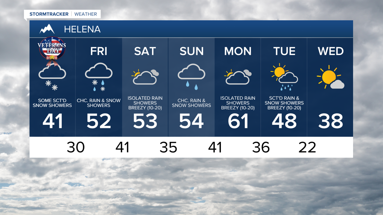
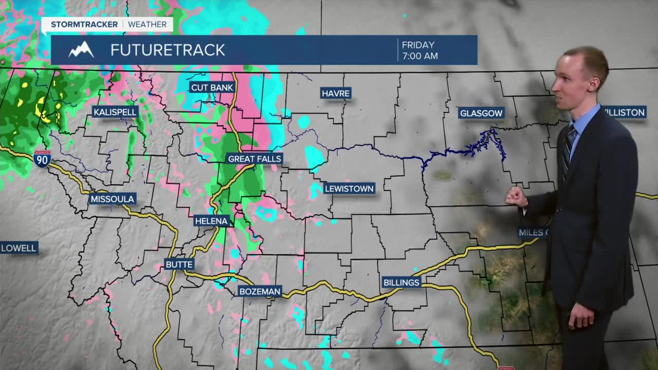
A warm front is then going to approach and pass through our area late tomorrow night and during the day on Friday. There are going to be some showers around with this front, especially in north-central Montana. The showers will initially be in the form of snow ahead of the warm front, but this snow will mix in with and change over to rain once the front passes through our area, at least in the lower elevations. In the mountains, primarily snow showers are expected. Once again, light snow accumulations are possible in locations that see some of this snow. This warm front is also going to allow our temperatures to warm back up into the upper 40s and low to mid 50s. Breezy conditions (sustained wind speeds between 10 and 25 mph) are also expected behind this front on Friday.
We are going to have pleasant temperatures this weekend as highs are going to be in the 50s. It is going to feel like it is in the 40s though as it is going to be breezy on both Saturday and Sunday, especially during the PM hours, as sustained wind speeds are going to be between 10 and 25 mph. On Saturday, we are going to have partly to mostly cloudy skies with some isolated valley rain and mountain rain/snow showers around. On Sunday, we are going to have overcast skies with some scattered valley rain and mountain rain/snow showers around throughout the day. Some snow showers are also possible in the valleys Sunday morning.
The warmest day of the next week is going to be on Monday as highs are going to be in the upper 50s and low to mid 60s. A cold front is then going to cool our temperatures down a lot for the middle of next week as highs are going to be in the mid to upper 40s and low 50s on Tuesday, and the mid to upper 30s and low 40s on Wednesday. It is also going to be windy on Monday and Tuesday as sustained wind speeds are going to be between 15 and 30 mph, and wind gusts up to 45+ mph are going to be possible at times. There are also going to be scattered rain and snow showers around Monday night and Tuesday as this cold front passes through our area.