


The weather this weekend is not going to be the greatest as several disturbances are going to be affecting our area. The first disturbance is going to impact our area from tomorrow morning through Sunday morning. After midnight tonight, a few snow showers are going to start to work their way into parts of our area.
For Saturday morning, many locations are going to be dry, but there will be a couple rain and snow showers around. More rain and snow showers are then going to develop tomorrow afternoon, and these showers will stick around through tomorrow night. In the lower elevations, generally rain showers are expected, but there will be some snow showers around at times. In the higher elevations, mainly snow showers are expected.
There will continue to be some rain and snow showers around Sunday morning, but really a lot of locations are going to be dry during the morning hours on Sunday. More rain and snow showers will develop Sunday afternoon though ahead of the next disturbance. Just like with Saturday, rain showers are generally expected in the lower elevations on Sunday with some snow mixing in at times, while snow showers are expected in the higher elevations.
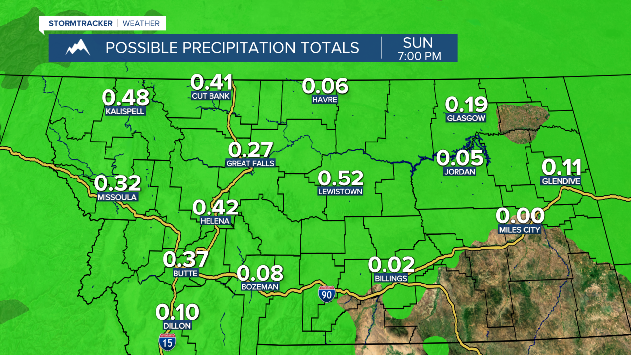
Between Friday and Sunday evening, roughly a quarter to a half an inch of liquid precipitation is expected in most locations, although lower liquid amounts are expected in the northeastern part of the state. A lot of this liquid is going to be in the form of rain, or snow that immediately melts, as generally less than 2 inches of snow accumulation is expected for most towns/cities, although the mountains could pick up several inches of snow accumulation this weekend.
The temperatures will also continue to be below average this weekend as highs in most locations are going to be in the mid to upper 40s and low 50s.
More scattered rain and snow showers are then expected on Monday, before some warmer temperatures, drier conditions, and sunnier skies return to our area for the rest of next week. The wind will also pick up next week as breezy conditions (sustained wind speeds between 10 and 25 mph) are expected more often than not.

More scattered rain and snow showers are then expected on Monday, before some warmer temperatures, drier conditions, and sunnier skies return to our area for the rest of next week. The wind will also pick up next week as breezy conditions (sustained wind speeds between 10 and 25 mph) are expected more often than not.

