


A DENSE FOG ADVISORY is in effect for central and southern Valley County until 11am Friday. Visibility less than a quarter mile is expected.
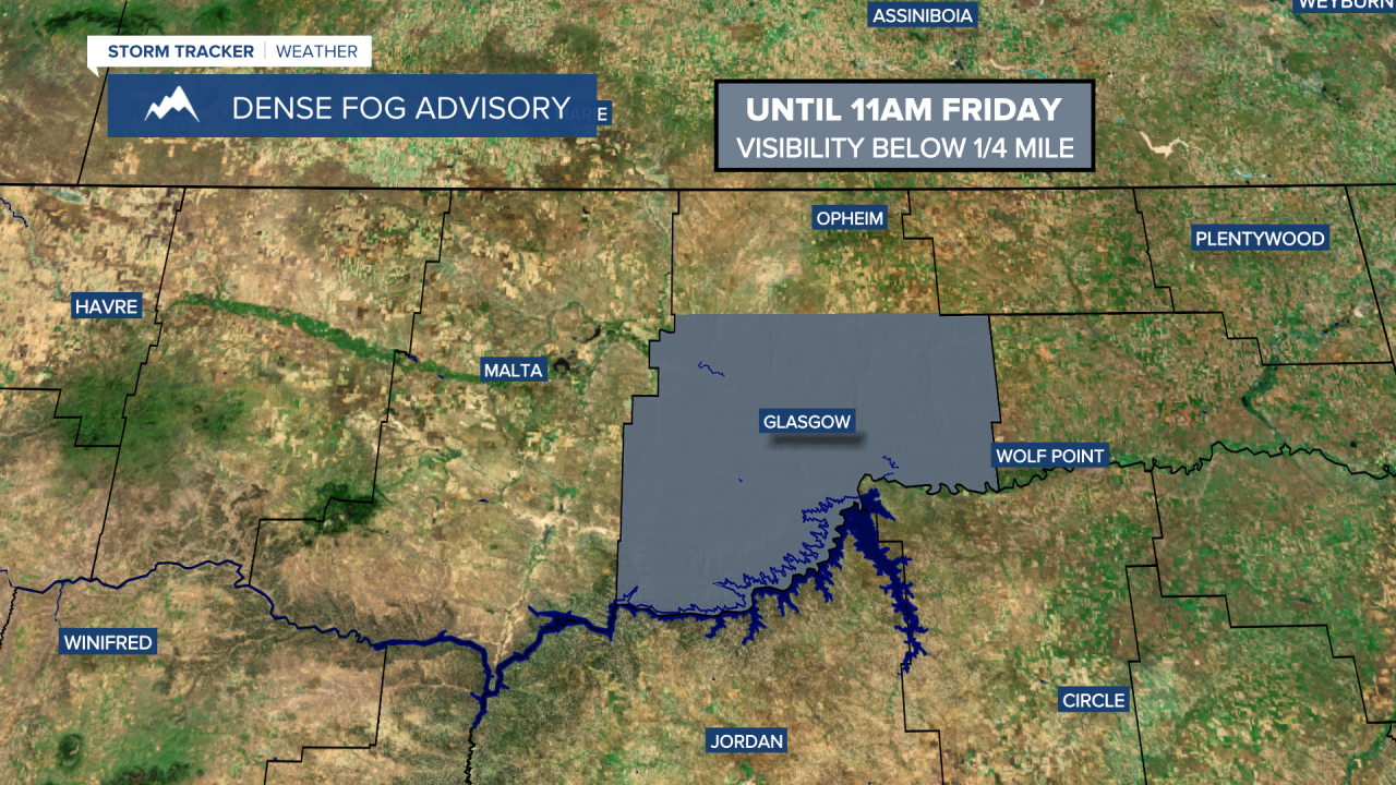
We are going to have increasing clouds tonight with a few isolated snow showers around after midnight along the Continental Divide. We are also going to have a wide range of low temperatures again tonight as lows are going to range from the single digits below zero to the mid 20s above zero, with the coldest temperatures along the eastern half of the Hi-Line. It is also going to be breezy tonight in portions of central and north-central Montana as sustained wind speeds are going to be between 10 and 25 mph. There is also going to be some dense fog around tonight, mainly in Valley County.
For tomorrow, we are going to have mostly to partly cloudy skies with a few scattered snow showers around, generally in the mountains, as a disturbance passes through our area, and light snow accumulations are possible. We are then going to have partly to mostly cloudy skies on Saturday with a slight chance of snow showers. It is also going to be chilly on these two days as highs are going to be in the 20s and 30s in most locations. There is also going to be a breeze around tomorrow in portions of central and north-central Montana as sustained wind speeds are going to be between 10 and 25 mph. On Saturday, it is going to be breezy in the higher elevations as sustained wind speeds are going to be between 10 and 25 mph.
There are then going to be areas of snow around during the second half of Sunday, Sunday night, and Monday, as a storm system passes by our area to the south. Accumulating snow is expected in many locations over these two days. We are also going to have overcast skies on these two days. The temperatures are also going to cool down some between Sunday and Monday as highs are going to be in the 20s and low 30s on Sunday, and the teens on Monday.
On Tuesday and Wednesday, there are going to continue to be some scattered areas of snow around, generally in locations east of I-15, as this storm system lingers over the Great Plains. We are also going to have mostly to partly cloudy skies on these two days. It is also going to be cold on these two days as highs are going to be in the mid to upper teens and low to mid 20s.


