Lows are going to be in the 30s in most locations tonight, although there are going to be a few 20s around in east-central and eastern Montana, and a few low 40s around in central Montana. We are also going to have partly cloudy to mostly clear skies and dry conditions tonight.
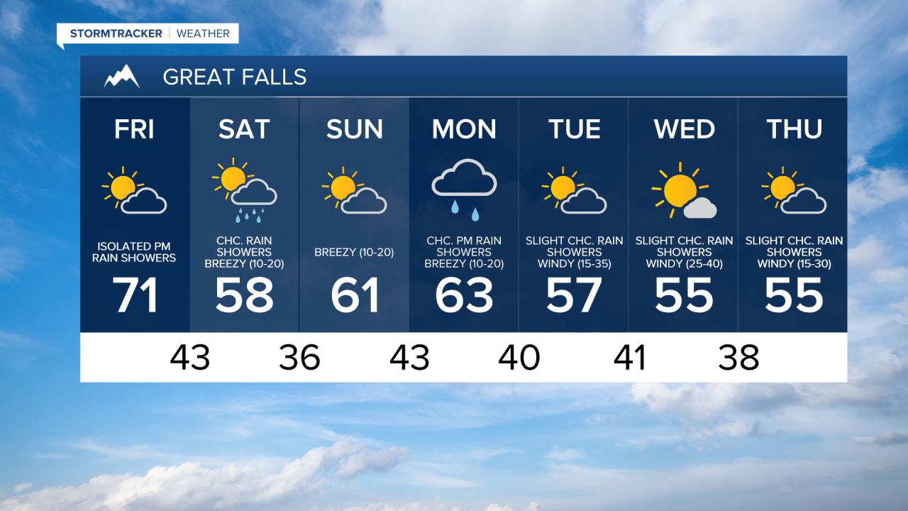
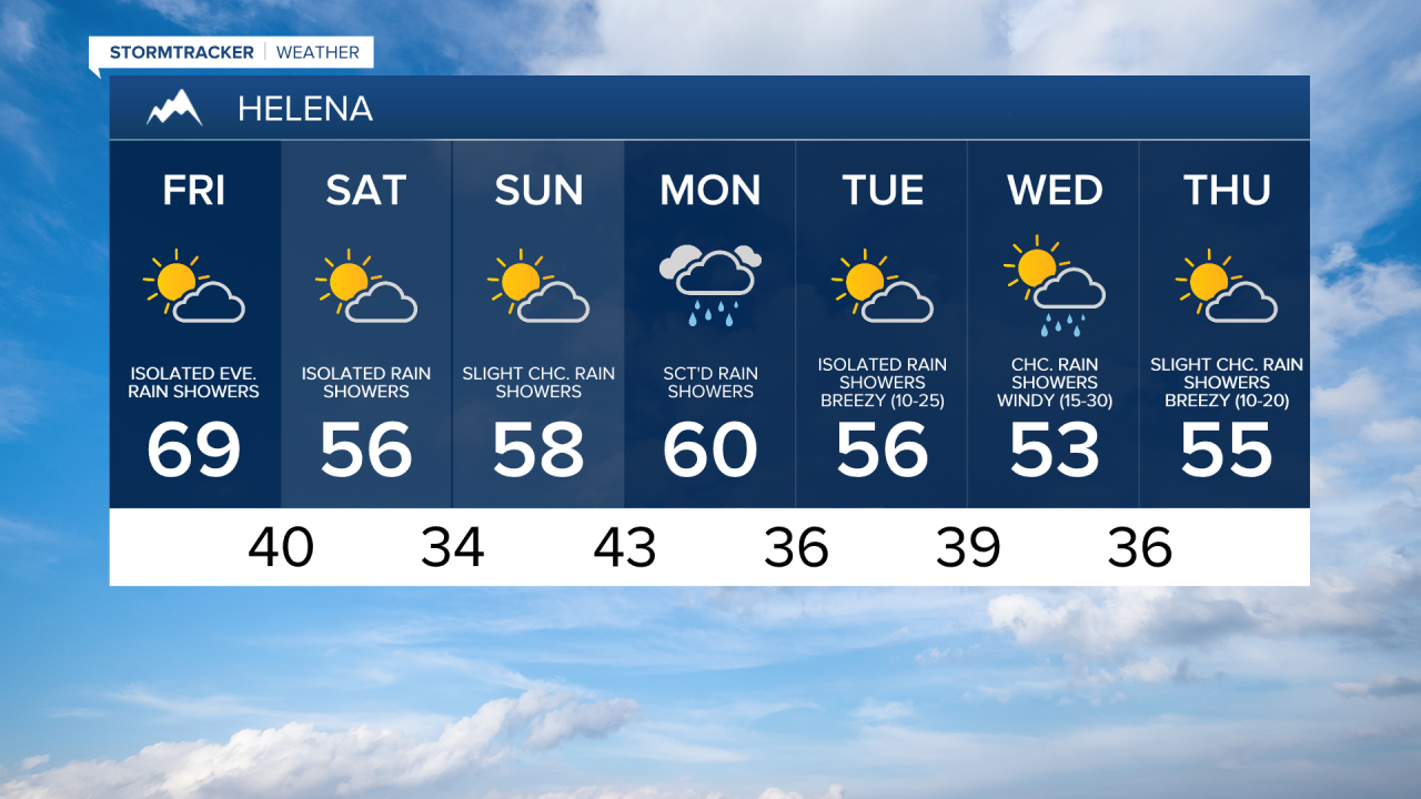
For tomorrow, we are going to have increasing clouds with some isolated PM rain showers around, generally in locations west of I-15, as a cold front begins to approach our area. There are then going to be some scattered valley rain and mountain rain/snow showers around tomorrow night as this cold front passes through our area. We are then going to have partly cloudy skies with a chance of valley rain and mountain rain/snow showers on Saturday, especially during the morning, as this cold front leaves our area.
The temperatures are also going to cool down some between tomorrow and Saturday as highs tomorrow are going to be in the mid to upper 60s and low 70s in most locations, and highs on Saturday are going to be in the mid to upper 50s and low 60s in most locations. There is also going to be a bit of a breeze around tomorrow along the Hi-Line and in eastern Montana as sustained wind speeds are going to be between 10 and 20 mph. It is then going to be breezy on Saturday, especially during the afternoon and evening, as sustained wind speeds are going to be between 10 and 20 mph.
For Sunday, we are going to have increasing clouds with a slight chance of valley rain and mountain rain/snow showers as we are going to be in between storm systems. We are then going to have a chance to see some PM valley rain and mountain rain/snow showers on Monday in north-central Montana, and there are going to be scattered valley rain and mountain rain/snow showers around on Monday, especially during the afternoon/evening, in south-central Montana, as another storm system passes through our area.
The temperatures on Sunday and Monday are going to continue to be above average for this time of year as highs are going to be in the mid to upper 50s and low to mid 60s in most locations. It is also going to be breezy on both of these days, especially during the PM hours, as sustained wind speeds are going to be between 10 and 20 mph.
For Tuesday, Wednesday, and Thursday, we are going to have partly cloudy skies with some isolated valley rain and mountain rain/snow showers around, generally in the mountains, as we are going to continue to remain in an unsettled weather pattern. The temperatures on these three days are also going to be near to a little bit above average for this time of year as highs are going to be in the 50s in most locations. It is also going to be windy on these three days in north-central Montana as sustained wind speeds on Tuesday and Thursday are going to be between 15 and 35 mph, and sustained wind speeds on Wednesday are going to be between 25 and 40 mph. In south-central Montana, it is going to be breezy on Tuesday and Thursday as sustained wind speeds are going to be between 10 and 25 mph, and it is going to be windy on Wednesday as sustained wind speeds are going to be between 15 and 30 mph.