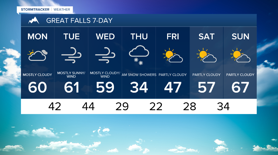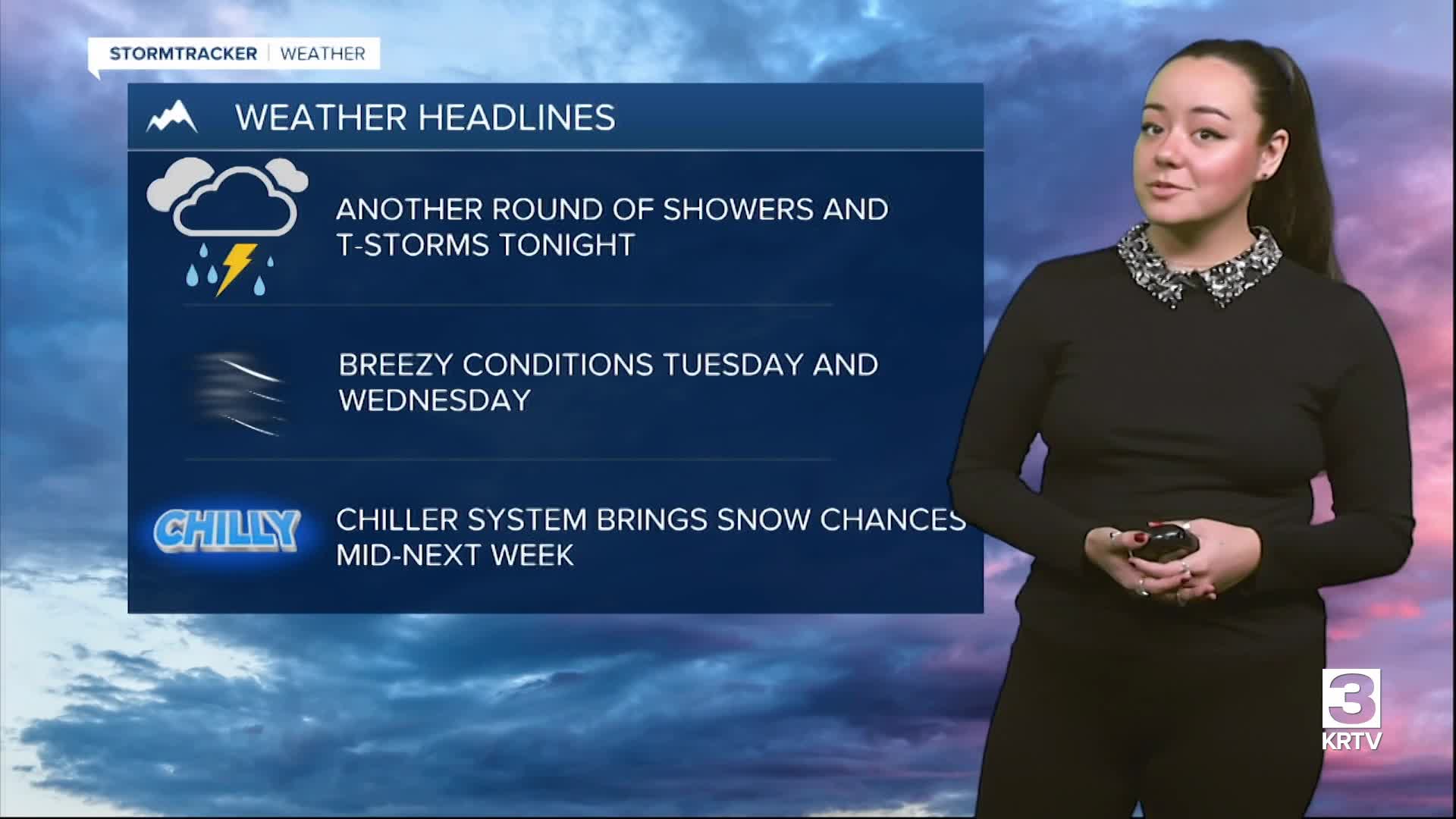


WEATHER DISCUSSION: Sunday saw another mainly dry morning and afternoon until another round of showers and thunderstorms made their way into the region, sticking around through much of tonight. Otherwise, expect cloudy to mostly cloudy skies with low temperatures in the 30s and 40s. Winds will be slightly breezy, with gusts up to 20-30 mph. Gusty winds and lightning across Southwest and Central Montana will be the primary concern tonight with thunderstorms. Some light snow near and above pass level is possible, but impacts look minimal at this time.

A south to southwest flow aloft remains in place. Additional isolated to scattered shower activity looks to develop Monday afternoon, otherwise, expect partly sunny to mostly cloudy skies with high temperatures in the 50s and low 60s. Winds will begin to increase towards the evening, especially for the Rocky Mountain Front where wind gusts could reach up to 50 mph.

Breezy west to southwest winds Tuesday and Wednesday across the region. At this time, there are no high wind warnings, but gusts could reach up to 50 mph. An upper-level system approaches the Pacific NW Wednesday, bringing much cooler temperatures towards next weekend.
The system will also bring snow levels down to lower elevations. There is still some uncertainty with overall amounts with this system, but at least brief light snow at lower elevations is a reasonable expectation at this time by Thursday morning. Next weekend, a drier stretch is possible with warming temperatures.