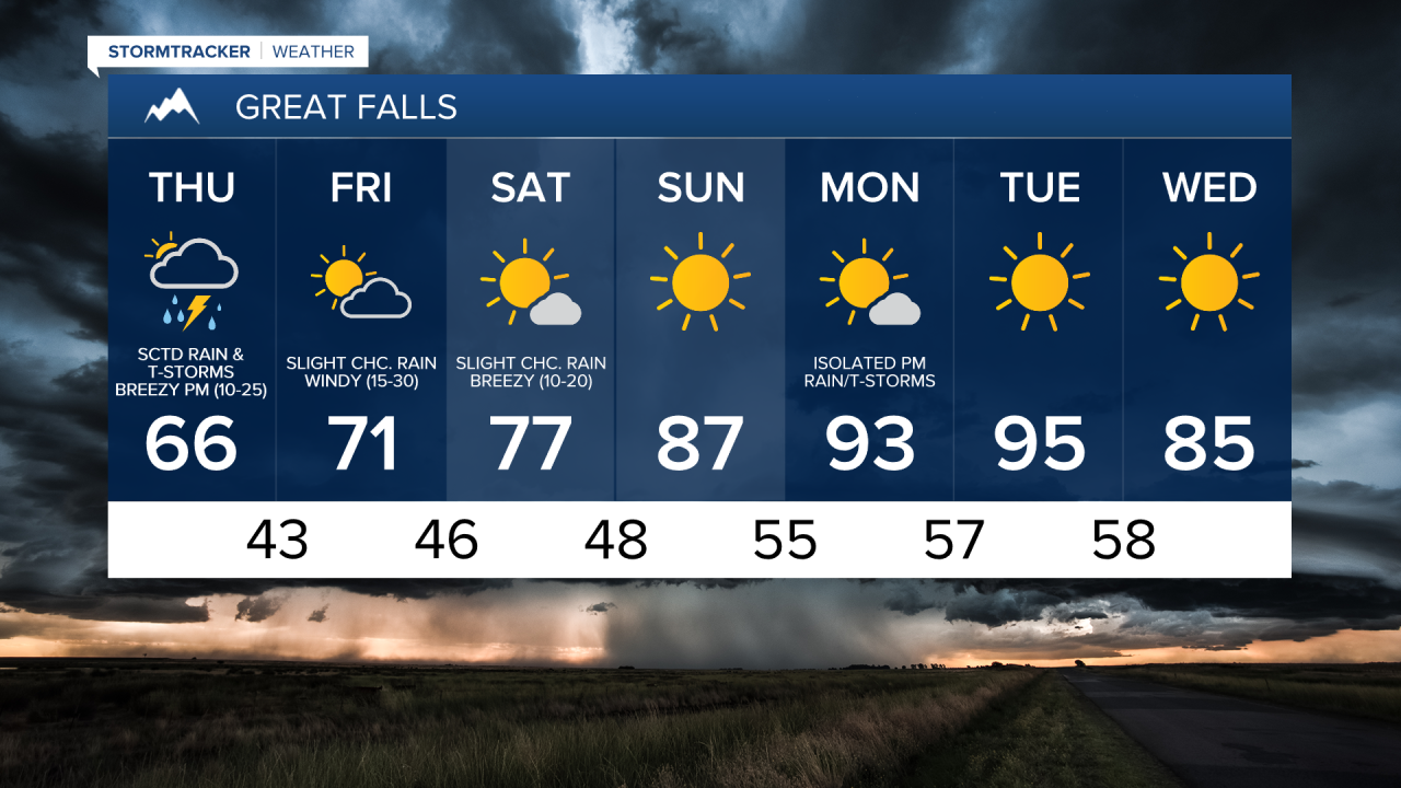
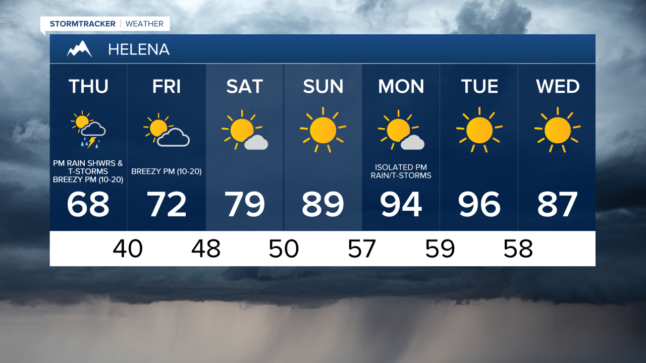
There are going to be some scattered rain showers and thunderstorms around this evening and tonight, especially before midnight, as a disturbance works its way through our area. There are then going to be scattered rain showers and thunderstorms around tomorrow, generally after 11am, as cold front works its way through our area.
With any thunderstorms that do develop over the next 36 hours, heavy rainfall, gusty winds, small hail, and frequent lightning are going to be the main hazards. Some of the thunderstorms over the next 36 hours may also be severe with damaging winds, large hail, and maybe even a tornado.


We are also going to have a wide range of temperatures between central Montana and eastern Montana tonight and tomorrow. In central Montana, it is going to be cool tonight as lows are going to be in the low to mid 50s. It is then going to be mild tomorrow in central Montana as highs are going to range from the mid 60s to the mid 70s. In eastern Montana, it is going to be mild tonight as lows are going to be in the mid 60s, and it is going to be hot tomorrow as highs are going to be around 90 degrees. It is also going to be breezy tomorrow afternoon and evening as sustained wind speeds are going to be between 10 and 25 mph. There is also a Lake Wind Advisory in effect for Fort Peck Lake from 3am tomorrow until 7pm Friday.
Friday is then going to have partly cloudy skies and mainly dry conditions as this cold front leaves our area and as an upper level ridge works its way into our area. It is also going to be mild on Friday as highs are going to be in the upper 60s and low to mid 70s, and it is going to be windy on Friday as well as sustained wind speeds are going to be between 15 and 30 mph.
Mostly sunny to sunny skies are then expected this weekend and early next week as this upper level ridge is going to be in control of our weather. Most locations are also going to be dry this weekend and early next week, although a couple isolated rain showers and thunderstorms are possible on Saturday and Monday. The temperatures are also going to warm up a lot this weekend and early next week as highs on Saturday are going to be in the mid to upper 70s; highs on Sunday are going to be in the mid to upper 80s; and highs on Monday and Tuesday are going to be in the mid 90s. The temperatures are then going to cool down some next Wednesday as highs are going to be back in the mid 80s.