A WINTER WEATHER ADVISORY is in effect for the Glacier area until 6am Wednesday.
A WINTER WEATHER ADVISORY is in effect for the southern Rocky Mountain Front, portions of central Montana, and the Butte/Bozeman area until 11am/12pm Wednesday.

A WINTER STORM WARNING is in effect for some of the mountains in southern Montana until 6pm Wednesday or 12pm/6pm Thursday.

A LAKE WIND ADVISORY is in effect for Fort Peck Lake until 9pm Thursday.

A RED FLAG WARNING is in effect for most of northeastern Montana until 9pm Tuesday.

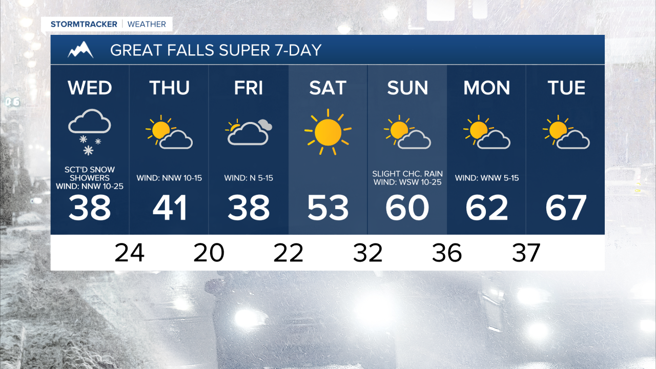
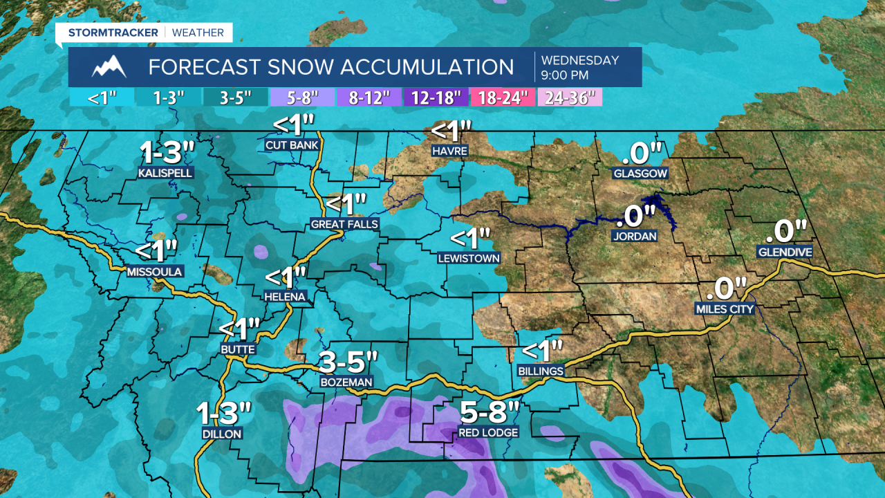
There are going to be scattered snow showers around tonight and tomorrow as a disturbance passes through our area. Some rain showers are also possible initially. In the mountains and the foothills, 2 to 8 inches of snow accumulation is expected. In the lower elevations, up to 5 inches of snow accumulation is possible, but most locations will receive 0 to 2 inches of snow accumulation. This snow will also create difficult travel conditions over the mountain passes, so please use extreme caution when driving. We are also going to have partly to mostly cloudy skies tonight and mostly cloudy skies tomorrow.
It is also going to be breezy and chilly tonight as sustained wind speeds are going to be between 10 and 25 mph and lows are going to be in the mid to upper 20s and low to mid 30s in most locations. It is then going to be a lot colder tomorrow than it was today as highs are going to be in the mid to upper 30s and low to mid 40s in most locations. We are also going to have gusty to strong winds around tomorrow as sustained wind speeds are going to be between 10 and 30 mph, and wind gusts over 40 mph are possible. Also, the strongest wind tomorrow is going to be in locations east of I-15.
On Thursday, we are going to have partly cloudy skies with some isolated snow showers around, generally in the mountains and in northeastern Montana. We are then going to have partly to mostly cloudy skies on Friday with a slight chance of snow showers, generally in the mountains. We are also going to continue to have well below average temperatures for this time of year on these two days as highs are going to be in the mid to upper 30s and low to mid 40s in most locations. It is also going to be breezy on Thursday as sustained wind speeds are going to be between 10 and 25 mph (strongest wind east of I-15), and it is going to be a bit breezy on Friday as sustained wind speeds are going to be between 10 and 20 mph.
We are then going to have really nice weather on Saturday as we are going to have lots of sunshine, mainly dry conditions, little wind (sustained wind speeds between 5 and 15 mph), and warmer temperatures as highs are going to be in the mid to upper 40s and low to mid 50s in most locations.
There are then going to be a few isolated rain and mountain snow/rain showers around on Sunday and Monday as a disturbance passes through our area. We are also going to have partly cloudy skies and pleasant temperatures on these two days as highs are going to be in the mid to upper 50s and low to mid 60s. It is also going to be breezy on Sunday as sustained wind speeds are going to be between 10 and 25 mph, and it is going to be a little breezy on Monday as sustained wind speeds are going to be between 5 and 20 mph.
On Tuesday, we are going to have partly cloudy skies with a slight chance of rain showers. It is also going to be mild on Tuesday as highs are going to be in the mid to upper 60s and low 70s in most locations.