


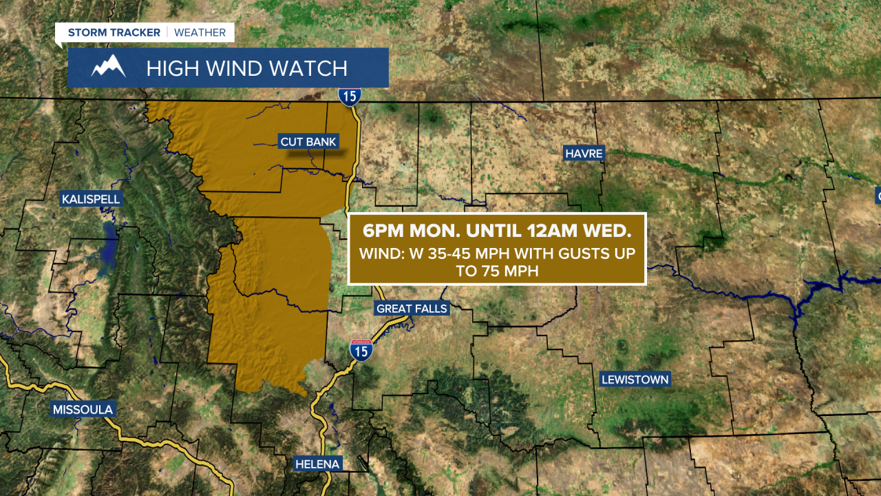
A HIGH WIND WATCH is in effect for the Rocky Mountain Front and some adjacent locations from 6pm Monday until 12am Wednesday.
We are going to have mostly clear skies and mainly dry conditions tonight. It is also going to be chilly again tonight as lows are going to be in the 30s and low 40s in most locations.
For tomorrow, we are going to have partly to mostly cloudy skies (via increasing clouds) with a few isolated showers/thunderstorms around during the afternoon and evening. There are then going to be some scattered showers and thunderstorms around tomorrow night, generally in locations east of I-15, as a disturbance passes through our area. We are then going to have partly cloudy skies with some isolated showers and thunderstorms around on Sunday. We are also going to have pleasant temperature this weekend as highs are going to be in the 70s and upper 60s tomorrow and the mid to upper 60s and low to mid 70s on Sunday. There is also going to be a bit of a breeze around in some areas tomorrow and Sunday as sustained wind speeds are going to be between 10 and 20 mph.
There are then going to be scattered showers and thunderstorms around on Monday, generally during the afternoon/evening, as a disturbance passes through our area. It is also going to be cloudy on Monday. We are also going to have gusty winds around on Monday as sustained wind speeds are going to be between 10 and 30 mph. Also, highs on Monday are going to be in the 60s and low to mid 70s in most locations.
Strong winds are then expected on Tuesday and Wednesday as sustained wind speeds are going to be between 15 and 35 mph, and widespread wind gusts over 50 mph are possible. The temperatures are also going to warm up some between Tuesday and Wednesday as highs are going to be in the mid to upper 60s and low to mid 70s on Tuesday and the 70s and low 80s on Wednesday. We are also going to have partly cloudy skies with a few isolated showers and thunderstorms around on Tuesday, generally in locations east of I-15, as Monday’s disturbance leaves our area and we are going to have lots of sunshine and dry conditions on Wednesday.
Lots of sunshine, mainly dry conditions, less wind and warm temperatures (highs in the mid to upper 70s and low to mid 80s) are then expected on Thursday and Friday as high pressure is going to be in control of our weather.


