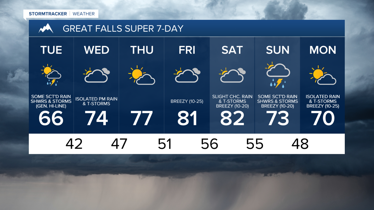
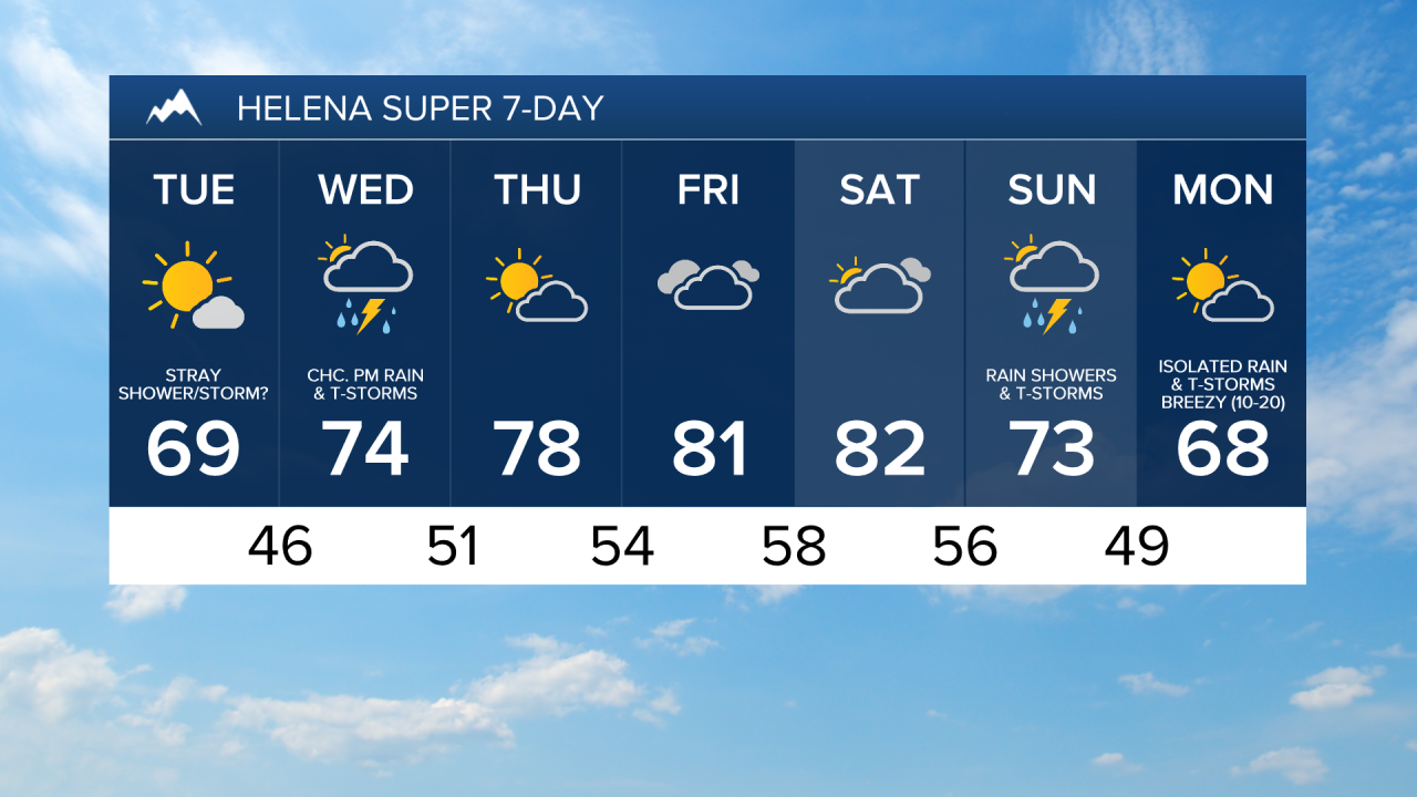
There are going to be some scattered rain showers and thunderstorms around this evening, tonight, and tomorrow, especially along the Hi-Line east of I-15, as a disturbance slowly works its way through our area. We are also going to have mostly cloudy skies tonight along the Hi-Line, and partly cloudy to mostly clear skies tonight in locations south of the Hi-Line. Some patchy areas of fog may also develop tonight. For tomorrow, we are going to have mostly cloudy skies along the Hi-Line, and partly cloudy to mostly sunny skies in locations south of the Hi-Line.
It is going to be cool tonight and tomorrow as lows tonight are going to be in the 40s in most locations, and highs tomorrow are going to be in the 60s and upper 50s in most locations. There is also going to be a bit of a breeze around tonight along the Rocky Mountain Front. It is then going to be a bit breezy throughout central Montana tomorrow as sustained wind speeds are going to be between 10 and 20 mph.
On Wednesday, we are going to have partly to mostly cloudy skies with some isolated rain showers and thunderstorms around during the afternoon and evening as a disturbance begins to approach our area. There are then going to be a few scattered rain showers and thunderstorms around Wednesday night as this disturbance passes through our area. It is also going to be warmer on Wednesday than it is going to be tomorrow as highs are going to be in the 70s in most locations.
Partly to mostly cloudy skies and mainly dry conditions are then expected on Thursday and Friday as high pressure is going to be in control of our weather. It is also going to be warm on these two days as highs are going to be in the 70s and low to mid 80s, with Friday being the warmer of the two days. Breezy conditions are also expected on Friday as sustained wind speeds are going to be between 10 and 25 mph.
On Saturday, we are going to have partly to mostly cloudy skies with a slight chance of rain showers and thunderstorms, generally during the afternoon and evening. It is also going to be warm and breezy on Saturday as highs are going to be in the upper 70s and low to mid 80s, and sustained wind speeds are going to be between 10 and 20 mph.
There are then going to be scattered rain showers and thunderstorms around on Sunday as a storm system passes through our area. We are then going to have partly cloudy to mostly sunny skies on Monday with some isolated rain showers and thunderstorms around as we remain in an unsettled weather pattern. The temperatures are also going to cool down some over these two days as highs are going to be in the upper 60s and low to mid 70s on Sunday, and the mid to upper 60s and low 70s on Monday. It is also going to be breezy on these two days, but especially on Monday, as sustained wind speeds are going to be between 10 and 25 mph.