


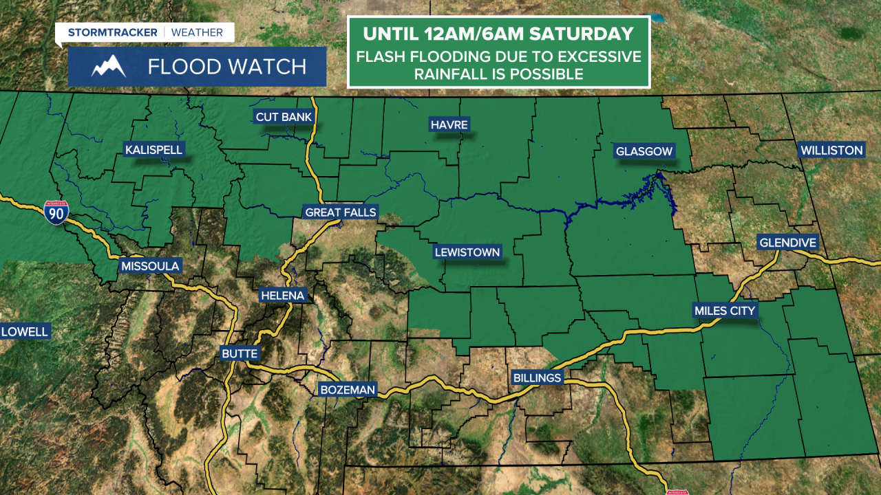
A FLOOD WATCH is in effect for a lot of Montana until 12am/6am Saturday. Flash flooding due to excessive rainfall is possible.
There are going to continue to be some scattered showers and thunderstorms around this evening and tonight. We are also going to have mostly cloudy skies and mild temperatures tonight as lows are going to be in the 50s and low 60s.
For tomorrow, there are going to be scattered showers and thunderstorms around throughout the day. We are also going to have mostly cloudy skies tomorrow in a lot of central and north-central Montana, while northeastern Montana enjoys mostly sunny skies. It is also going to be mild tomorrow as highs are going to be in the 70s and mid to upper 60s in most locations. There is also going to be a bit of a breeze around tomorrow, especially in locations east of I-15, as sustained wind speeds are going to be between 10 and 20 mph.
On Sunday, we are going to have partly to mostly cloudy skies in central and western Montana and mostly to mainly sunny skies in eastern Montana. There are also going to be some scattered showers and thunderstorms around in central and western Montana, generally during the afternoon and evening. It is also going to be mild on Sunday as highs are going to be in the 70s and low 80s in most locations.
Showers and thunderstorms are then likely on Monday, generally during the afternoon/evening, around the Helena area, and there is a chance of showers and thunderstorms on Monday in north-central Montana. We are also going to have partly cloudy skies and pleasant temperatures on Monday as highs are going to be in the 70s and low to mid 80s in most locations.
Tuesday is then going to be a drier and sunnier day as we are going to have partly cloudy to mostly sunny skies with a chance of PM showers and thunderstorms around the Helena area and some isolated PM showers and thunderstorms around in north-central Montana. It is also going to be warm on Tuesday as highs are going to be in the mid to upper 70s and low to mid 80s.
There are then going to be scattered showers and thunderstorms around on Wednesday, and there is a chance of showers and thunderstorms on Thursday as another storm system passes through our area. The temperatures are also going to cool down some over these two days as highs are going to be in the mid to upper 60s and low to mid 70s in most locations on Wednesday and the 60s in most locations on Thursday. It is also going to be a bit breezy on these two days as sustained wind speeds are going to be between 10 and 20 mph.
We are then going to have partly cloudy skies on Friday with some isolated showers and thunderstorms around. Also, highs on Friday are going to be in the mid to upper 60s and low to mid 70s in most locations.


