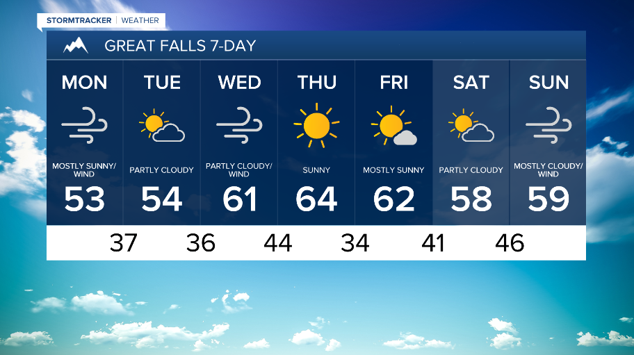


WEATHER DISCUSSION: As high pressure takes control, more mild and dry conditions were around Sunday. Tonight, expect a mix of cloud cover with low temperatures in the 20s, 30s, and 40s. Winds increase tonight.

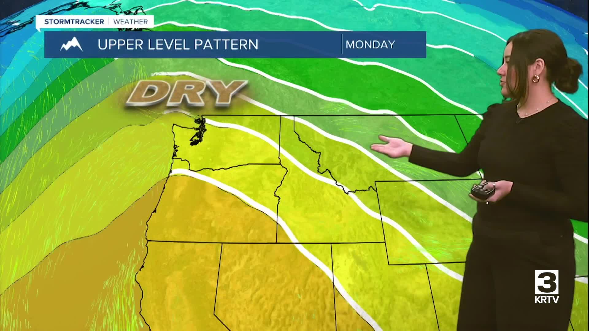
An upper-level ridge is currently hanging out over the region, meaning warm and mostly dry conditions. As we head into this evening, the ridge will begin flattening as a temporary shortwave trough moves over the area. This combined with a moderately strong surface pressure gradient will lead to windy conditions across North Central Montana with the strongest winds along the Rocky Mountain Front.

Also expect isolated snow showers to the mountains of North Central Montana and isolated rain/snow showers to portions of the lower-elevations of North Central Montana with the greatest coverage along the Hi-Line this evening through Monday morning.
Windy conditions will linger into Monday morning while shortwave trough hands out into the afternoon before another upper-level ridge builds back in. Monday will be the coolest day of this forecast period though still above average, with high temperatures in the 40s and 50s with gradually clearing and mostly sunny/sunny skies. Monday evening to early Tuesday morning, another round of light but primarily mountain precipitation is likely.

Tuesday through Friday, the upper-level ridge will remain over the region, allowing temperatures to warm up each day through Thursday with mostly dry weather. Wednesday and Thursday will be the warmest days of this forecast period with high temperatures approaching or exceeding record highs for many locations. Tuesday night into Wednesday morning, the surface pressure gradient will increase which will bring another round of windy conditions to the Rocky Mountain Front.