
We're tracking both rain and snow showers Tuesday afternoon. As we head closer to sunset and temperatures continue to drop we'll see any remaining rain turn over to snow.
Falling temperatures means wet roads may freeze over. Slippery, icy roads are expected Tuesday night and Wednesday.
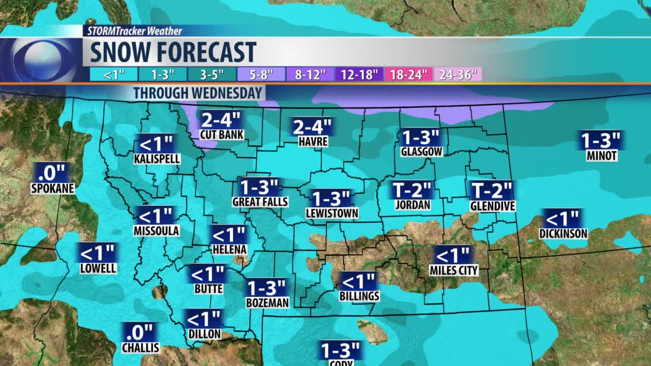
Snow will continue to fall through the night, and linger into early Wednesday. For most of us, snow totals won't be too high, but they will be high enough to make roads slippery. Most of the area will see between 1 and 4 inches of snow.
Most of North Central Montana is under a Winter Weather Advisory through Wednesday morning.
There are some areas that we expect to see more snow, and some areas we expect to see less. One of the least impacted areas will be Helena, where only a few flakes are expected, with little to no accumulation. Helena is not under the Winter Weather Advisory.
Higher snow totals of 3 to 6 inches are expected along the Rocky Mountain front for places like Browning, Saint Mary, and Heart Butte. Higher totals are also expected at pass level, both over the divide and through the Little Belts.
The hardest hit area from this latest snow storm looks to be extreme Northeastern Montana. Northern Valley, Daniels, and Sheridan County are under a Winter Storm Warning through Wednesday morning.
Snow totals in the warned area will range from 5 to as much as 10 inches.
WINTER WEATHER RESOURCES:
- STORMTracker Weather page
- Live interactive radar
- STORMTracker on Facebook
- Montana webcams
- Road Conditions


