

WEATHER DISCUSSION: Mild and warm temperatures were seen throughout Central and Eastern portions of the state today and a chillier SW flow moves in. Tonight, expect mostly cloudy skies with low temperatures in the 30s and 40s. Breezy winds are expected across the region with gusts up to 30-40 mph at times.

Southwesterly flow aloft is in place across the Northern Rockies ahead of an upper-level low pushing into the Northwest United States. The combination of warmer surface temperatures, sufficiently cool temperatures aloft, and a leading shortwave progressing across the region ahead of the upper low is resulting in a few showers and thunderstorms seen early this afternoon, continuing into this evening. Gusty winds are the main threat with any Thunderstorm seen through this evening before they begin to taper off.
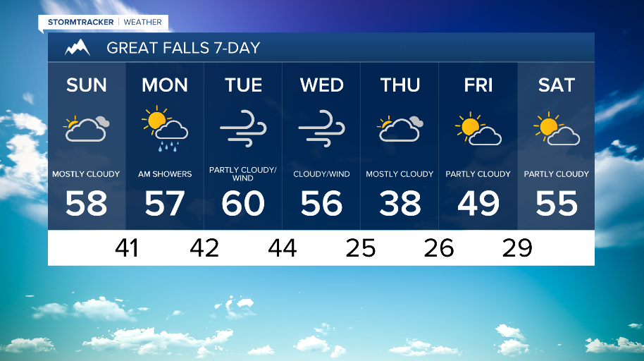
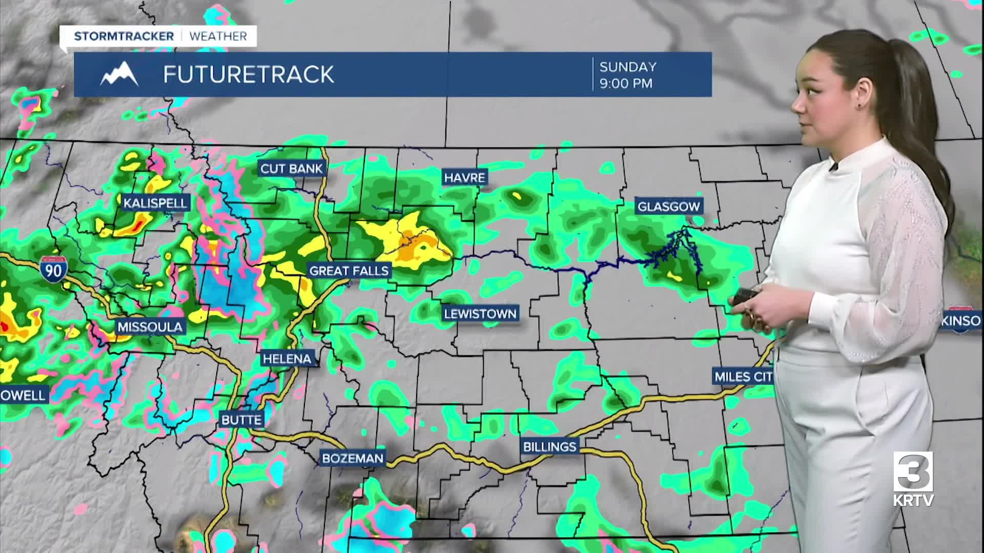
As the upper-level low progresses inland across California, southwest to south flow aloft remains, bringing another round of showers and thunderstorms Sunday, though mainly across Southwest Montana and portions of Central Montana. Temperatures also cool across the region Sunday, ranging in the high-40s around the Browning to the mid-60s around Eastern areas. Expect partly cloudy skies and winds on the lighter side around 5 to 15 mph.


Spotty precipitation looks to remain through the day Monday with the addition of mainly mountain snow through Tuesday. However, the main concern will be for gusty westerly to southwesterly winds on Tuesday. Another upper-level system is expected to arrive Wednesday at some point, likely bringing cooler and wetter conditions into Thursday behind a cold front. Snow levels look to drop to all elevations behind this front, though there is uncertainty with exactly how the precipitation will track and how much snow will accumulate.
Looking toward Friday and the next weekend, the system looks to depart but it is still unclear how fast of a warm up the region will receive.