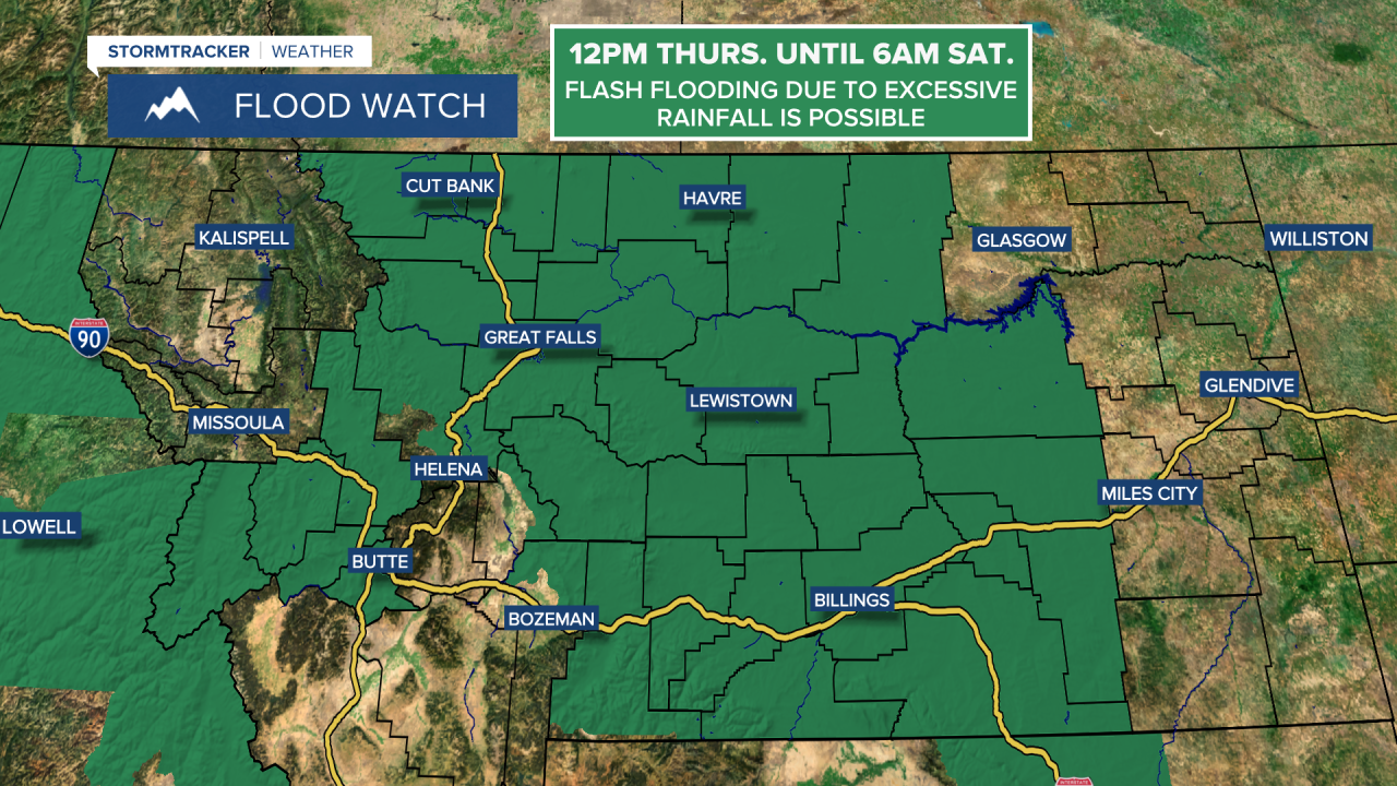
A FLOOD WATCH is in effect for most of central and north-central Montana from 12pm Thursday until 6am Saturday. Flash flooding due to excessive rainfall is possible.
We are going to have partly to mostly cloudy skies tonight with a few scattered showers and thunderstorms around, especially before midnight. It is also going to be mild tonight as lows are going to be in the 50s and low to mid 60s.
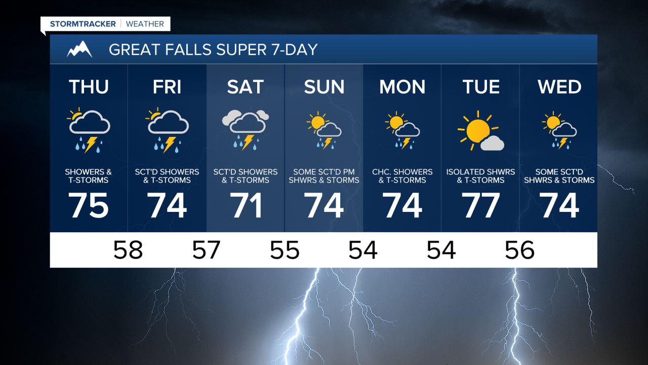
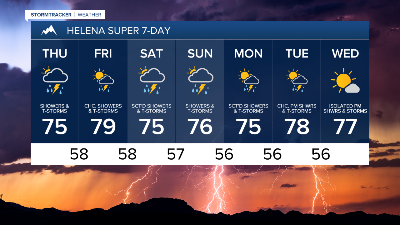
For tomorrow, there are going to be some scattered showers and thunderstorms around during the morning. Showers and thunderstorms are then likely tomorrow afternoon/evening and tomorrow night as a storm system begins to impact our area. On Friday, we are going to have mostly to partly cloudy skies with scattered showers and thunderstorms around, especially in northern Montana, as this storm system continues to impact our area.
With the thunderstorms that we see tomorrow and Friday, the main hazards are going to be heavy rainfall, gusty winds, small to medium-sized hail, and frequent lightning. Some of the thunderstorms that we see tomorrow afternoon/evening may also be severe with damaging winds (58+ mph) and/or large hail (1+” in diameter).

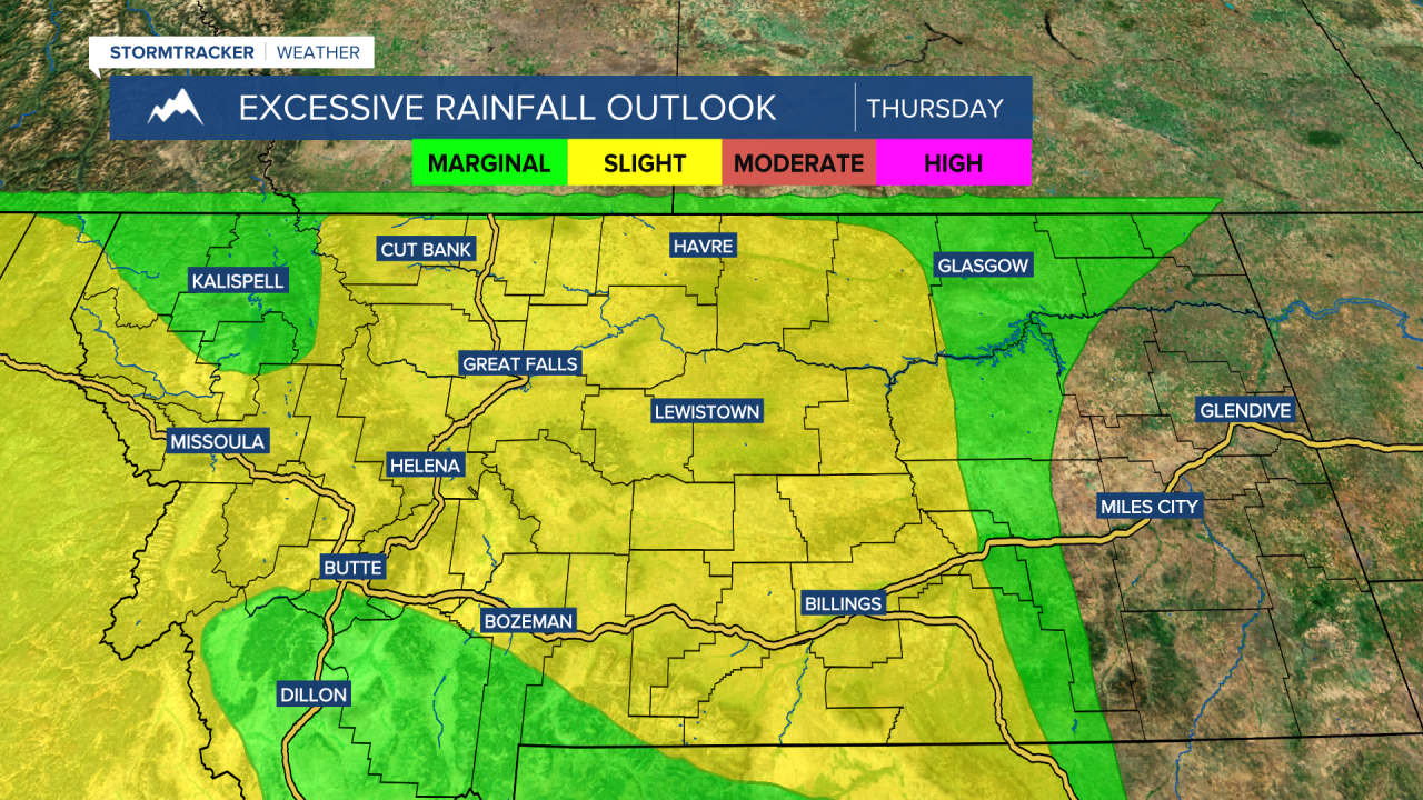
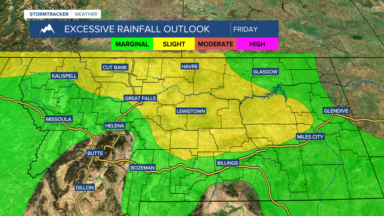
There is also a slight risk of excessive rainfall for portions of Montana tomorrow and Friday. This means that there is a 15+% chance that flash flooding will occur within 25 miles of a given location in the areas that are under the slight risk. Basically, there is going to be some heavy rainfall tomorrow and Friday, and this heavy rainfall may lead to flash flooding in some areas. If a roadway is flooded, make sure you turn around and don’t drown.
It is also going to be mild/warm tomorrow and Friday as highs are going to range from the upper 60s to the mid 80s, with the warmest temperatures in northeastern Montana.
There are then going to be more scattered showers and thunderstorms around this weekend, especially during the PM hours. We are also going to have mostly cloudy skies on Saturday and partly to mostly cloudy skies on Sunday. On Saturday, highs are going to be in the mid to upper 60s and low to mid 70s in most locations. It is then going to be a little warmer on Sunday as highs are going to be in the 70s and low 80s.
On Monday and Wednesday, we are going to have partly cloudy skies with some scattered showers and thunderstorms around, especially during the PM hours. On Tuesday, we are going to have increasing clouds with a chance of showers and thunderstorms, generally during the afternoon/evening. It is also going to be mild/warm on these three days as highs are going to be in the 70s and low to mid 80s.