WeatherToday's Forecast

Actions

Some snow accumulation and rain

Snow accumulation and rain tonight
Posted
and last updated

WEATHER DISCUSSION: For most lower elevation locations, conditions remained mostly dry. High temperatures remained above average, and more chilly temperatures are expected tonight along with precipitation chances.

Expect low temperatures in the 20s and 30s tonight with mostly cloudy/cloudy skies, and 5 to 15 mph winds with gusts up to 30/40 mph. Windier conditions are expected around the Rocky Mountain Front with gusts up to 50 mph, impacting travel due to blowing snow.

032926 Lows Tonight

Tonight, an upper-level shortwave moves across the Canadian/Montana Border along with a Pacific Cold Front, bringing snow to the Rocky Mountain Front tonight through the day on Monday. The snow will be the heaviest tonight into Monday morning. Across the plains of North Central, isolated locations will see light rain tonight through Monday.

032926 Winter Weather Advisories

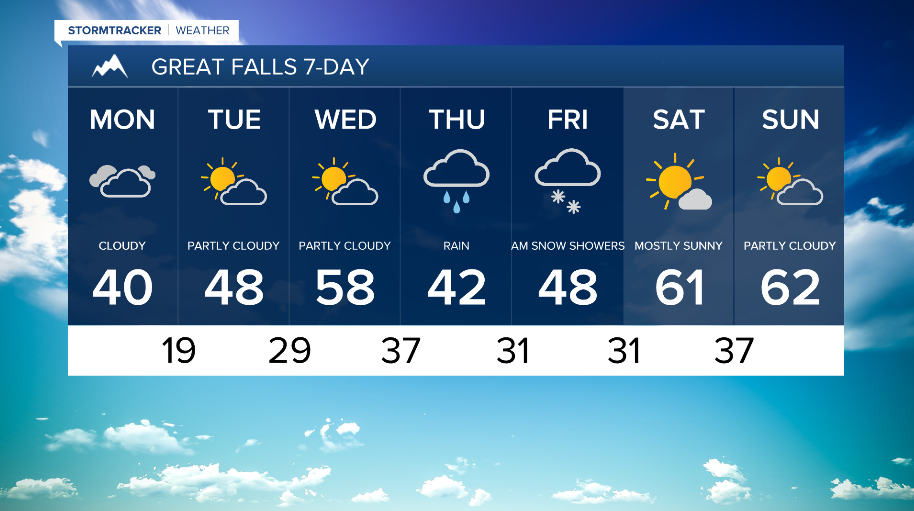
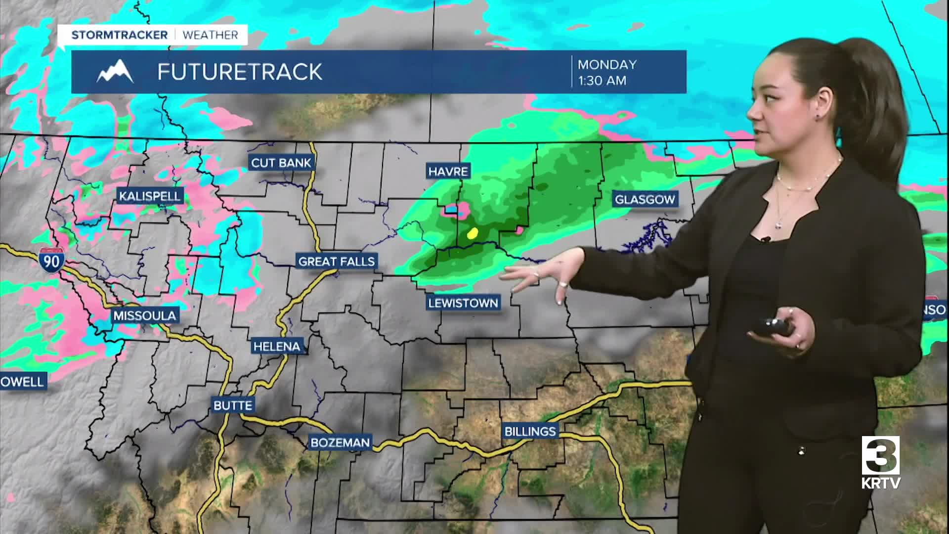
Monday, the rain/snow showers continue to stay isolated across North Central, Central, and SW Montana. Due to the cold front passage, it will be colder across the region with well-below seasonal average temperatures expected along the Hi-line. Expect high temperatures in the 30s and 40s with partly sunny to cloudy skies. Due to a strong surface pressure gradient, it will be windy on Monday with the strongest winds along the Rocky Mountain Front and SW MT.

032926 Highs Tomorrow

The area dries out a bit Tuesday with cool temperatures across the area. On Wednesday, an upper-level ridge forms over the region, briefly allowing temperatures to warm up with mostly dry weather. An upper-level trough quickly follows and remains through Friday, bringing cooler temperatures and a return to widespread precipitation.

032926 GF 7 day
032926 Helena 7 day
032926 Havre 7 day