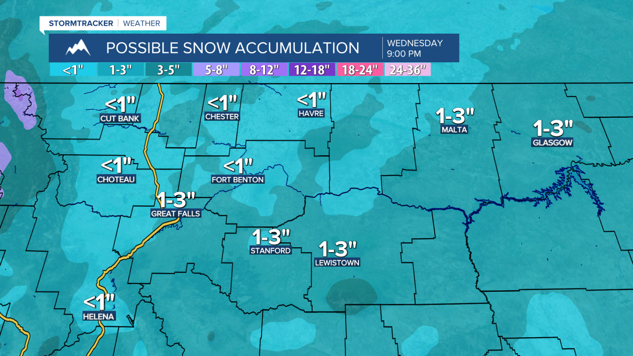
A Winter Weather Advisory is in effect for a lot of Montana through Wednesday morning. A general coating to 4 inches of snow accumulation is expected in the lower elevations, while higher amounts are possible in the higher elevations.
There is also a Winter Storm Warning in effect for southwestern Montana until 5am Wednesday. 4 to 12+ inches of new snow accumulation is expected in locations with an elevation above 6500 feet.

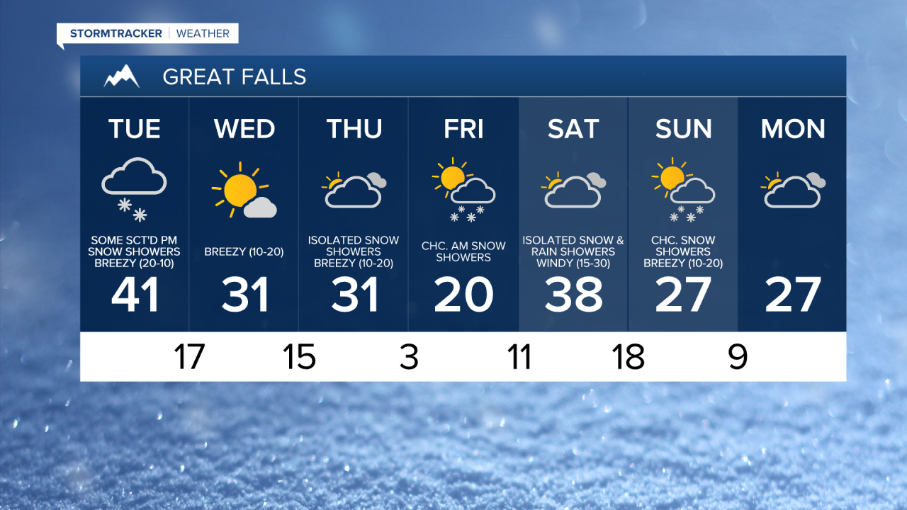
There are going to be a few scattered rain and snow showers around tonight, especially before midnight, as a warm front works its way northward through our area. In locations that see snow, light snow accumulations are possible. We are also going to have a wide range of temperatures tonight as lows along the Hi-Line are going to be in the mid to upper teens and low to mid 20s, while lows elsewhere are going to be in the 20s and 30s. It is also going to be a bit breezy tonight, especially after midnight, as sustained wind speeds are going to be between 5 and 20 mph.
For tomorrow, a couple rain and snow showers are possible during the morning. Some light to moderate snow is then going to develop during the afternoon and evening in central Montana as a cold front begins to pass through our area. Some rain is also possible tomorrow afternoon during the initial onset of the precipitation. There is then going to be some light to moderate snow around in portions of central and eastern Montana tomorrow night as this cold front continues to work its way eastward across Montana. A general coating to 4 inches of snow accumulation is expected in the lower elevations, while higher amounts are possible in the higher elevations. Along the Hi-Line, less than an inch of snow accumulation is expected, if you even see snow at all.

We are also going to have a wide range of temperatures tomorrow as highs are going to range from the low 20s to the mid 40s, with the coldest temperatures expected along the Hi-Line and along the Rocky Mountain Front. It is also going to be a bit breezy tomorrow, especially during the morning, as sustained wind speeds are going to be between 5 and 20 mph.
On Wednesday, we are going to have mostly sunny skies and mostly dry conditions. We are then going to have mostly cloudy skies with some isolated snow showers around on Thursday as the next cold front begins to approach our area. It is also going to be chilly on these two days as highs are going to be in the upper 20s and low to mid 30s. There is also going to be a bit of a breeze around on both of these days as sustained wind speeds are going to be between 5 and 20 mph.
Another round of light to moderate snow is expected Thursday night and Friday morning as another cold front passes through our area. Once this cold front leaves our area, we will clear out and see a lot of sunshine for the rest of Friday. It is also going to be cold on Friday as highs are only going to be in the teens and 20s.
Windy conditions and warmer temperatures are then expected on Saturday as sustained wind speeds are going to be between 15 and 30 mph, and high temperatures are going to be in the mid to upper 30s and low 40s. We are also going to have mostly cloudy skies with a chance of snow and rain showers on Saturday as a cold front begins to approach our area.
There are then going to be some scattered snow showers around on Sunday, especially during the morning, as this cold front departs our area. We are then going to have mostly cloudy skies with a slight chance of snow showers on Monday. It is also going to be chilly on these two days as highs are going to be in the mid to upper 20s and low to mid 30s. There is also going to be a bit of a breeze around on Sunday as sustained wind speeds are going to be between 10 and 20 mph.