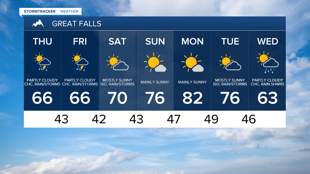
A disturbance is going to pass through our area tonight giving us partly to mostly cloudy skies and a chance to see a couple rain showers, generally after midnight and generally in locations south of Great Falls. Tomorrow is then going to have partly cloudy skies with a few scattered rain showers and isolated thunderstorms around, generally during the afternoon and evening, as we continue to have some lingering moisture around our area from this disturbance. There are then going to be a few more scattered rain showers and isolated thunderstorms around on Friday, generally during the afternoon and evening, as another disturbance begins to approach our area. We are then going to have a chance to see a few more rain showers and isolated thunderstorms on Saturday, generally during the afternoon and evening, as this disturbance leaves our area. We are also going to have partly to mostly cloudy skies on Friday, and partly cloudy to mostly sunny skies on Saturday. Now even though there are going to be some showers around over the next few days, not much precipitation is expected as most locations are going to receive less than a tenth of an inch of precipitation, although some isolated locations may pick up between a tenth and a quarter of an inch of precipitation between tonight and Saturday night.

In terms of temperatures, the high temperatures for the next three days are going to be near to a little bit above average for this time of year as highs are going to be in the mid to upper 60s and low 70s, and the low temperatures for the next three nights are going to be above average for this time of year as lows are going to be in the low to mid 40s. It is also going to be a bit breezy tomorrow, especially in locations south and west of Great Falls, as sustained wind speeds are going to be between 5 and 20 mph, and wind gusts are going to be between 20 and 30 mph.
Mainly sunny skies and mostly dry conditions are then expected on Sunday and Monday as high pressure is going to be in control of our weather. The temperatures on these two days are also going to be well above average for this time of year as highs on Sunday are going to be in the mid 70s, and highs on Monday are going to be in the low to mid 80s.
We are then going to have partly cloudy to mostly sunny skies with some isolated rain showers and thunderstorms around on Tuesday as the next storm system begins to approach our area. We are then going to have partly cloudy skies with a chance of rain showers on Wednesday as this storm system passes through our area. The temperatures are also going to cool down a lot over these two days as highs on Tuesday are going to be in the mid 70s, and highs on Wednesday are going to be in the low to mid 60s.