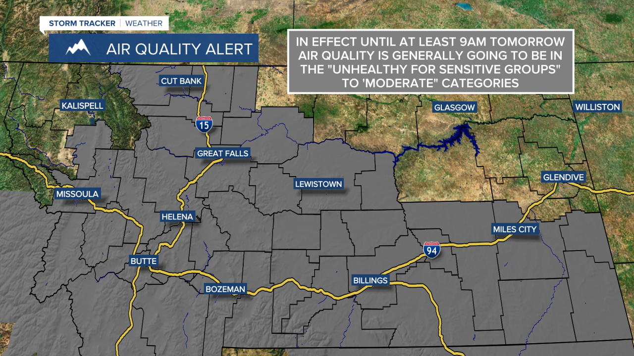
Due to wildfires burning locally, and due to wildfires burning in other states throughout the western U.S., smoky and/or hazy skies are expected for the foreseeable future here in Montana. With this smoke in the air, the air quality is likely going to continue to be in the “moderate” or “unhealthy for sensitive groups” categories for the foreseeable future, so if you are sensitive to increased particulates in the atmosphere, then you may want to try and limit your time outdoors. There is also an Air Quality Alert in effect until at least 9am tomorrow morning for a decent chunk of Montana due to this poor air quality.
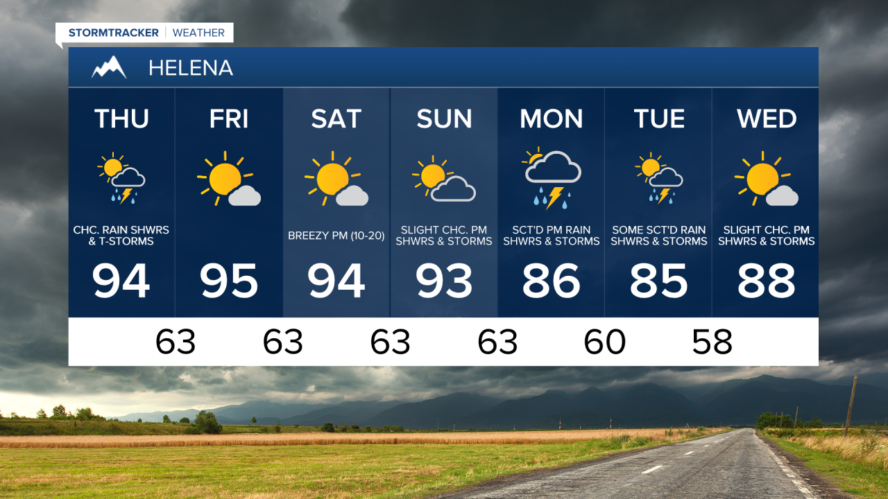
We are going to have mostly to partly cloudy skies tonight with a few scattered rain showers and thunderstorms around as a disturbance begins to work its way through our area. There are then going to be some scattered rain showers and thunderstorms around tomorrow, generally in locations east of I-15, as this disturbance continues to work its way through our area. We are also going to have partly cloudy skies tomorrow.
In terms of temperatures, it is going to be mild tonight as lows are going to be in the mid to upper 60s and low 70s in most locations. It is then going to be very warm/hot tomorrow as highs are going to range from the mid 80s in eastern Montana to the mid 90s in central Montana. There is also going to be a little bit of a breeze around tonight in spots as sustained wind speeds are going to be between 5 and 15 mph. Breezy conditions are then expected tomorrow in eastern Montana as sustained wind speeds are going to be between 10 and 20 mph.
On Friday and Saturday, we are going to have mostly sunny skies (via increasing clouds) and mainly dry conditions. We are then going to have partly to mostly cloudy skies with a slight chance of rain showers and thunderstorms during the afternoon/evening on Sunday.
It is also going to be hot on Friday, Saturday, and Sunday as highs are going to be in the low to mid 90s in most locations. There is also going to be a little bit of a breeze around in eastern Montana and along the Hi-Line Friday afternoon/evening as sustained wind speeds are going to be between 10 and 15 mph. Breezy conditions are then expected Saturday afternoon/evening and Sunday afternoon/evening along the Hi-Line and in central Montana as sustained wind speeds are going to be between 10 and 20 mph.
There are then going to be some scattered rain showers and thunderstorms around Monday afternoon/evening, Monday night, and Tuesday as a stronger disturbance works its way through our area. Right now, this is looking like it is going to be the most widespread rain event that we have had in weeks with rainfall amounts over a quarter inch possible for many towns and cities in central Montana. We are also going to have increasing clouds on Monday, mostly cloudy skies Monday night, and partly cloudy skies on Tuesday. Wednesday is then going to have mostly sunny skies with a few isolated rain showers and thunderstorms around.
The temperatures next week are also going to be cooler than the temperatures over the next several days are going to be as highs are going to be in the mid to upper 80s in most locations. It is also going to be a little breezy on Monday in eastern Montana and along the Hi-Line as sustained wind speeds are going to be between 10 and 15 mph.